Center for Brooklyn History
Map Collections
Search
About
Othmer Library & Archives
Submit search query
Refine 3 records
Clear filters
2
Location
Brooklyn (New York, N.Y.)
891
Crown Heights (New York, N.Y.)
25
East Flatbush (New York, N.Y.)
23
Flatbush (New York, N.Y.)
35
Kensington (New York, N.Y.)
11
Prospect Lefferts Gardens (Brooklyn, New York, N.Y.)
16
Prospect Park South (New York, N.Y.)
8
Windsor Terrace (New York, N.Y.)
10
Subject
Landowners
434
Real property
619
Date
19th Century
945
or enter range:
from
to
Genres
Cadastral maps
597
Manuscript maps
365
Sort by:
Date (earliest)
Date (most recent)
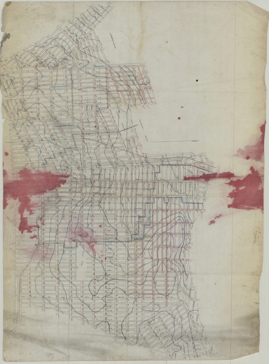
[Map covering area east from Greenwood Cemetery to Howard Ave. and north from Ave G. to Eastern Pkwy]
[Map covering area east from Greenwood Cemetery to Howard Ave. and north from Ave G. to Eastern Pkwy]
[18??]
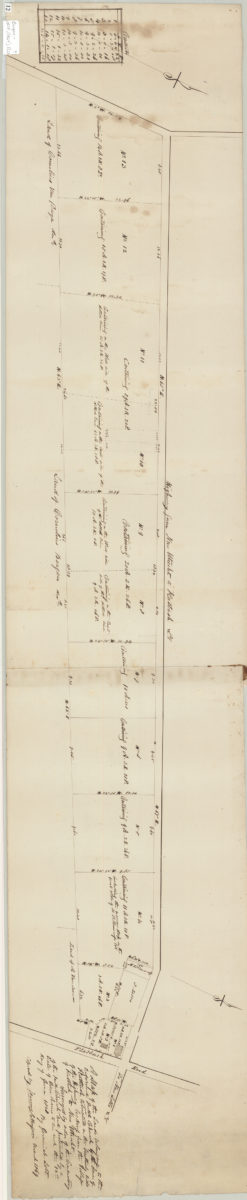
A map of the land belonging to the Reformed Dutch Church by the … [text illegible] of Flatbush, situated in the southerly side of the highway leading from the village of Flatbush to New Utrecht: 12th day of June 1828:
A map of the land belonging to the Reformed Dutch Church by the … [text illegible] of Flatbush, situated in the southerly side of the highway leading from the village of Flatbush to New Utrecht: 12th day of June 1828:
March 1869
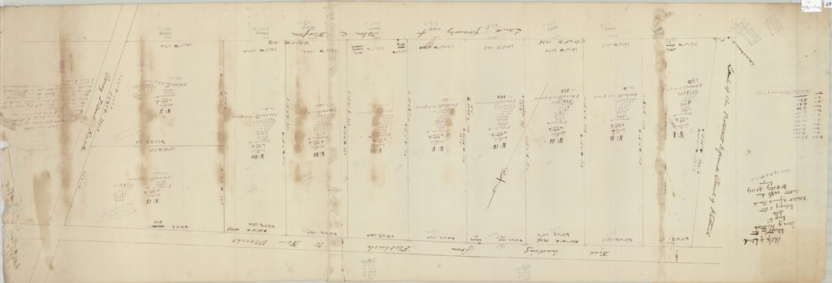
Map of land situated in the town of Flatbush, Kings Co. belonging to the Protestant Reformed Church contains 44 46/100 acres: Wm. H. Story, Apl. 1869, surveyor [drawn by T.G. Bergen]
Map of land situated in the town of Flatbush, Kings Co. belonging to the Protestant Reformed Church contains 44 46/100 acres: Wm. H. Story, Apl. 1869, surveyor [drawn by T.G. Bergen]
1869