Center for Brooklyn History
Map Collections
Search
About
Othmer Library & Archives
Submit search query
Refine 2 records
Clear filters
2
Location
Brooklyn (New York, N.Y.)
891
Jamaica Bay (N.Y.)
5
New York Harbor (N.Y. and N.J.)
16
Queens (New York, N.Y.)
83
Rockaway (New York, N.Y.)
1
Subject
Coasts
4
Piers
25
Date
19th Century
945
or enter range:
from
to
Genres
Bathymetric maps
94
Manuscript maps
365
Nautical charts
30
Sort by:
Date (earliest)
Date (most recent)
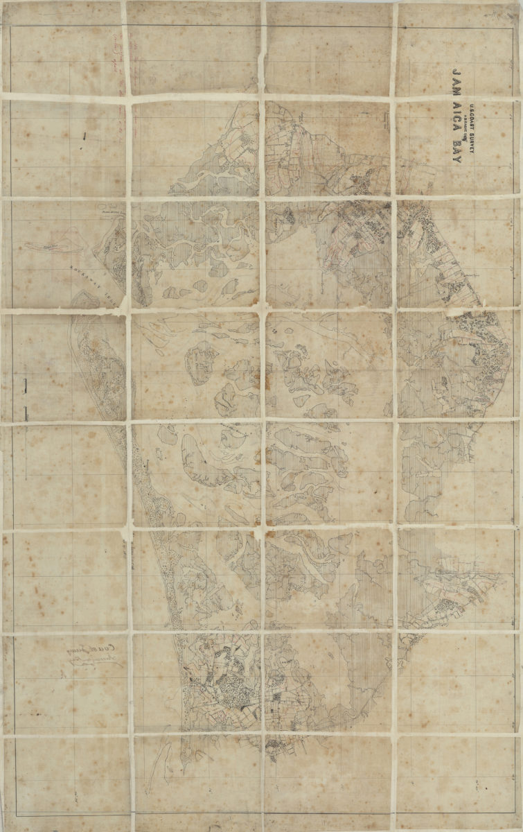
Jamaica Bay: U.S. Coast Survey, A.D. Bache, supt
Jamaica Bay: U.S. Coast Survey, A.D. Bache, supt
[185?]
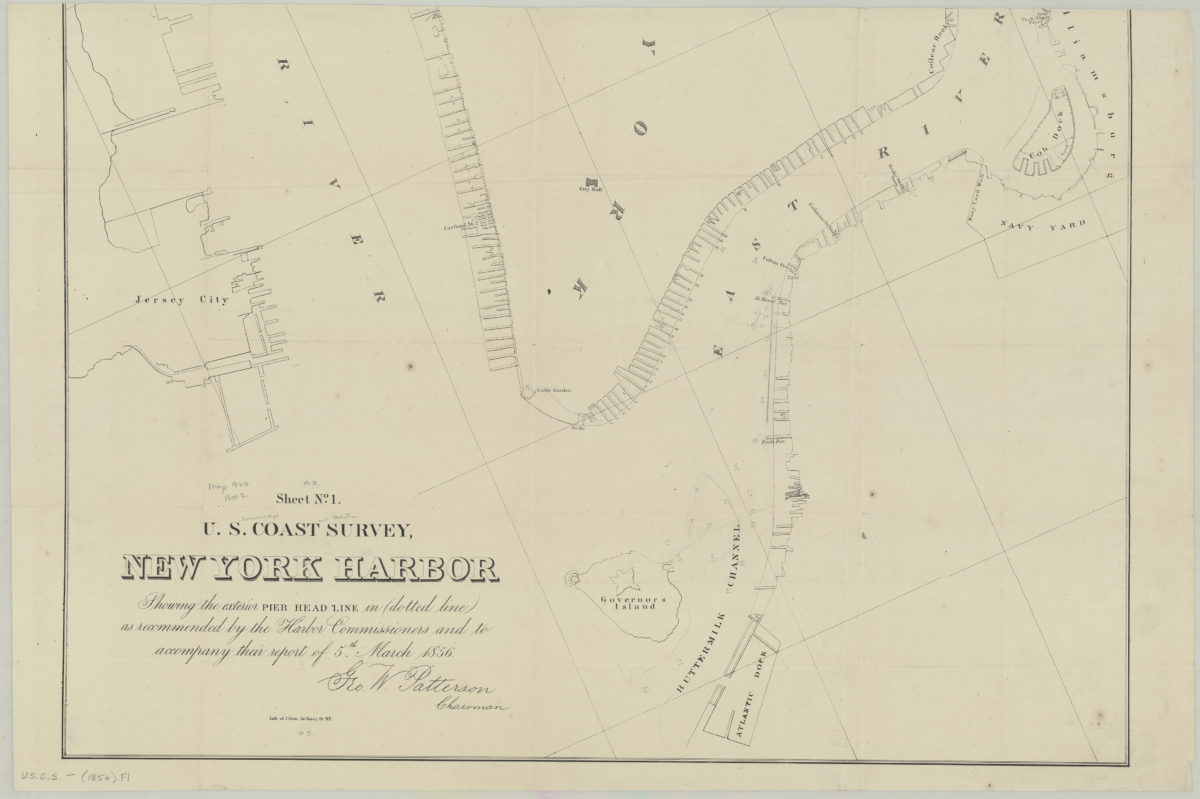
Sheet no. 1, U.S. Coast Survey, New York Harbor: showing the exterior pier head line in dotted line as recommended by the Harbor Commissioners and to accompany their report of 5th March 1856
Sheet no. 1, U.S. Coast Survey, New York Harbor: showing the exterior pier head line in dotted line as recommended by the Harbor Commissioners and to accompany their report of 5th March 1856
[1856]