Center for Brooklyn History
Map Collections
Search
About
Othmer Library & Archives
Submit search query
Refine 4 records
Clear filters
2
Location
Brooklyn (New York, N.Y.)
891
Brooklyn Heights (New York, N.Y.)
76
Brooklyn-Queens Expressway (New York, N.Y.)
3
Carroll Gardens (New York, N.Y.)
21
Columbia Street Waterfront District (New York, N.Y.)
3
Downtown Brooklyn (New York, N.Y.)
29
Red Hook (New York, N.Y.)
19
Williamsburg (New York, N.Y.)
36
Subject
Central business districts
10
Express highways
3
Roads
117
Subways
55
Date
20th Century
469
21th Century
66
or enter range:
from
to
Genres
Road maps
83
Tourist maps
55
Sort by:
Date (earliest)
Date (most recent)
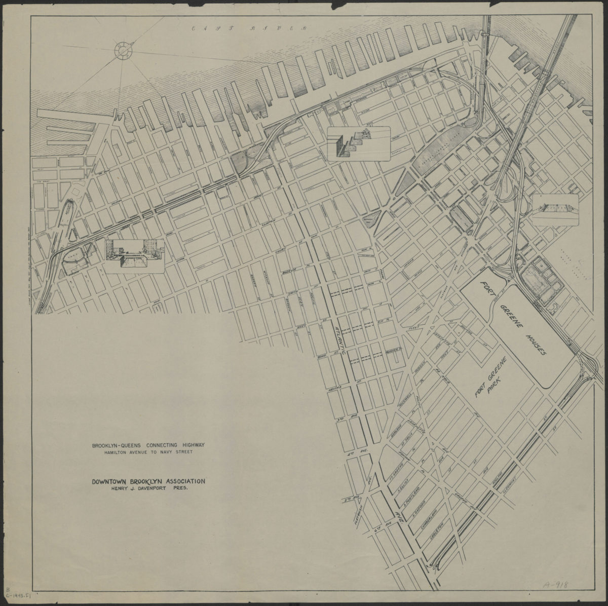
Brooklyn-Queens connecting highway: Hamilton Avenue to Navy Street: Downtown Brooklyn Association
Brooklyn-Queens connecting highway: Hamilton Avenue to Navy Street: Downtown Brooklyn Association
[1943]
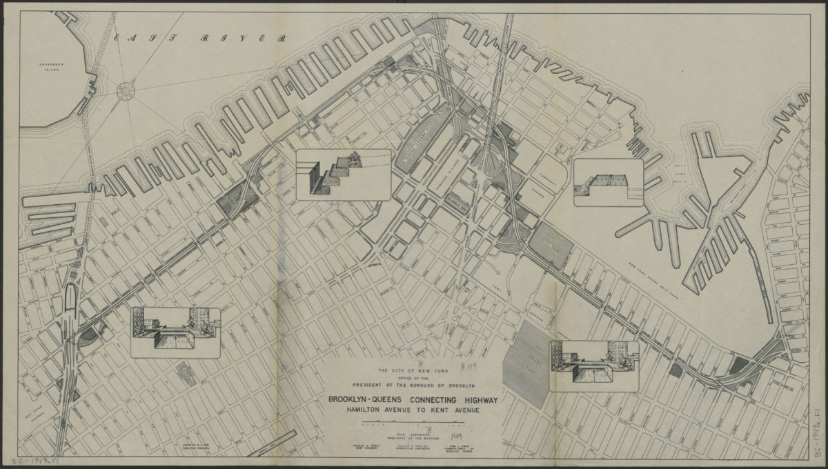
Brooklyn-Queens connecting highway: Hamilton Avenue to Kent Avenue
Brooklyn-Queens connecting highway: Hamilton Avenue to Kent Avenue
[1949]
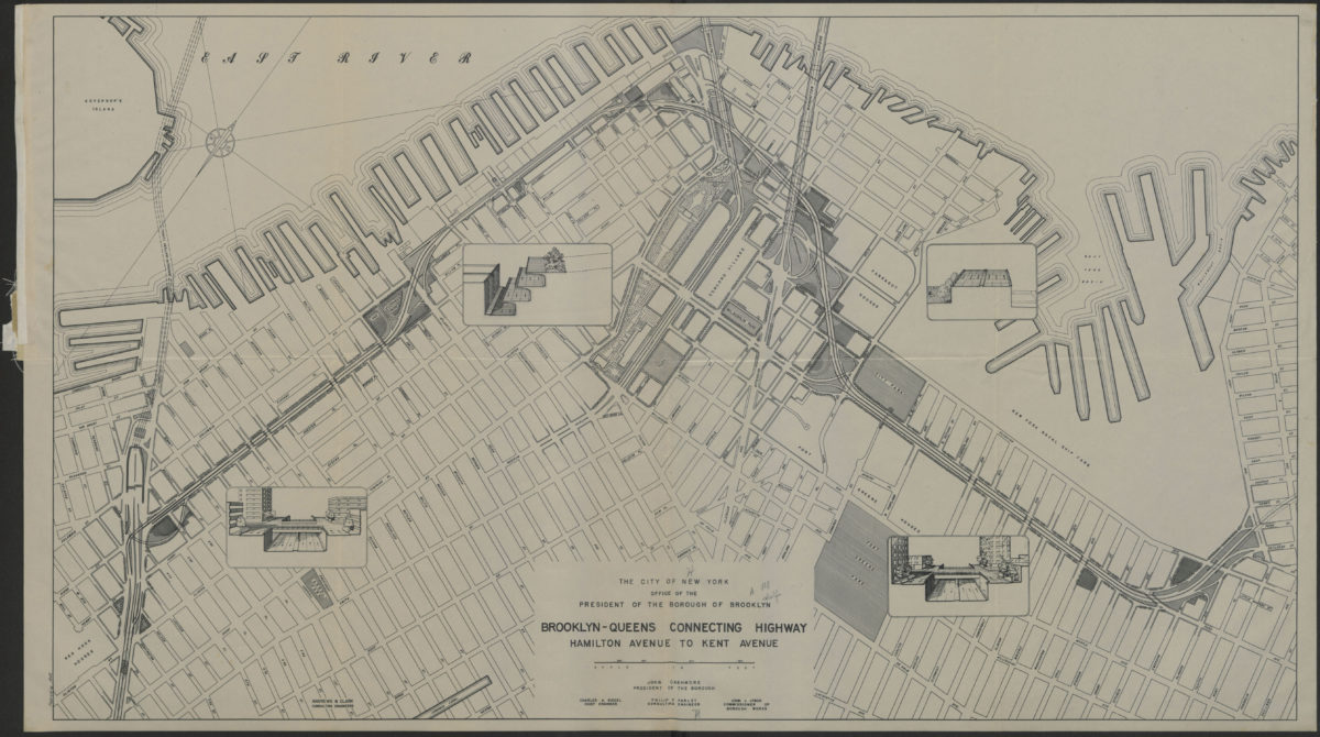
Brooklyn-Queens connecting highway: Hamilton Avenue to Kent Avenue
Brooklyn-Queens connecting highway: Hamilton Avenue to Kent Avenue
1949
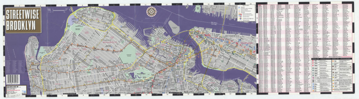
Streetwise Brooklyn: Streetwise Maps, Inc
Streetwise Brooklyn: Streetwise Maps, Inc
[2008; ca. 2000]