Center for Brooklyn History
Map Collections
Search
About
Othmer Library & Archives
Submit search query
Refine 3 records
Clear filters
2
Location
Long Island (N.Y.)
197
Nassau County (N.Y.)
24
Queens (New York, N.Y.)
83
Suffolk County (N.Y.)
43
Subject
Roads
117
Street addresses
11
Streets
46
Zip codes
4
Date
20th Century
469
or enter range:
from
to
Genres
Road maps
83
Sort by:
Date (earliest)
Date (most recent)
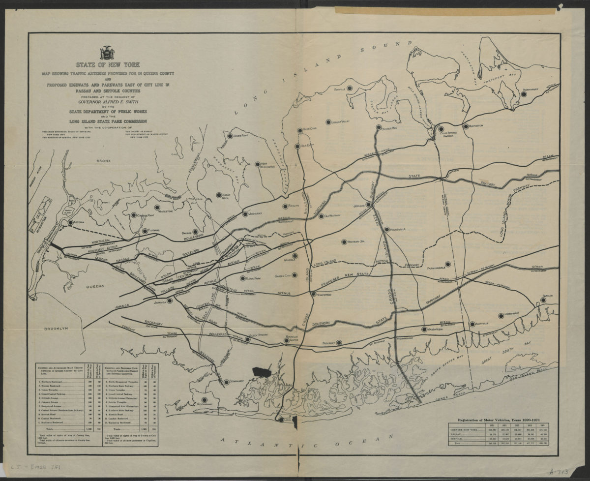
State of New York map showing traffic arteries provided for in Queens County and proposed highways and parkways east of city line in Nassau and Suffolk Counties: prepared at the request of Governor Alfred E. Smith
State of New York map showing traffic arteries provided for in Queens County and proposed highways and parkways east of city line in Nassau and Suffolk Counties: prepared at the request of Governor Alfred E. Smith
[1925]
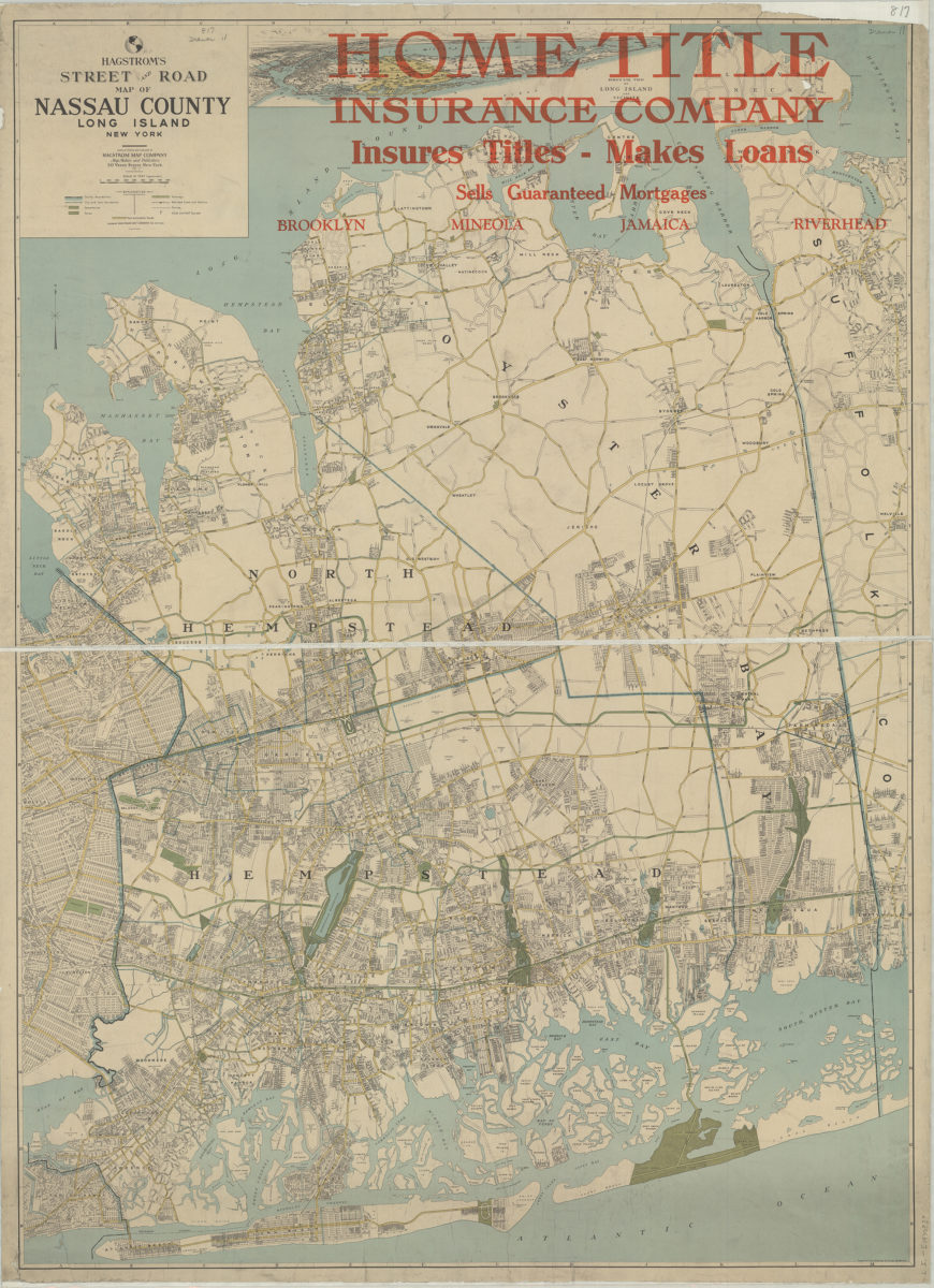
Hagstrom’s street and road map of Nassau County, Long Island, New York: compiled, printed and published by Hagstrom Map Company
Hagstrom’s street and road map of Nassau County, Long Island, New York: compiled, printed and published by Hagstrom Map Company
[1930]
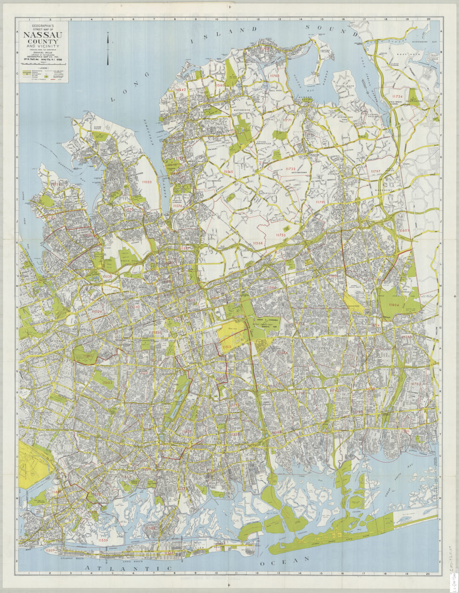
Geographia’s street map of Nassau County and vicinity: produced under the direction of Emanuel Polak
Geographia’s street map of Nassau County and vicinity: produced under the direction of Emanuel Polak
[197?]