Center for Brooklyn History
Map Collections
Search
About
Othmer Library & Archives
Submit search query
Refine 4 records
Clear filters
2
Location
Bath Beach (New York, N.Y.)
8
Bay Ridge (New York, N.Y.)
108
Bensonhurst (New York, N.Y.)
17
Brighton Beach (New York, N.Y.)
4
Brooklyn (New York, N.Y.)
891
Coney Island (New York, N.Y.)
22
Dyker Heights (New York, N.Y.)
23
Fort Hamilton (New York, N.Y.)
31
Gravesend (New York, N.Y.)
25
Manhattan Beach (New York, N.Y.)
2
Midwood (New York, N.Y.)
9
Sea Gate (New York, N.Y.)
7
Sheepshead Bay (New York, N.Y.)
13
Sunset Park (New York, N.Y.)
53
Subject
Election districts
36
Land use
5
Zoning
2
Date
20th Century
469
or enter range:
from
to
Genres
Zoning maps
55
Sort by:
Date (earliest)
Date (most recent)
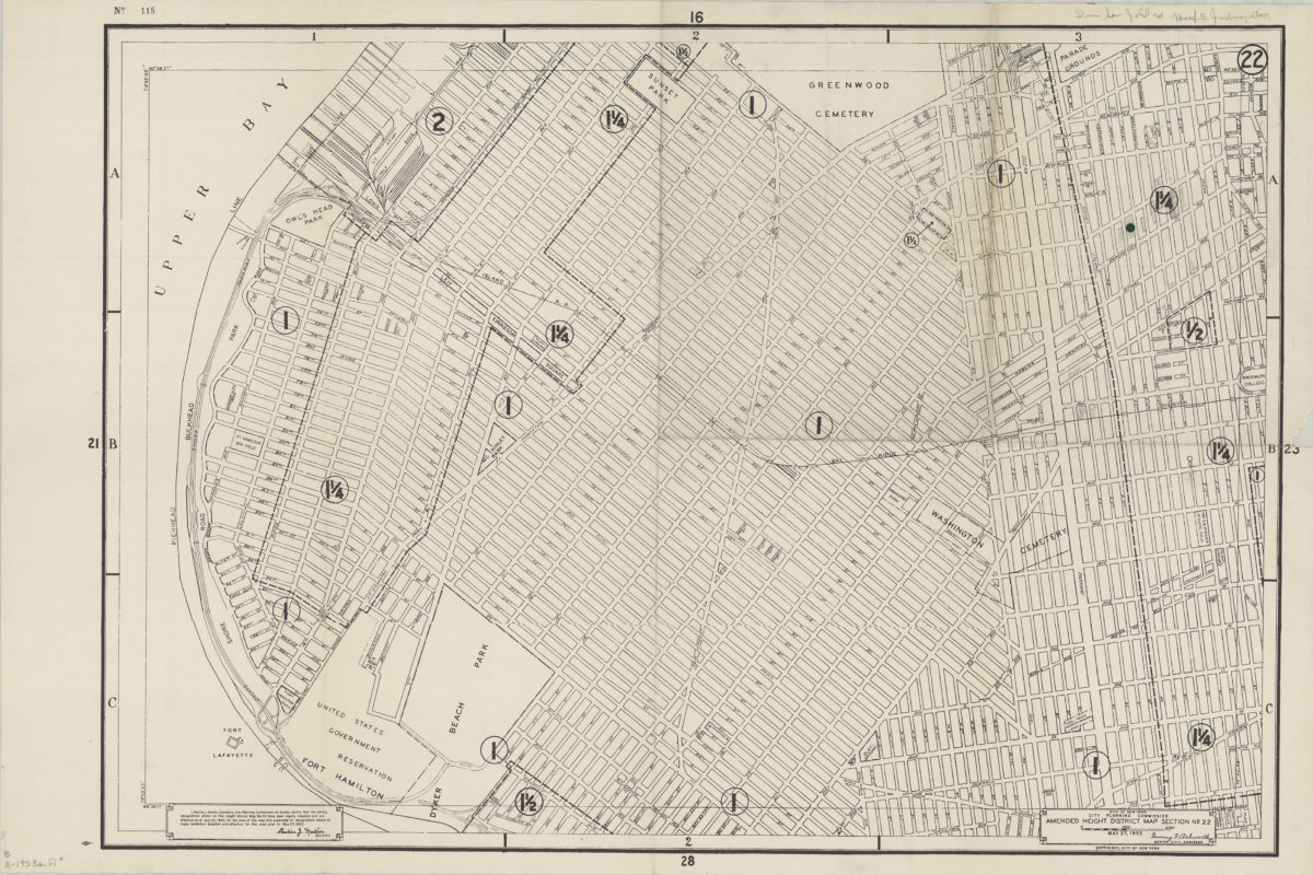
Amended use district map, section no. 22: City of New York, City Planning Commission, Irving F. Ashworth, senior civil engineer
Amended use district map, section no. 22: City of New York, City Planning Commission, Irving F. Ashworth, senior civil engineer
1953
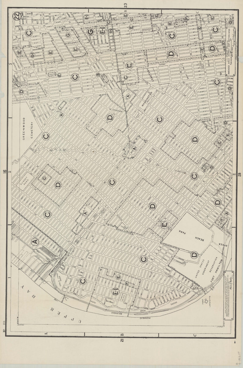
Amended use district map, section no. 22: City of New York, City Planning Commission, Irving F. Ashworth, senior civil engineer
Amended use district map, section no. 22: City of New York, City Planning Commission, Irving F. Ashworth, senior civil engineer
1953
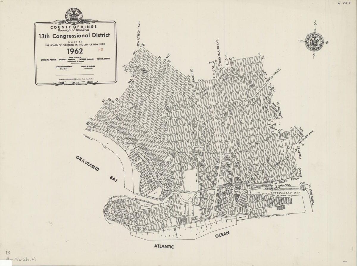
County of Kings, Borough of Brooklyn, 13th Congressional District: issued by the Board of Elections in the City of New York
County of Kings, Borough of Brooklyn, 13th Congressional District: issued by the Board of Elections in the City of New York
1962
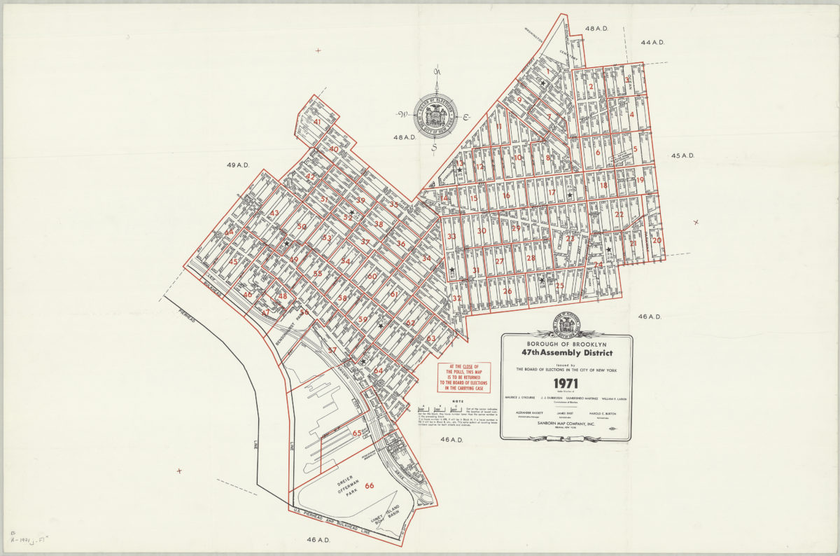
Borough of Brooklyn 47th Assembly District, 1971: issued by the Board of Elections in the City of New York
Borough of Brooklyn 47th Assembly District, 1971: issued by the Board of Elections in the City of New York
1971