Center for Brooklyn History
Map Collections
Search
About
Othmer Library & Archives
Submit search query
Refine 3 records
Clear filters
3
Location
Long Island (N.Y.)
197
Manhattan (New York, N.Y.)
120
New York (N.Y.)
164
New York (State)
95
New York Metropolitan Area
40
United States
10
Subject
Roads
117
Date
19th Century
945
20th Century
469
or enter range:
from
to
Genres
Early works
3
Facsimiles
1
Manuscript maps
365
Military maps
23
Pictorial maps
38
Transportation maps
120
Sort by:
Date (earliest)
Date (most recent)
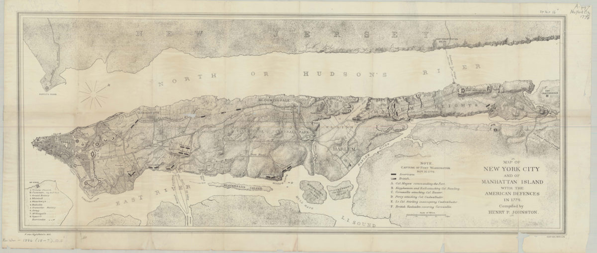
Map of New York City and of Manhattan Island with the American defences in 1776: compiled by Henry P. Johnston ; F. von Egloffstein del
Map of New York City and of Manhattan Island with the American defences in 1776: compiled by Henry P. Johnston ; F. von Egloffstein del
[18??]
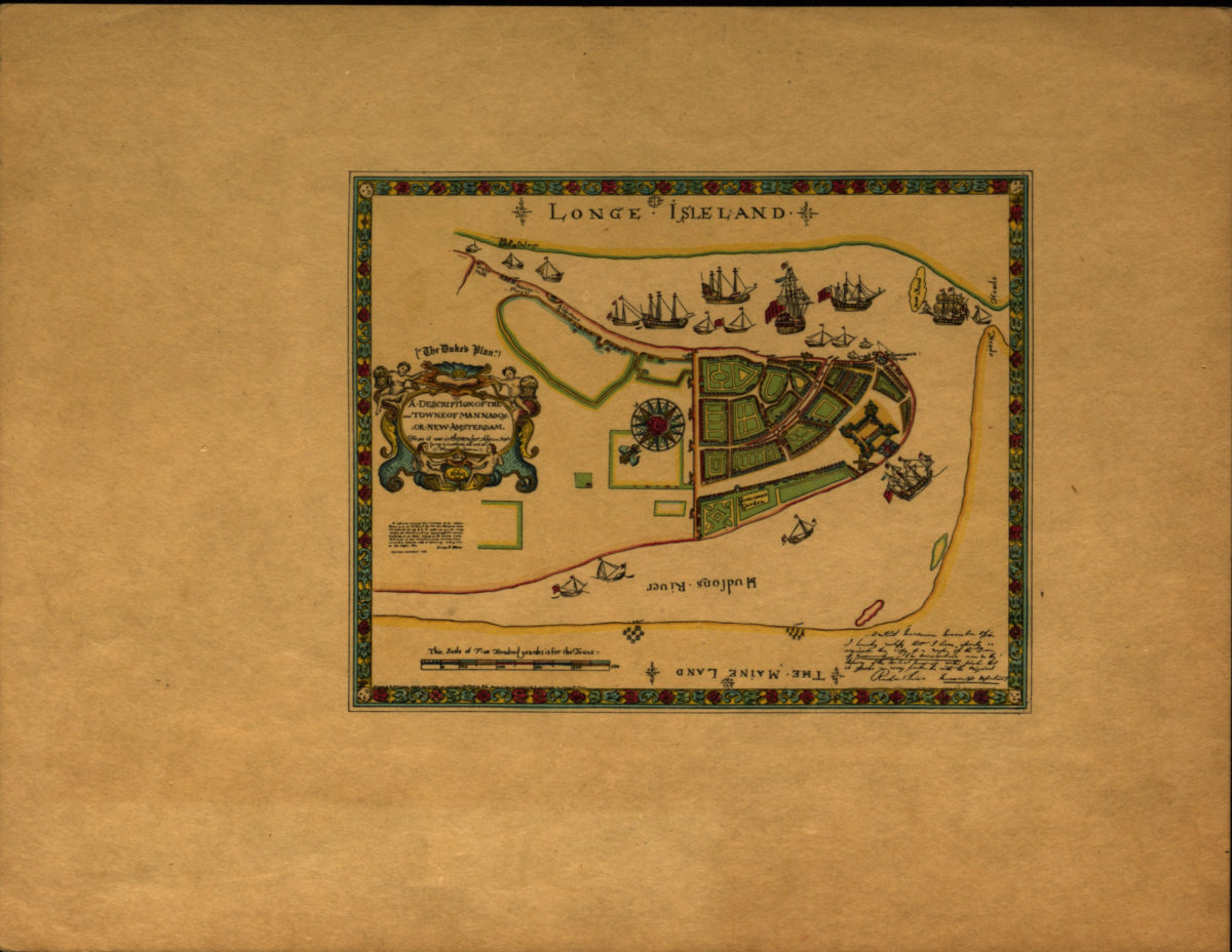
A description of the towne of Mannados or New Amsterdam: as it was in September 1661 lying in latitude 40 de. and 40 m. anno Domini 1664
A description of the towne of Mannados or New Amsterdam: as it was in September 1661 lying in latitude 40 de. and 40 m. anno Domini 1664
[1897]
Long Island, New York City & metro area counties: [prepared for] Texaco
Long Island, New York City & metro area counties: [prepared for] Texaco
1975