Center for Brooklyn History
Map Collections
Search
About
Othmer Library & Archives
Submit search query
Refine 3 records
Clear filters
2
Location
Brooklyn (New York, N.Y.)
891
Long Island (N.Y.)
197
New York (N.Y.)
164
New York (State)
95
New York Metropolitan Area
40
United States
10
Subject
Bridges
13
Local transit
63
Manuscript Maps
2
Railroads
72
Road maps
2
Roads
117
Subways
55
Tunnels
16
Date
21th Century
66
or enter range:
from
to
Genres
Manuscript maps
365
Map
191
Transportation maps
120
Sort by:
Date (earliest)
Date (most recent)
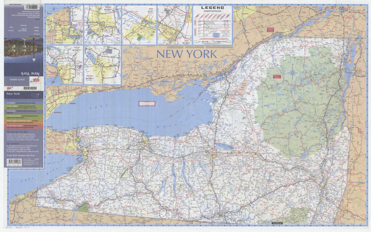
New York: including insets of Albany, Buffalo, Niagara Falls NY-ON, Rochester, Syracuse, Utica, plus Long Island map … toll & ferry information: AAA
New York: including insets of Albany, Buffalo, Niagara Falls NY-ON, Rochester, Syracuse, Utica, plus Long Island map … toll & ferry information: AAA
[2004]
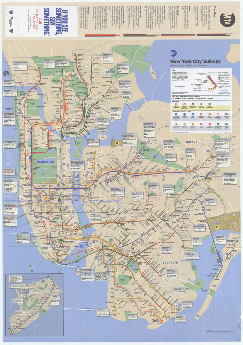
The map: MTA
The map: MTA
2014
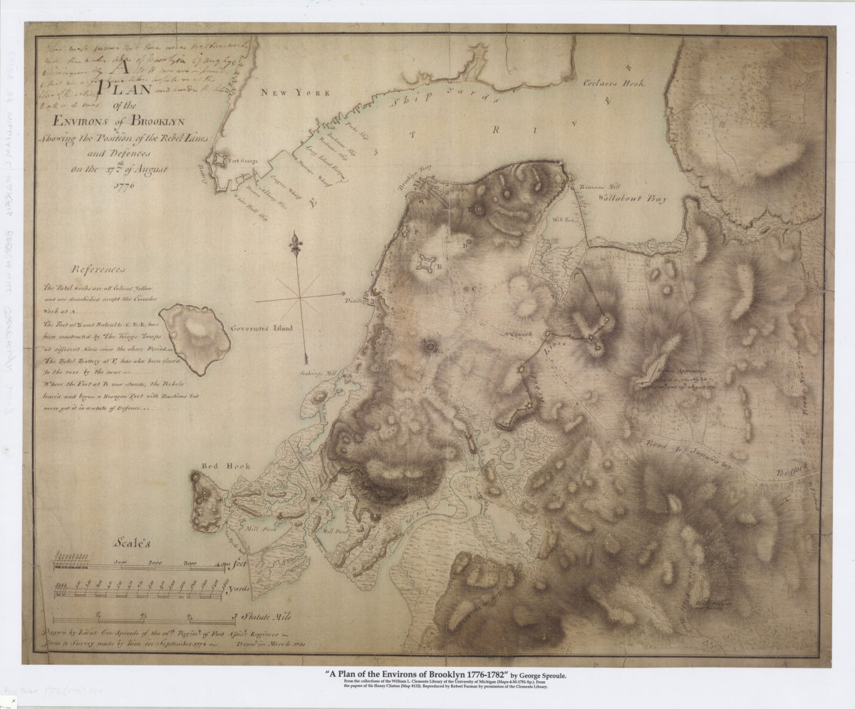
A plan of the environs of Brooklyn showing the position of the rebel lines and defences on the 27th of August 1776
A plan of the environs of Brooklyn showing the position of the rebel lines and defences on the 27th of August 1776
[2017]