Center for Brooklyn History
Map Collections
Search
About
Othmer Library & Archives
Submit search query
Refine 2 records
Clear filters
2
Location
Brooklyn (New York, N.Y.)
891
Greenpoint (New York, N.Y.)
38
Williamsburg (New York, N.Y.)
36
Subject
Roads
117
Date
19th Century
945
or enter range:
from
to
Genres
Manuscript maps
365
Sort by:
Date (earliest)
Date (most recent)
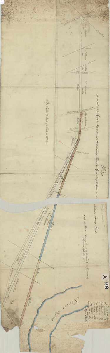
Map of an intended road 50 feet wide, from Williamsburg Turnpike Road along 5th Street to the Newtown Bridge Road: laid out … by order of the Town Commissioners: by Adolphus Lofs, surveyor
Map of an intended road 50 feet wide, from Williamsburg Turnpike Road along 5th Street to the Newtown Bridge Road: laid out … by order of the Town Commissioners: by Adolphus Lofs, surveyor
February 5, 1830
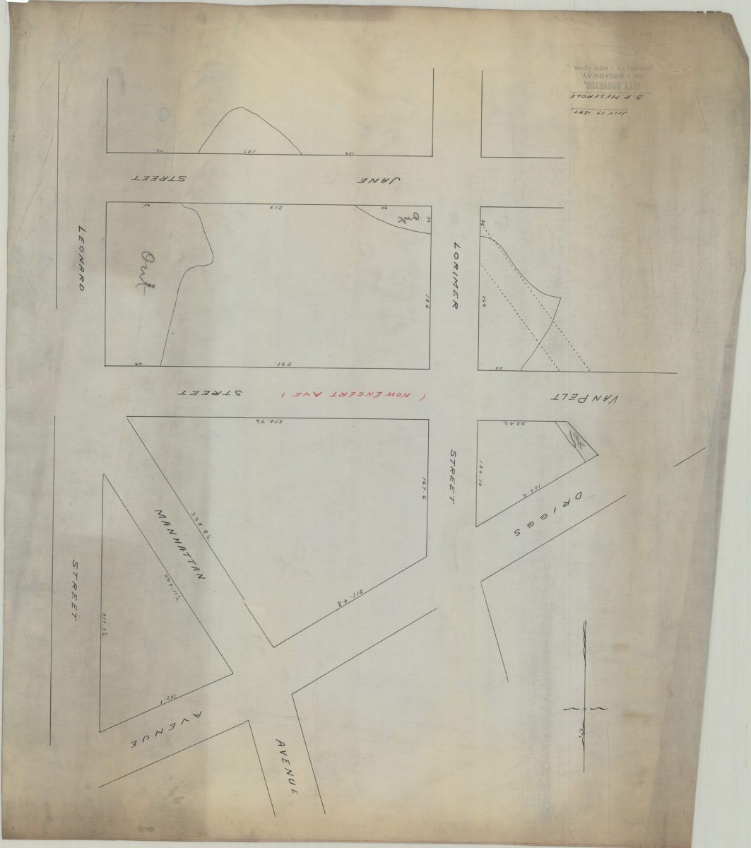
[Map of area bounded by Lorimer St., Jane St., Leonard St., and Driggs Ave.]: B.R. Meserole
[Map of area bounded by Lorimer St., Jane St., Leonard St., and Driggs Ave.]: B.R. Meserole
July 17, 1897