Center for Brooklyn History
Map Collections
Search
About
Othmer Library & Archives
Submit search query
Refine 55 records
Clear filter
1
Location
Brooklyn (New York, N.Y.)
891
Brooklyn Heights (New York, N.Y.)
76
Downtown Brooklyn (New York, N.Y.)
29
ferries
1
Flatiron District (New York, N.Y.)
1
Flushing (New York, N.Y.)
13
Manhattan (New York, N.Y.)
120
New York (N.Y.)
164
New York (State)
95
Queens (New York, N.Y.)
83
United States
10
Subject
Advertising
4
Airports
2
Baseball teams
1
Bridges
13
Central business districts
10
City planning
7
Culture and tourism
1
Electric railroads
5
Elevated highways
1
Exhibitions
5
ferries
32
Local transit
63
Postal codes
4
Public art
1
Railroads
72
Railroads, Elevated
24
Roads
117
Street addresses
11
Street railroads
8
Streets
46
Subways
55
Transportation
3
Tunnels
16
Show 3 more
Date
20th Century
469
21th Century
66
or enter range:
from
to
Genres
Aerial views
15
Map
191
Pictorial maps
38
Road maps
83
Thematic maps
60
Tourist maps
55
Transportation maps
120
Sort by:
Date (earliest)
Date (most recent)
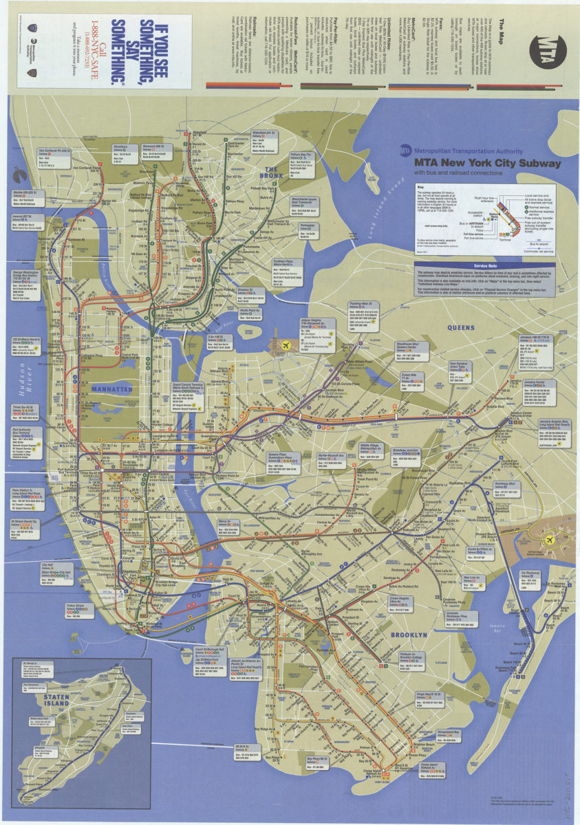
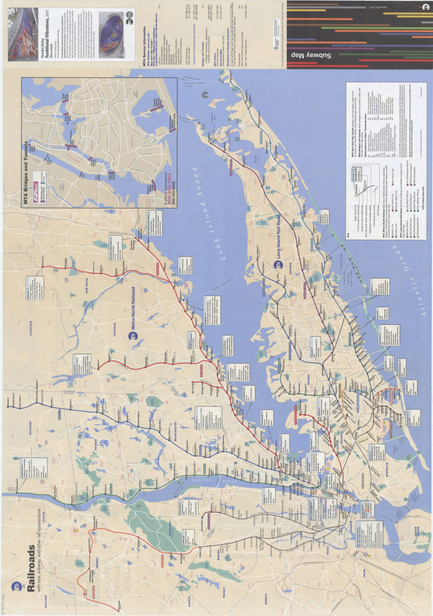
The map: MTA
The map: MTA
March 2011
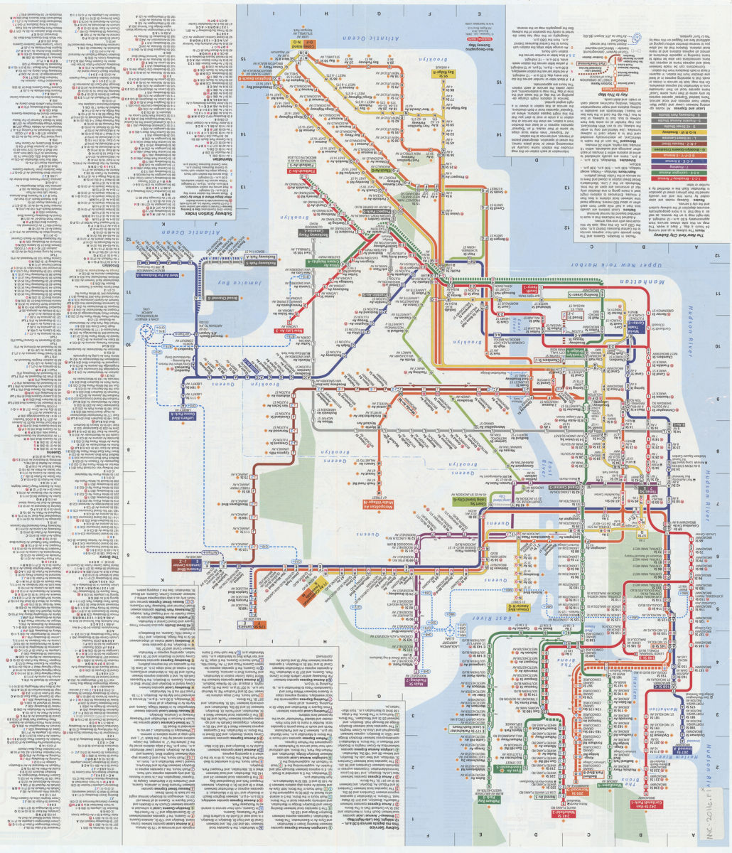
New York City subway, geographic & non-geographic maps: daytime, evening & late-night service, index of stations, places of interest: Tauranac Maps
New York City subway, geographic & non-geographic maps: daytime, evening & late-night service, index of stations, places of interest: Tauranac Maps
[2011, ca. 2008]
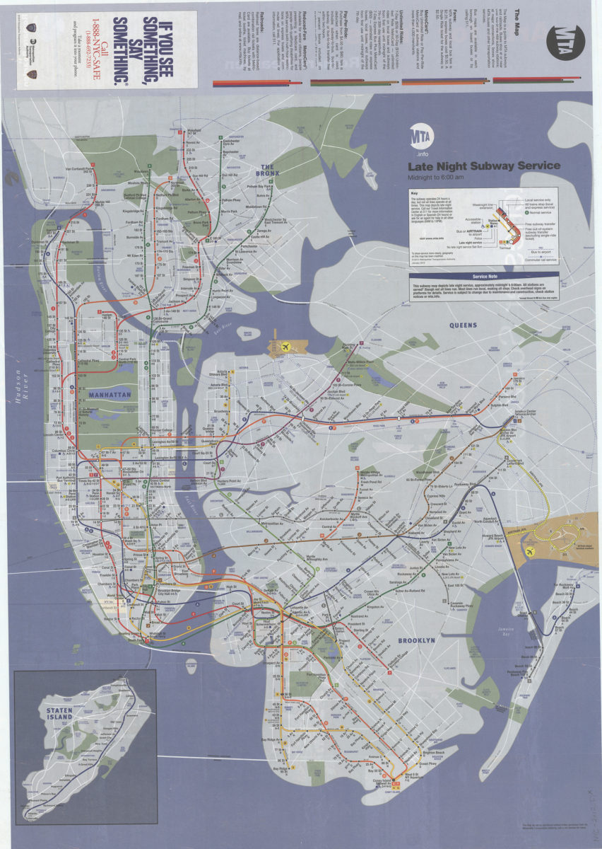
Late night subway service, midnight to 6: 12:00 AM: MTA.info
Late night subway service, midnight to 6: 12:00 AM: MTA.info
[ca. 2012]
The map: MTA
The map: MTA
2014
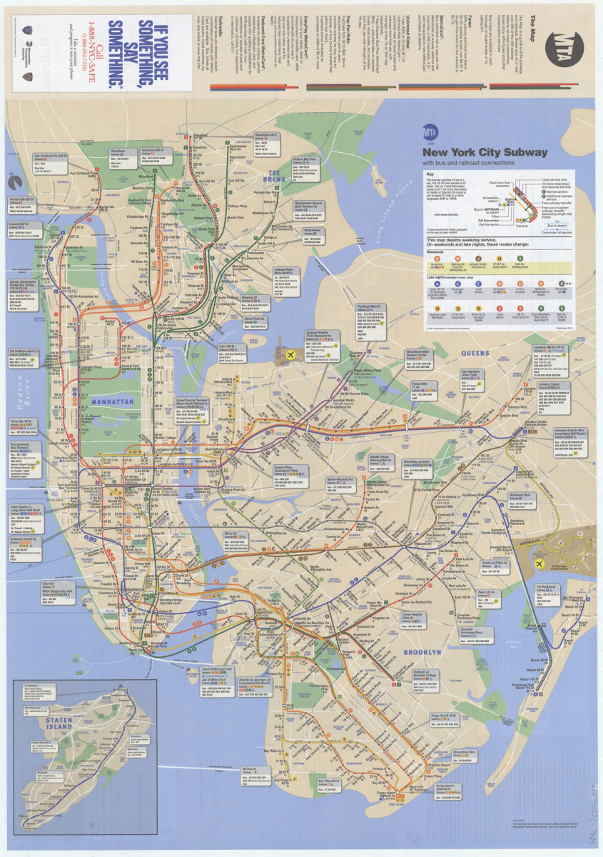
The map: MTA
The map: MTA
Sep-15
Previous
1
2