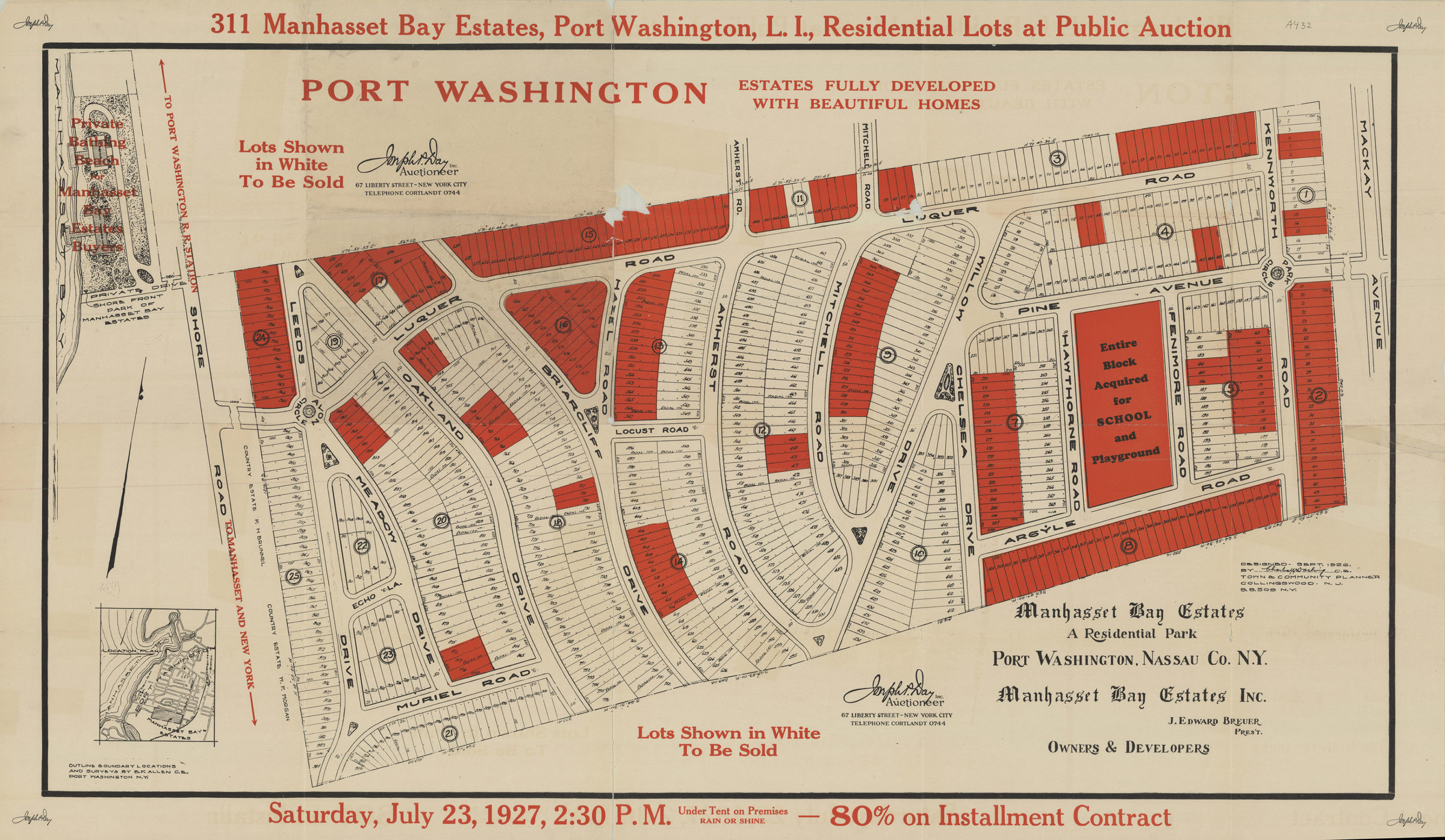
311 Manhasset Bay Estates, Port Washington, L.I., residential lots at public auction: Saturday, July 23, 1927, 2: 30 P.M. 1927
Map No. L.I.-1927.Fl.Folio
Map area shown
Genre
Cadastral mapsDownload
Low Resolution Image
Citation
311 Manhasset Bay Estates, Port Washington, L.I., residential lots at public auction: Saturday, July 23, 1927, 2: 30 P.M.; , , ; Brooklyn Historical Society.Loading zoom image... 