311 Manhasset Bay Estates, Port Washington, L.I., residential lots at public auction: Saturday, July 23, 1927, 2: 30 P.M. 1927
Map No. L.I.-1927.Fl.Folio
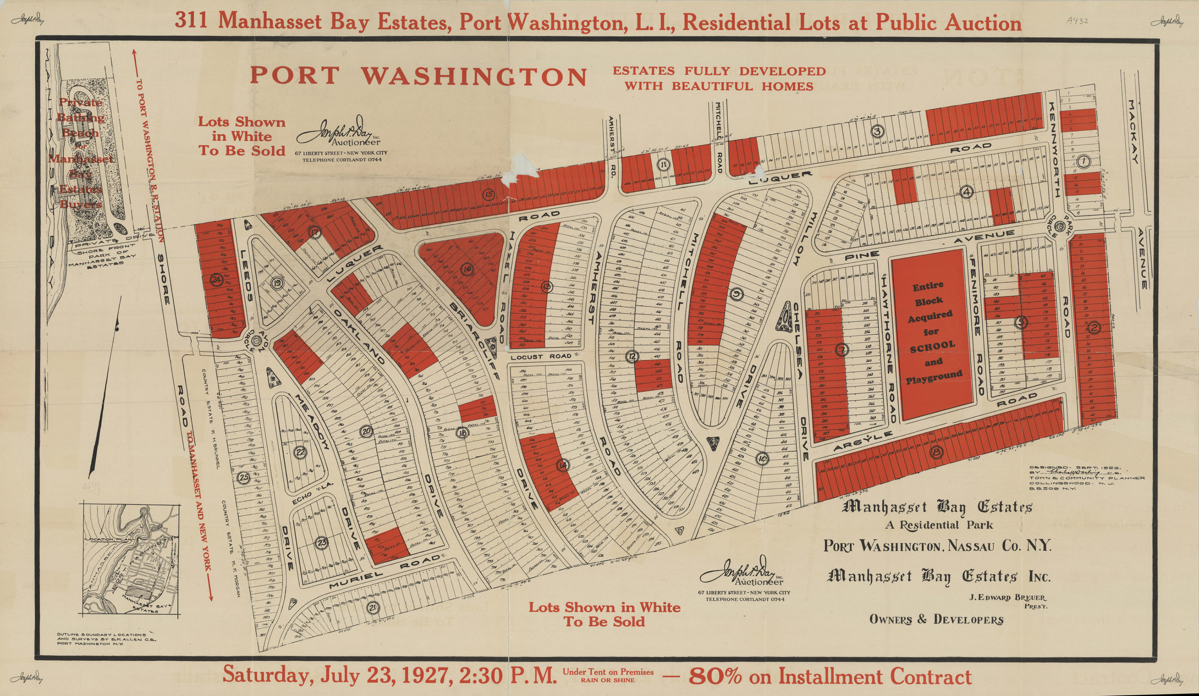
Cadastral map covering an area west of Shore Road near its intersection with Luquer Road in the town of Port Washington,N.Y. Shows property for sale including block and lot numbers as well as property dimensions. Includes location map. “Designed, Sept. 26, 1927 by Charles W. Darling, C.E., Town & community Planner, Collingwood, N.J.”
Map area shown
Genre
Cadastral mapsRelation
Full catalog recordSize
61 × 110 cmDownload
Low Resolution Image
Creator
Darling, Charles W.; Day, Joseph P.,Publisher
Brooklyn Historical SocietyCitation
311 Manhasset Bay Estates, Port Washington, L.I., residential lots at public auction: Saturday, July 23, 1927, 2: 30 P.M.; 1927, Map Collection, L.I.-1927.Fl.Folio; Brooklyn Historical Society.Scale
Scale not givenLoading zoom image... 