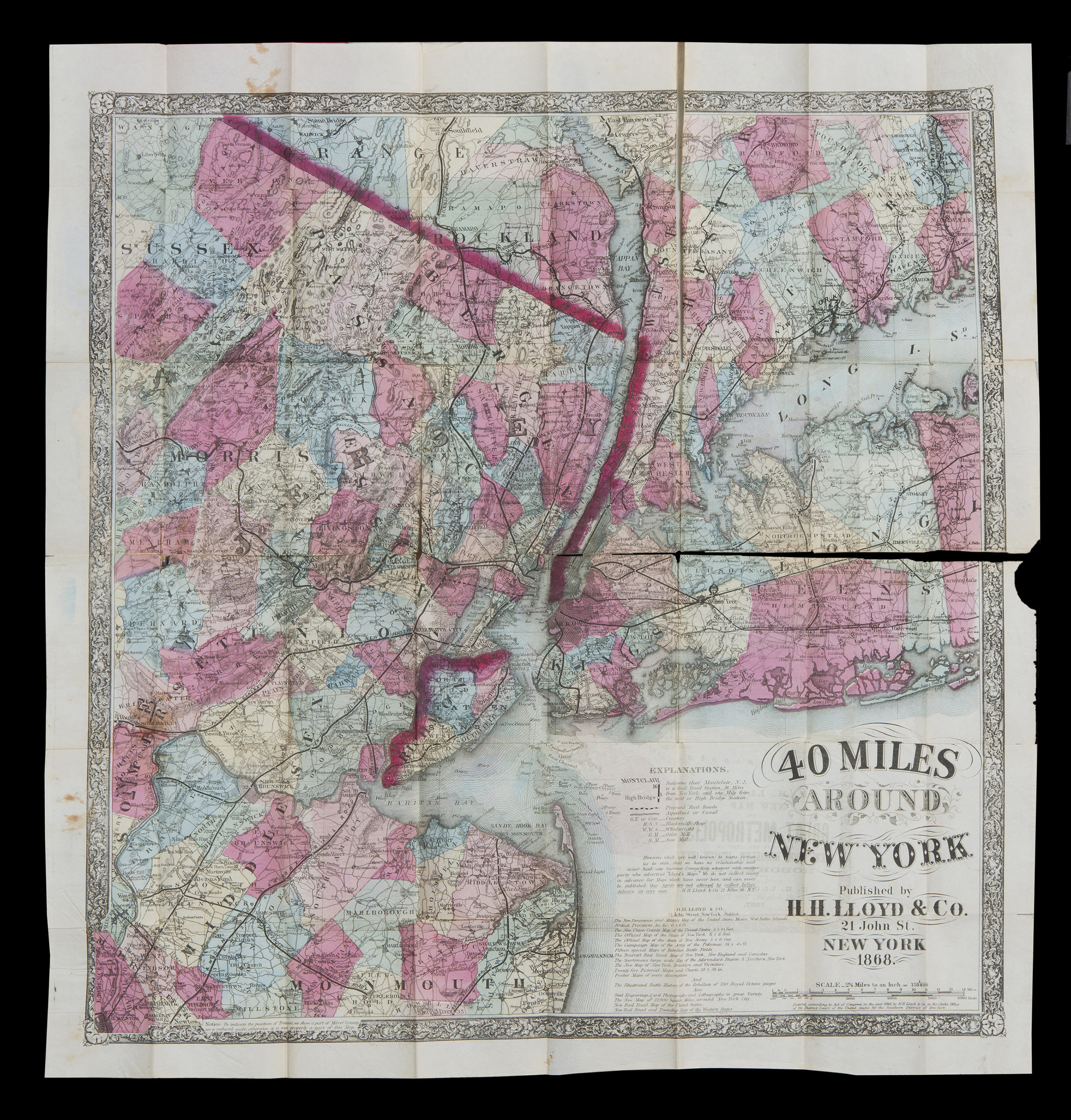
40 miles around New York 1867; [ca. 1866]
Covers New Jersey north and east from Trenton New York north from Westchester County Long Island east to Nassau County and part of Connecticut. Shows town boundaries, railroads, distances of railroad stations from New York, cemeteries, blacksmith shops, wheelwrights, grist mills, saw mills, aqueducts and canals, distances between railroad stations, and proposed railroads. Relief shown by hachures. “Notice. To indicate the position of Trenton, we show a part of Mercer County on a reduced scale otherwise it is not properly a part of this map.” “Eng’d by Fisk & Russell”–Verso. “Entered according to Act of Congress, in the year 1866, by H.H. Lloyd & Co. in the Clerk’s Office of the District Court of the United States for the Southern District of New York.” Includes key, text, and a list of maps published by the company (on map and inside cover). On verso: H.H. Lloyd’s new map of the great metropolis, including the cities of New York, Brooklyn, Jersey City, Hoboken, &c.
Map area shown
Genre
Zoning mapsRelation
Full catalog recordSize
80 × 73 cmDownload
Low Resolution Image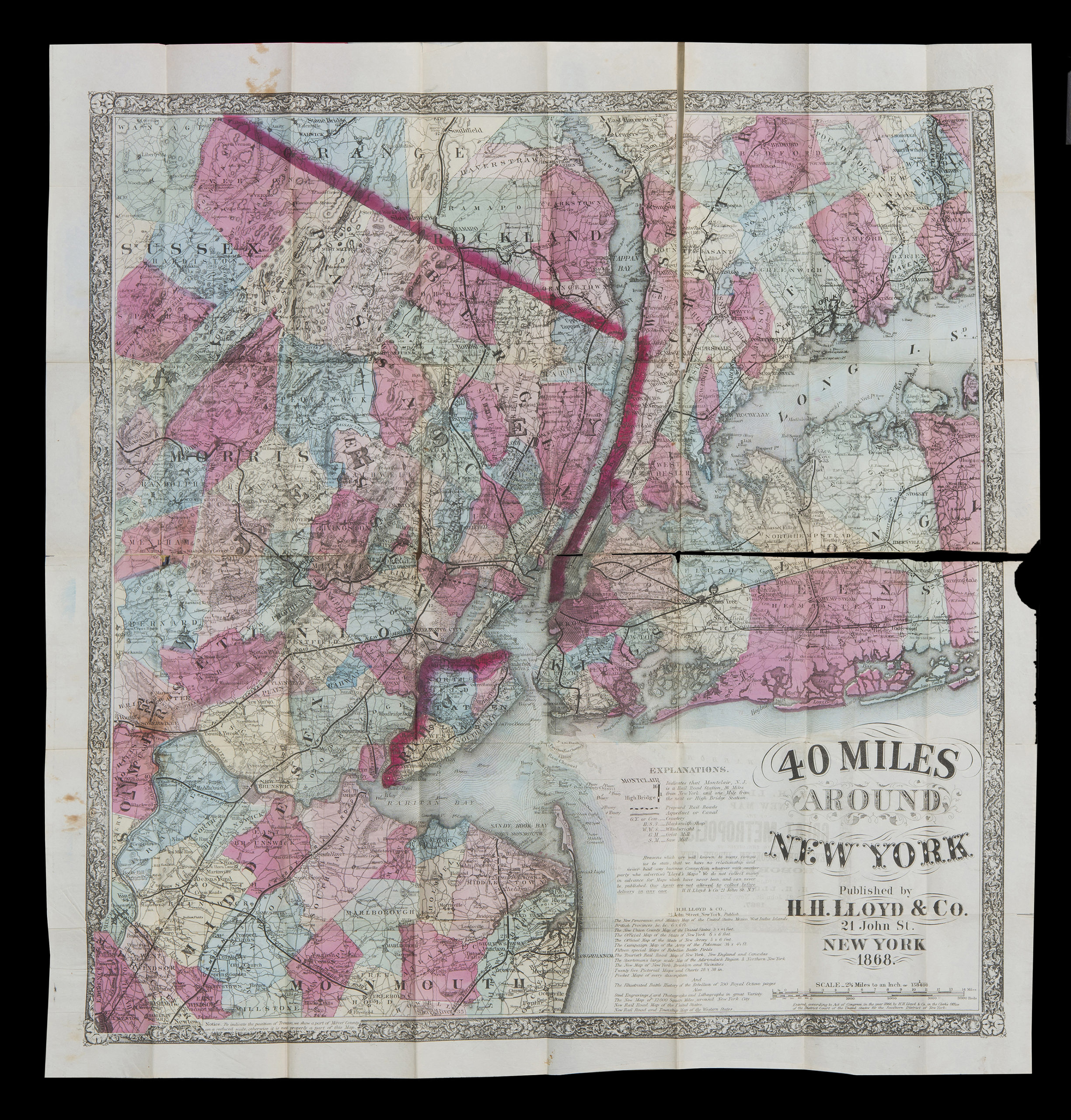
Creator
H.H. Lloyd & Co.,Publisher
Brooklyn Historical SocietyCitation
40 miles around New York; 1867; [ca. 1866], Map Collection, NYC-1868.Folded.RA; Brooklyn Historical Society.Scale
Scale 1:158,400. 1 in to