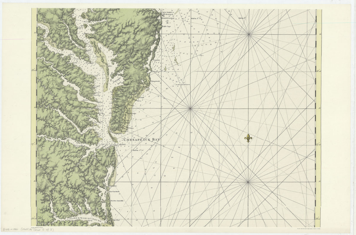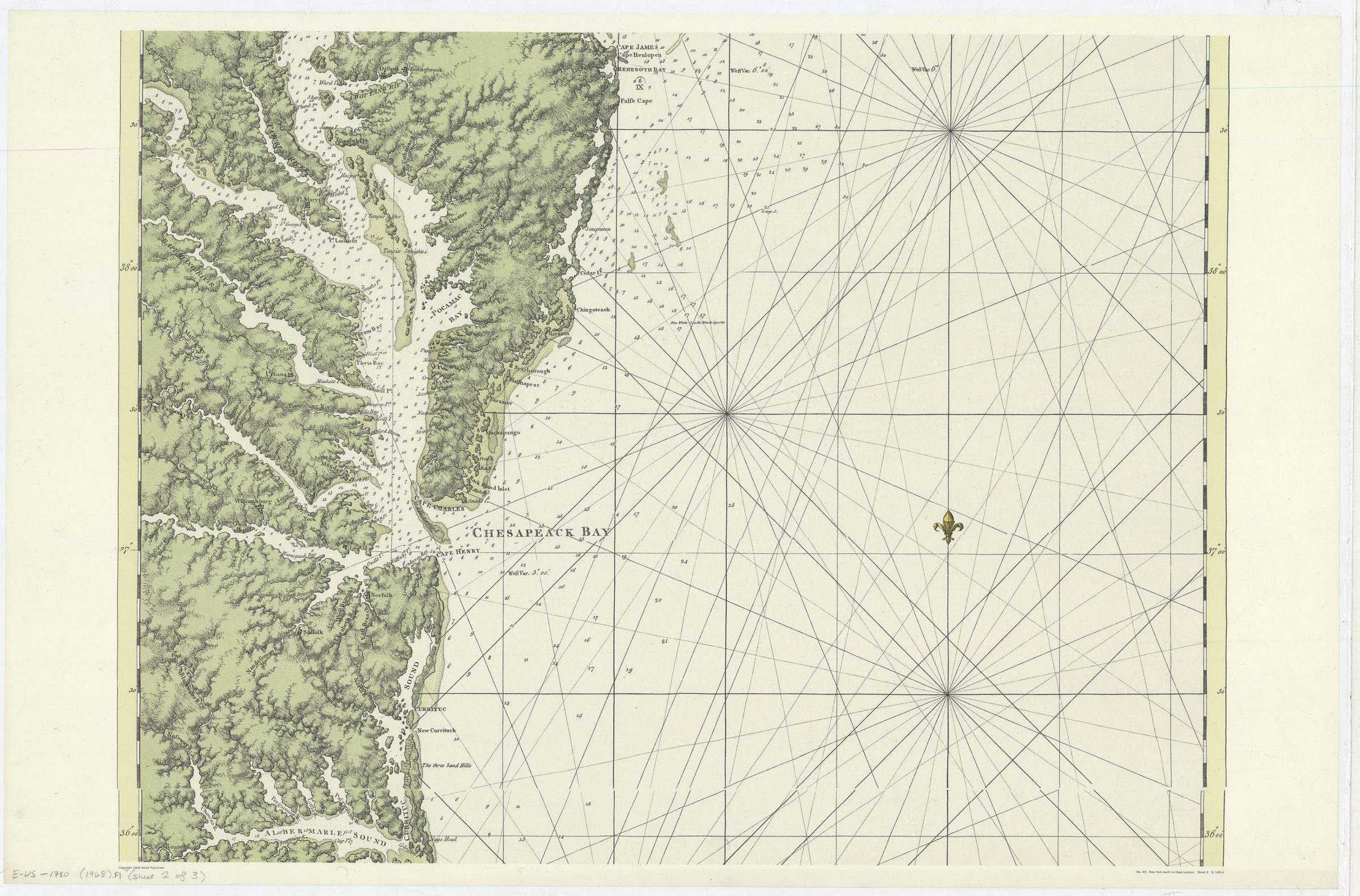
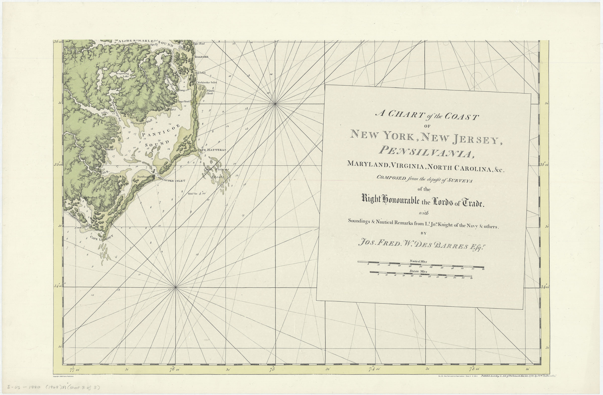
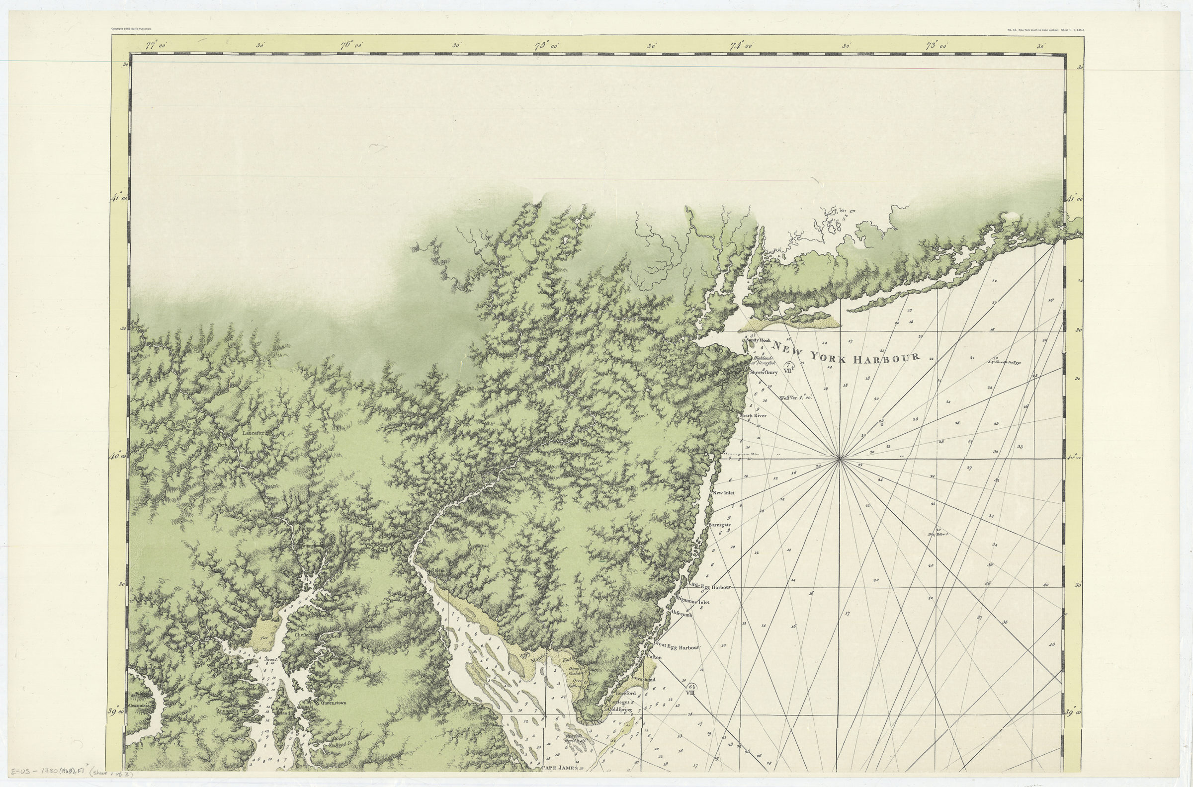
A chart of the coast of New York, New Jersey, Pensilvania, Maryland, Virginia, North Carolina, &c.: composed from the deposit of surveys of the right honourable the Lords of Trade with soundings & nautical remarks from Lt. Jno. Knight of the Navy 1968
Map No. E-US-1780 (1968).Fl
Facsimile. Relief shown by hachures. Depths shown by shading and soundings. Shows rhumb lines. “No. 42 New York South to Cape Lookout S 145-1.”
Map area shown
Relation
Full catalog recordSize
159 × 71 cmDownload
Low Resolution Image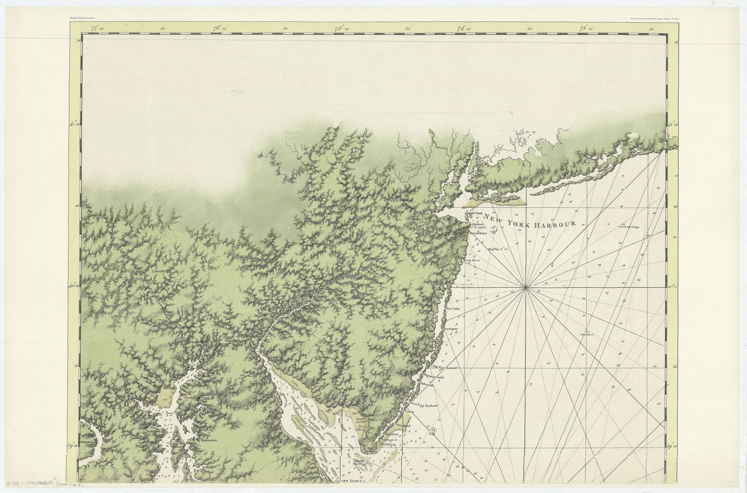
Creator
Des Barres, Joseph F. W.,Publisher
Brooklyn Historical SocietyCitation
A chart of the coast of New York, New Jersey, Pensilvania, Maryland, Virginia, North Carolina, &c.: composed from the deposit of surveys of the right honourable the Lords of Trade with soundings & nautical remarks from Lt. Jno. Knight of the Navy; 1968, Map Collection, E-US-1780 (1968).Fl; Brooklyn Historical Society.Scale
Scale [ca. 1:580,000]Loading zoom image...