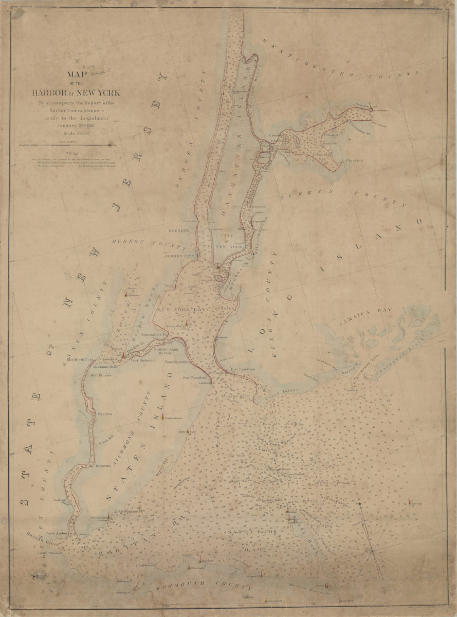
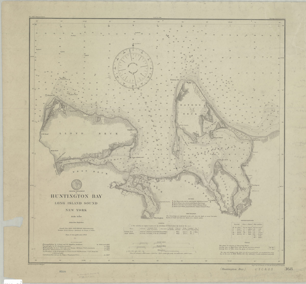
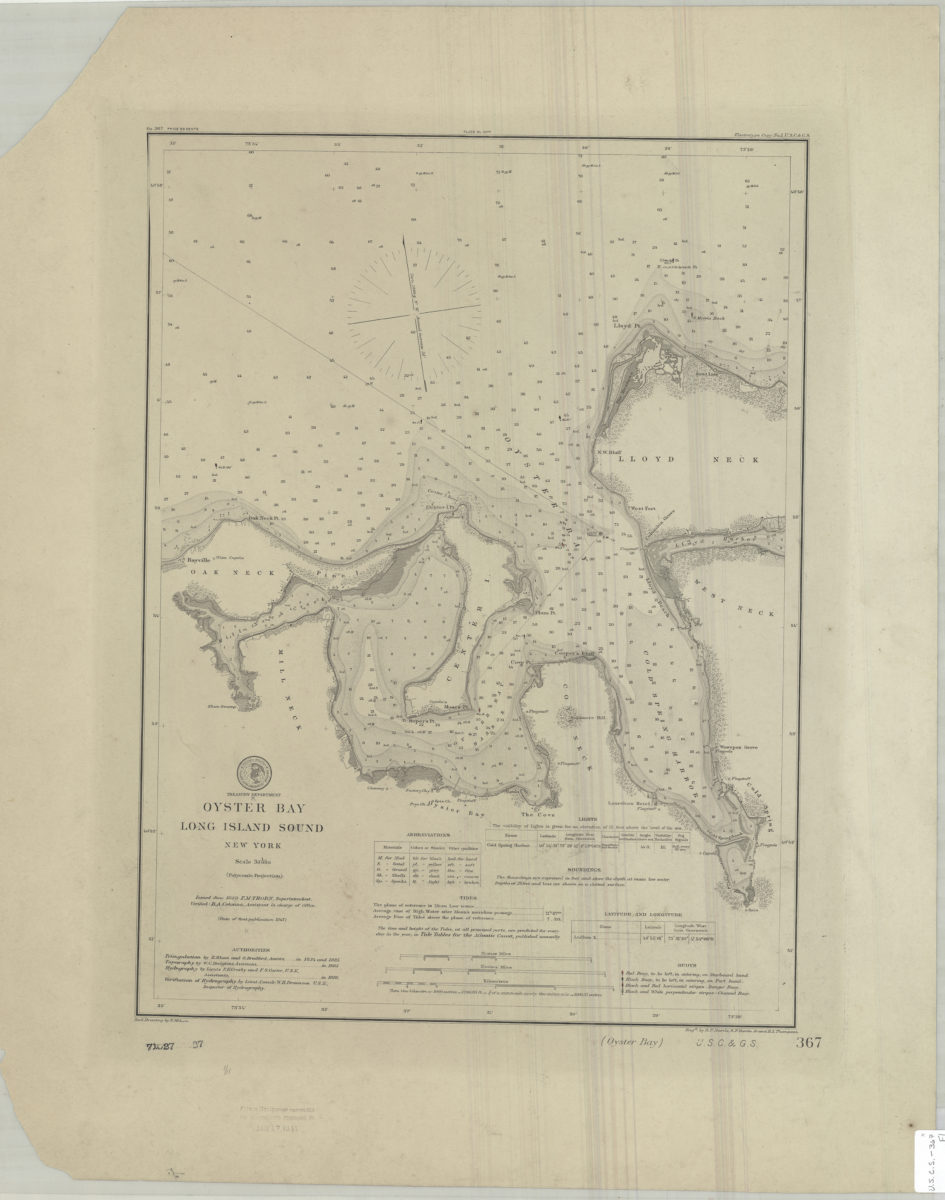
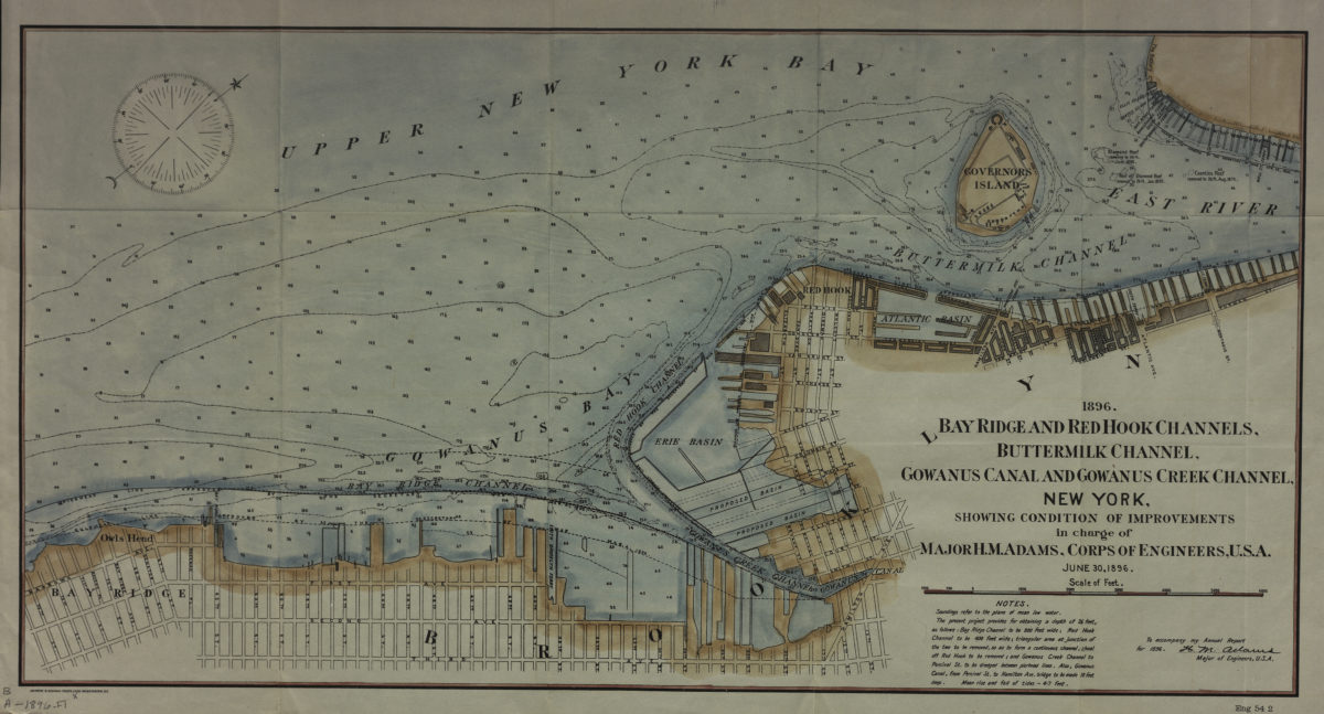
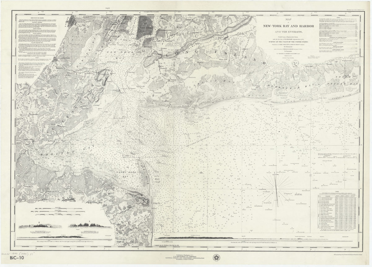
Map of the bays, harbors, and rivers around New York: showing the channels, soundings, lighthouses, buoys and the complete topography of the surrounding country. including Hempstead, Sandy-Hook, South-Amboy, Newark, Yonkers, N. Rochelle & Glen Cove
Map of the bays, harbors, and rivers around New York: showing the channels, soundings, lighthouses, buoys and the complete topography of the surrounding country. including Hempstead, Sandy-Hook, South-Amboy, Newark, Yonkers, N. Rochelle & Glen Cove
[ca. 1866]
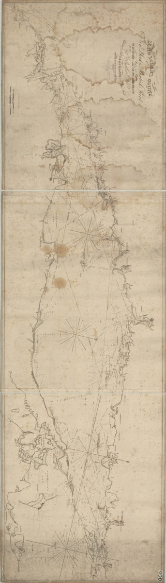
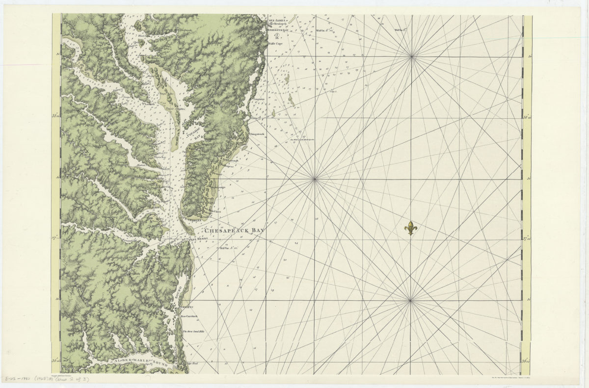
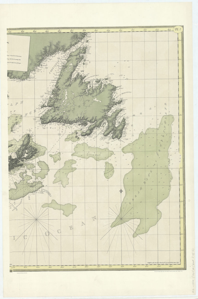
The coast of Nova Scotia, New England, New York, Jersey, the Gulph and River of St. Lawrence, the islands of Newfoundland, Cape Breton, St. John, Anticosti, Sable, etc., and soundings thereof:
The coast of Nova Scotia, New England, New York, Jersey, the Gulph and River of St. Lawrence, the islands of Newfoundland, Cape Breton, St. John, Anticosti, Sable, etc., and soundings thereof:
[ca. 1969]