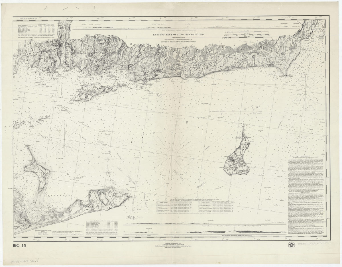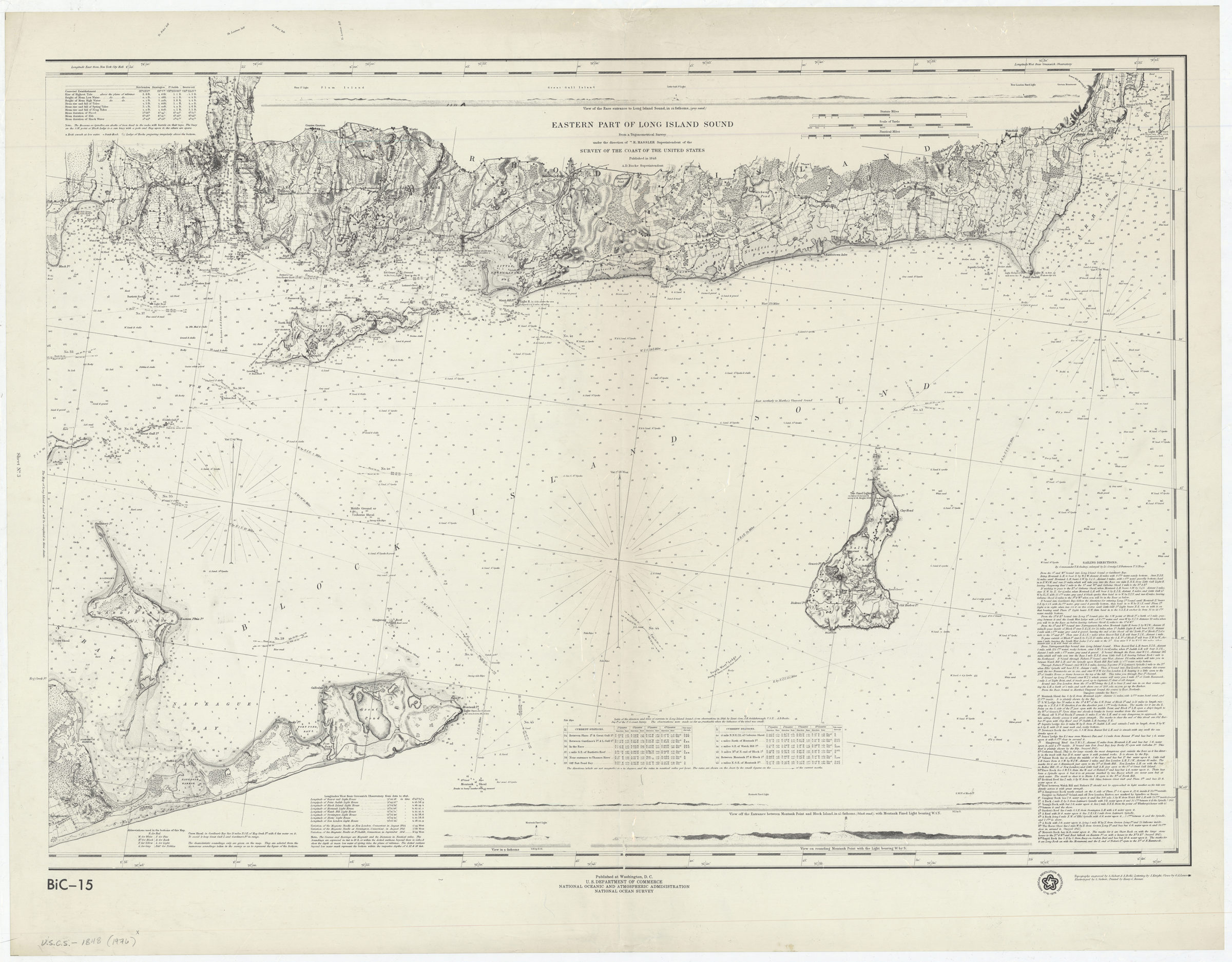
Eastern part of Long Island Sound: from a trigonometrical survey under the direction of F.R. Hassler, superintendent of the Survey of the Coast of the United States [1976]
Map No. U.S.C.S.-1848 (1976).Fl
Facsimile covering Long Island Sound from Amagansett, Long Island east to Naragansett Bay. Shows portions of Long Island and Connecticut. Also shows roads, structures, seafloor terrain, and courses and bearings. Relief shown by hachures. Depths shown by bathymetric tints and soundings. “American Revolution Bicentennial, 1776-1976.” Includes sailing directions, current table, tidal table, notes on abbreviations and longitudes, and 4 coastal panoramas. “BiC-15”–Lower left. “Sheet No. 3”–Left margin.
Map area shown
Relation
Full catalog recordSize
63 × 88 cmDownload
Low Resolution Image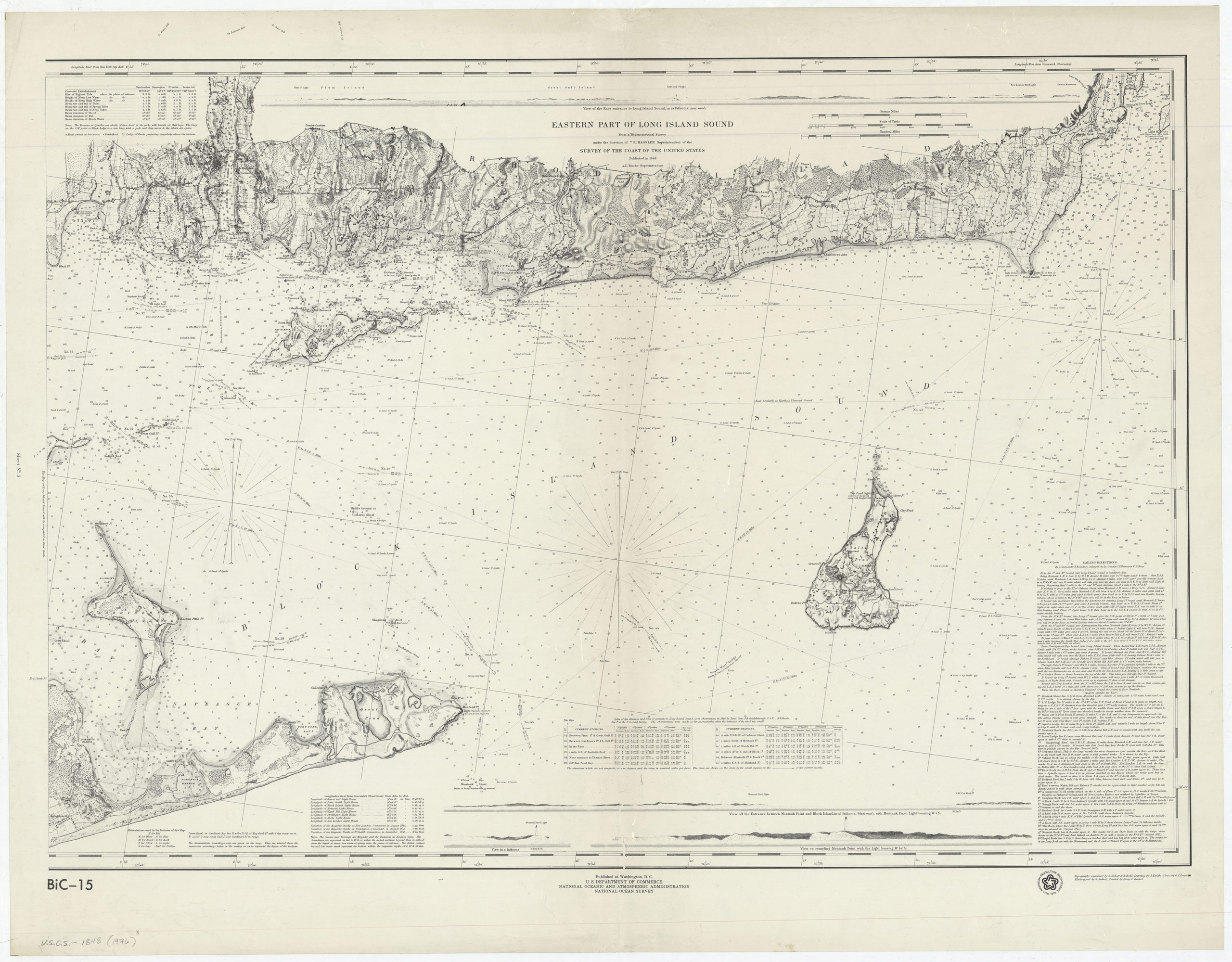
Creator
United States Coast Survey,Publisher
Brooklyn Historical SocietyCitation
Eastern part of Long Island Sound: from a trigonometrical survey under the direction of F.R. Hassler, superintendent of the Survey of the Coast of the United States; [1976], Map Collection, U.S.C.S.-1848 (1976).Fl; Brooklyn Historical Society.Scale
Scale [ca. 1:80,000]Loading zoom image...