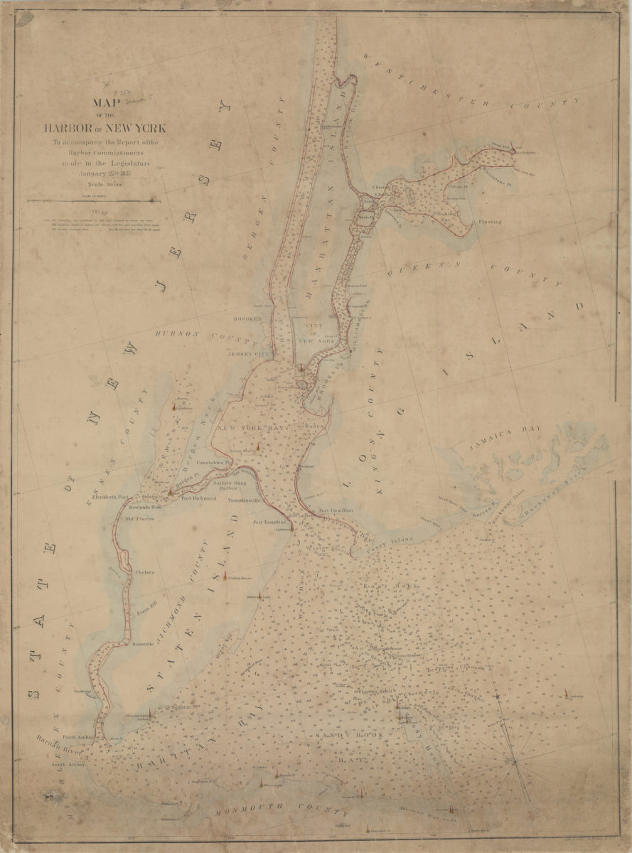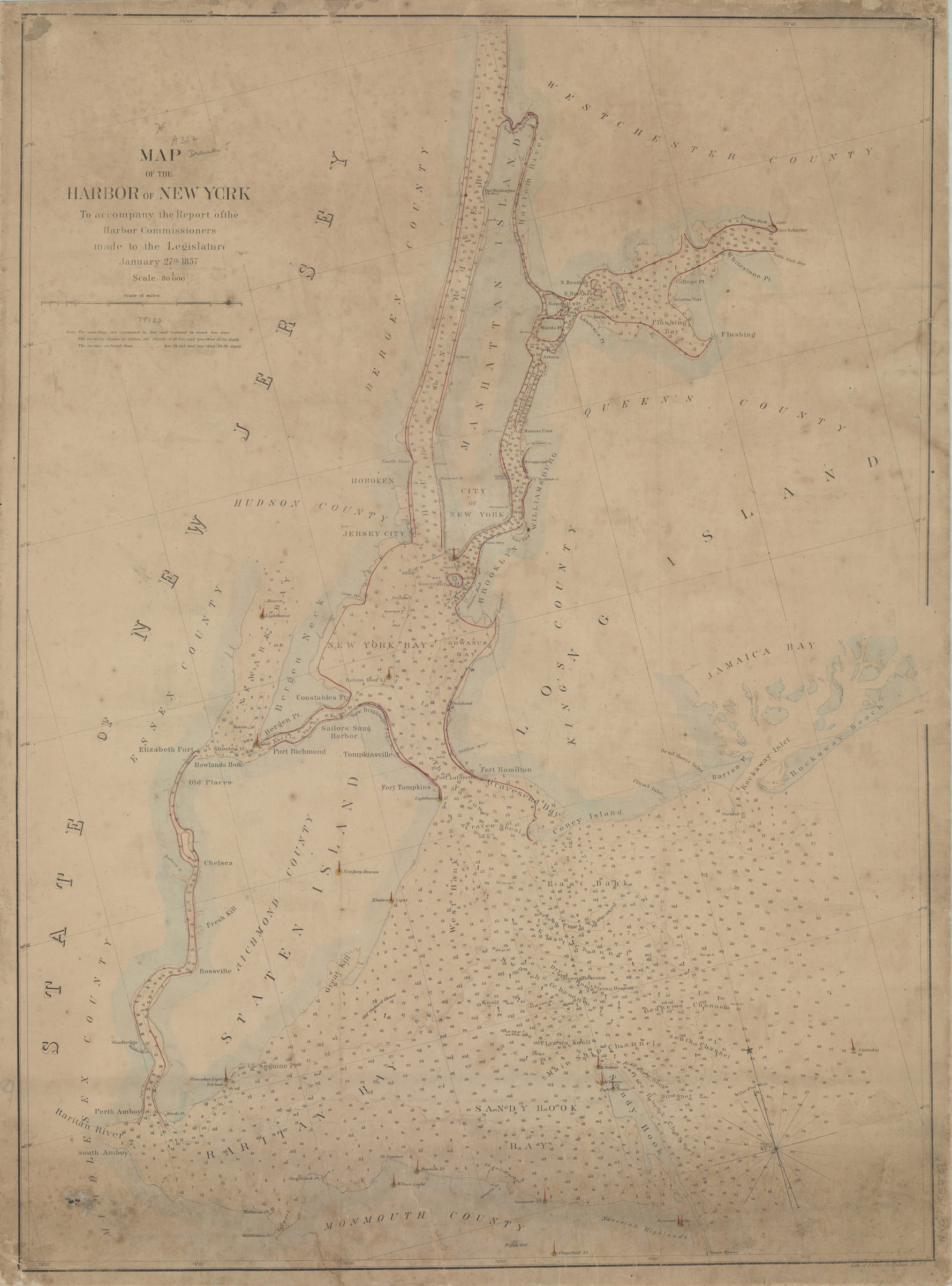
Map of the Harbor of New York: to accompany the report of the Harbor Commissioners made to the Legislature, January 27th, 1857 [1857]
Map No. NYC-1857.Fl
Covers New York Harbor region from the Hudson River and Flushing Bay south to Raritan Bay and Sandy Hook Bay. Shows location of lighthouses. Depths shown by soundings in feet. Includes text. BHS copy mounted on linen and annotated in red ink.
Map area shown
Relation
Full catalog recordSize
73 × 54 cmDownload
Low Resolution Image
Creator
Bien, Julius; New York (State),Publisher
Brooklyn Historical SocietyCitation
Map of the Harbor of New York: to accompany the report of the Harbor Commissioners made to the Legislature, January 27th, 1857; [1857], Map Collection, NYC-1857.Fl; Brooklyn Historical Society.Scale
Scale 1:80,000Loading zoom image...