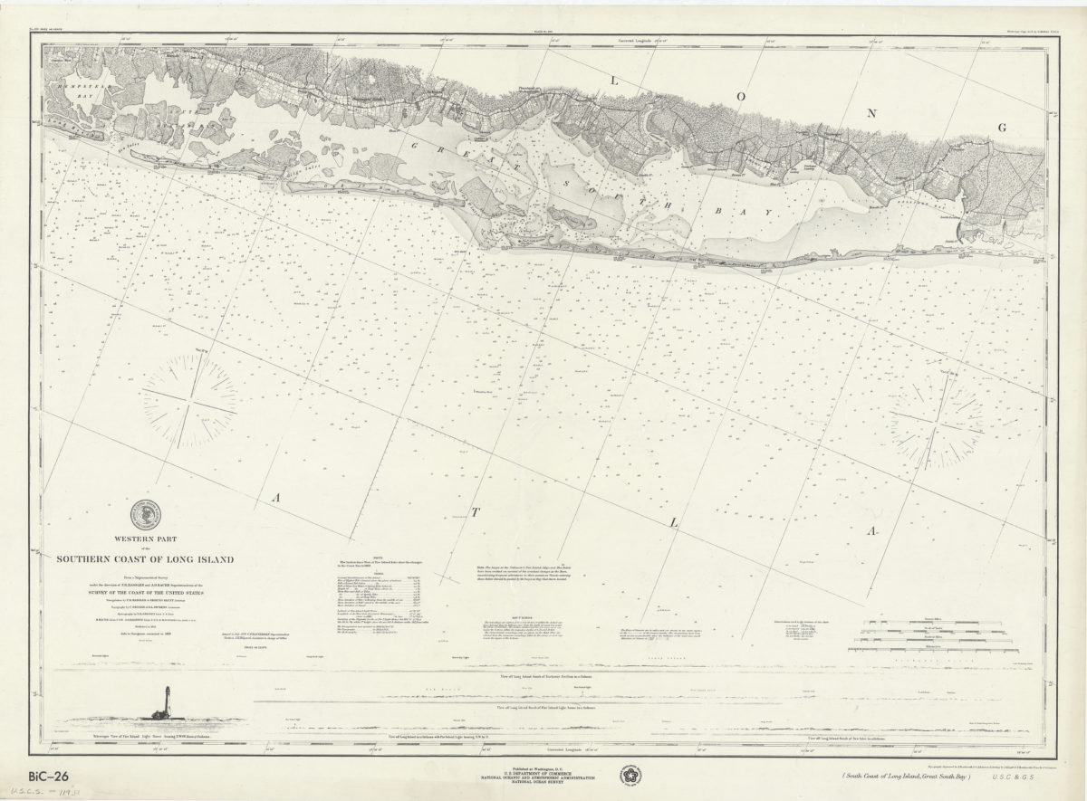
Western part of the southern coast of Long Island: from a trigonometrical survey under the direction of F.R. Hassler and A.D. Bache, superintendents of the Survey of the Coast of the United States [1976]
Map No. U.S.C.S.-119.Fl
Facsimile covering the southern portion of Long Island from Hempstead Bay east to Bellport Bay. Shows buoys, life saving stations, roads, and seafloor terrain. Relief shown by shading. Depths shown by shading and soundings in feet. “American Revolution Bicentennial, 1776-1976.” Includes text, seal, and 5 coastal views. Views: View off Long Island south of Rockaway Pavilion in 12 fathoms — View off Long Island south of Fire Island light-house in 12 fathoms — Telescopic view of Fire Island light house bearing N.W. 1/2 W. from 9 1/2 fathoms — View off Long Island in 12 fathoms with Fire Island light bearing N.W. by N. — View off Long Island south of New Inlet in 12 fathoms. “BiC-26”–Lower left margin.
Map area shown
Genre
Nautical chartsRelation
Full catalog recordSize
63 × 89 cmDownload
Low Resolution Image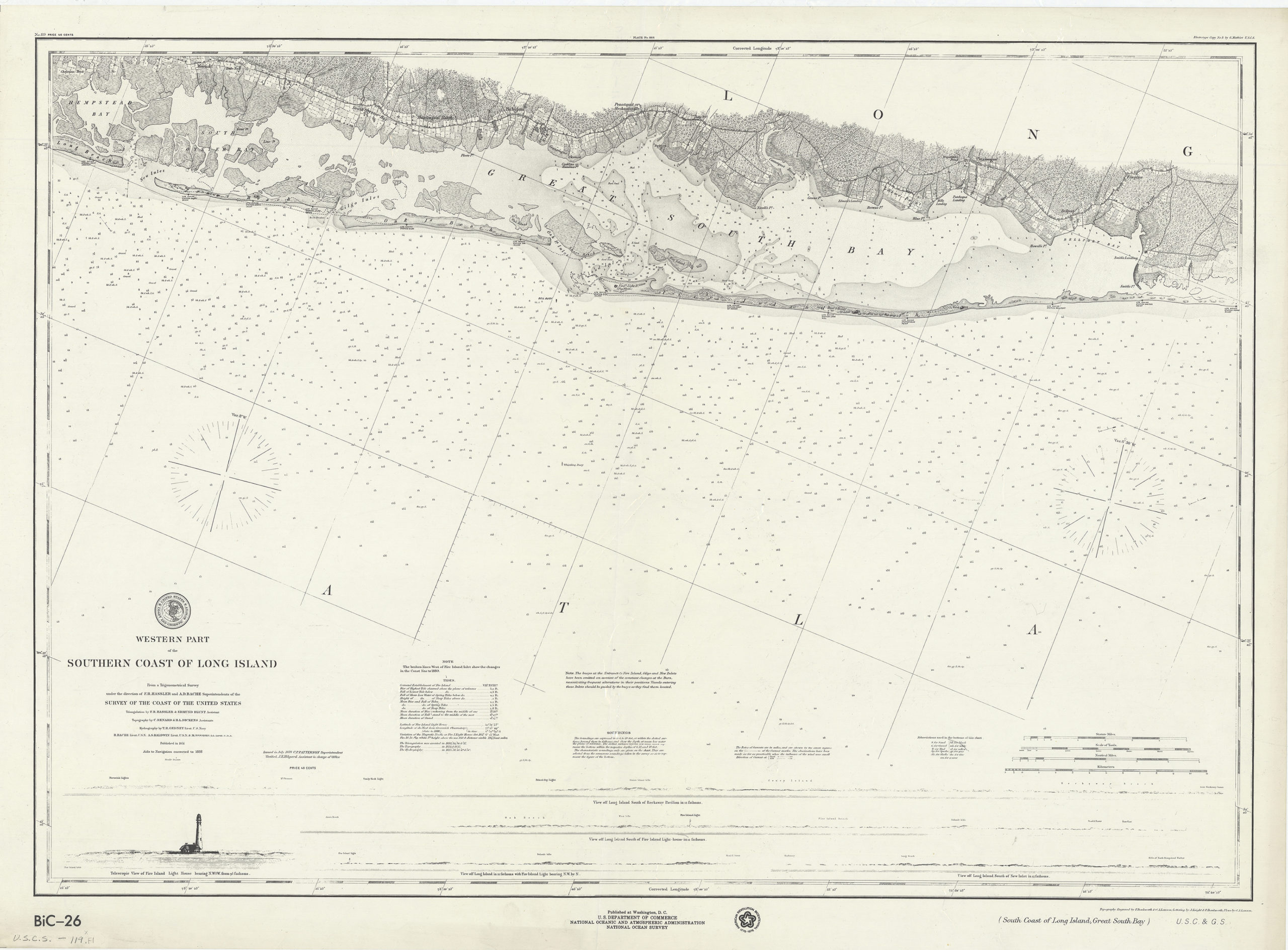
Creator
U.S. Coast and Geodetic Survey,Publisher
Brooklyn Historical SocietyCitation
Western part of the southern coast of Long Island: from a trigonometrical survey under the direction of F.R. Hassler and A.D. Bache, superintendents of the Survey of the Coast of the United States; [1976], Map Collection, U.S.C.S.-119.Fl; Brooklyn Historical Society.Scale
Scale 1:80,000Loading zoom image...