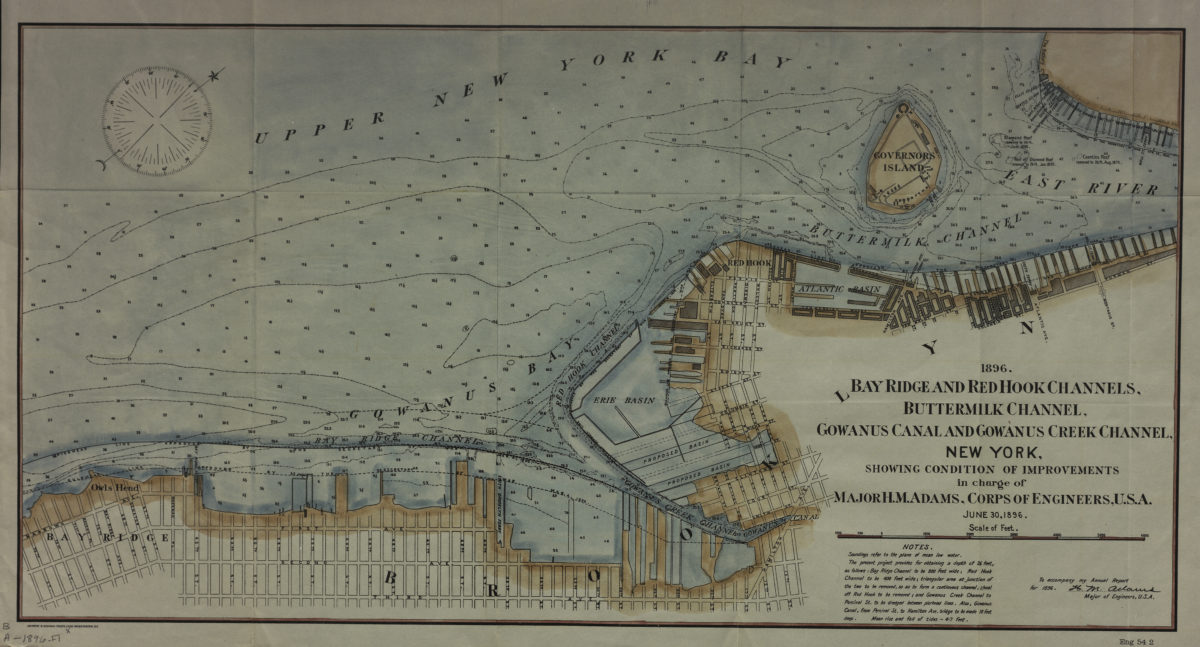
Bay Ridge and Red Hook Channels, Buttermilk Channel, Gownus Canal and Gowanus Creek Channel, New York, showing condition of improvements in charge of Major H.M. Adams, Corps of Engineers, U.S.A., June 30, 1896 1896
Map No. B A-1896.Fl
Covers the Brooklyn waterfront north from Bay Ridge through Red Hook to Brooklyn Heights also covers Gowanus Bay, Upper New York Bay, the Erie Basin, Governors Island, and a small portion of Lower Manhattan. Shows piers, streets, pierhead lines, and bulkhead lines. Relief shown by soundings and isolines. Oriented with north to the upper right. “To accompany my annual report for 1896, H.M. Adams, Major of Engineers, U.S.A.” Includes notes. “Eng 54 2”–Lower right corner.
Map area shown
Genre
Bathymetric mapsRelation
Full catalog recordSize
28 × 54 cmDownload
Low Resolution Image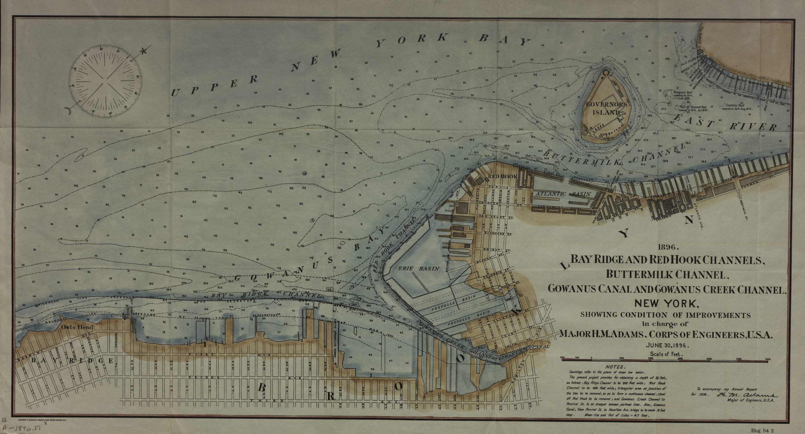
Creator
Adams, H. M.; Graham, Andrew B.,Publisher
Brooklyn Historical SocietyCitation
Bay Ridge and Red Hook Channels, Buttermilk Channel, Gownus Canal and Gowanus Creek Channel, New York, showing condition of improvements in charge of Major H.M. Adams, Corps of Engineers, U.S.A., June 30, 1896; 1896, Map Collection, B A-1896.Fl; Brooklyn Historical Society.Scale
Scale [ca. 1:15,568]Loading zoom image...