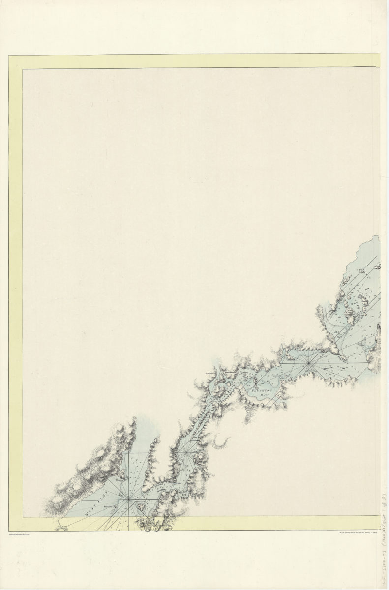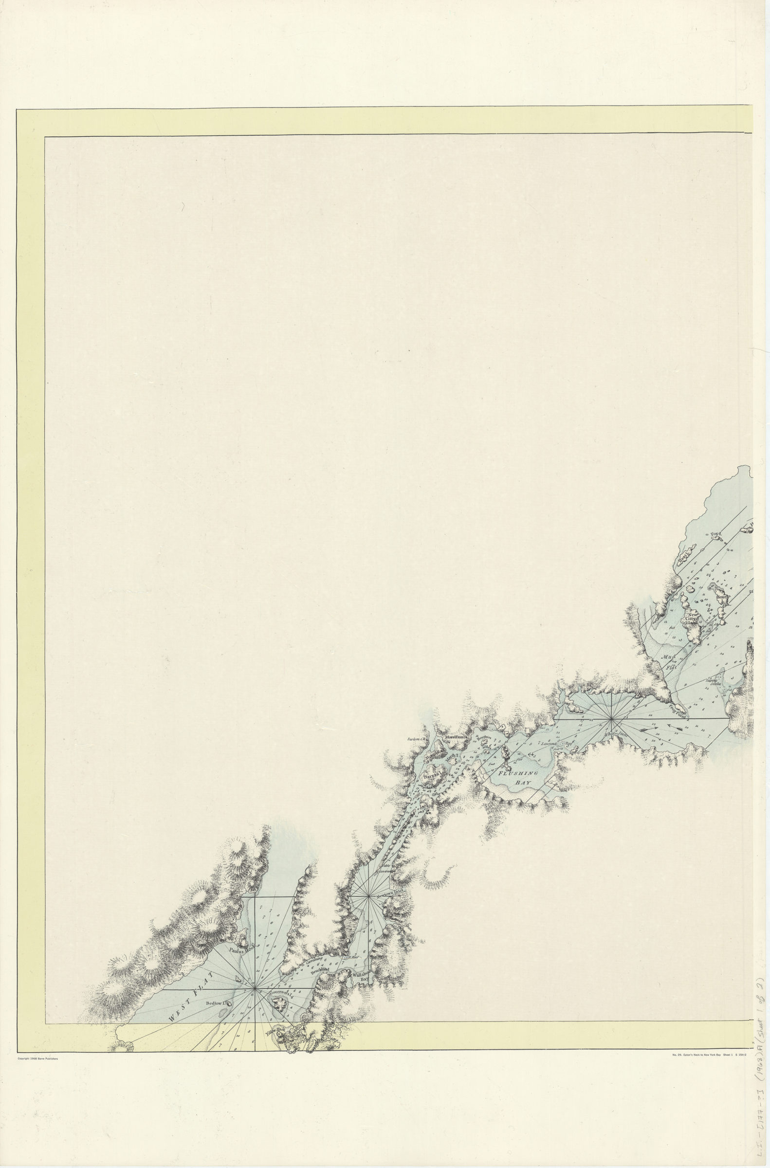
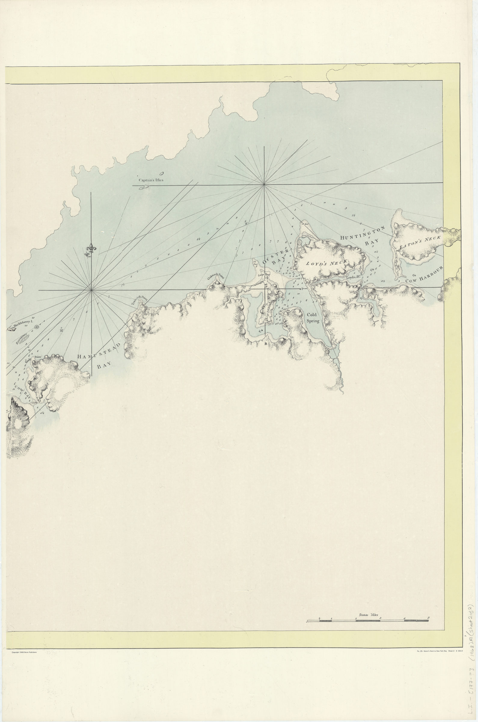
Eaton’s Neck to New York Bay [ca. 1968]
Map No. L.I.-[177-?] (1968).Fl.Folio
Facsimile of unknown map. Relief shown by hachures. Depths shown by soundings. Title from lower margin. “No. 29.” “S 154-2.”
Map area shown
Genre
Bathymetric mapsRelation
Full catalog recordSize
70 × 111 cmDownload
Low Resolution Image
Creator
Barre Publishers,Publisher
Brooklyn Historical SocietyCitation
Eaton’s Neck to New York Bay; [ca. 1968], Map Collection, L.I.-[177-?] (1968).Fl.Folio; Brooklyn Historical Society.Scale
Scale [ca. 1:54,000]Loading zoom image...