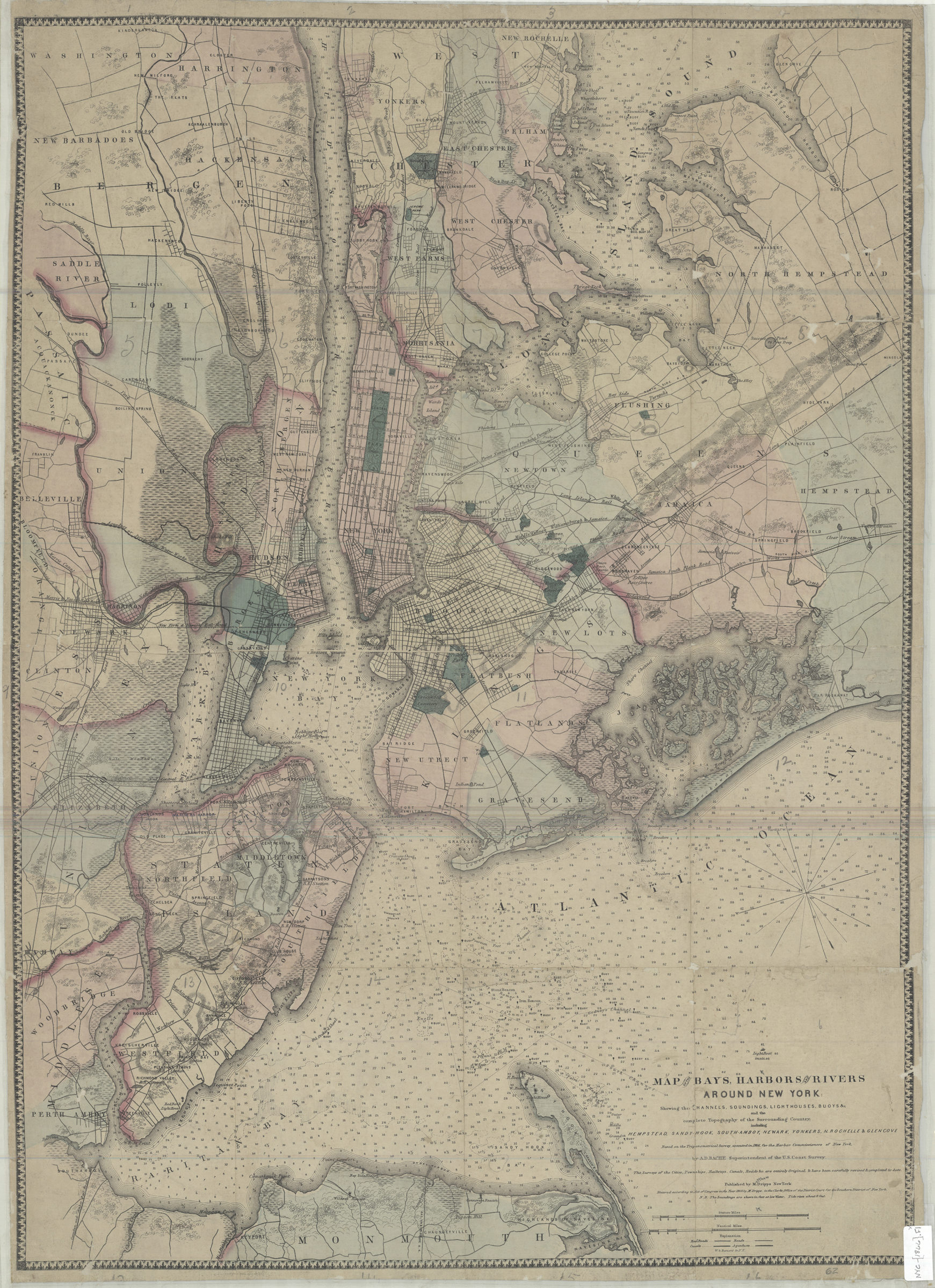
Map of the bays, harbors, and rivers around New York: showing the channels, soundings, lighthouses, buoys and the complete topography of the surrounding country. including Hempstead, Sandy-Hook, South-Amboy, Newark, Yonkers, N. Rochelle & Glen Cove [ca. 1866]
Map No. NYC-[1866].Fl
Covers area around Metropolitan New York from Monmouth County, New Jersey, north to New Rochelle, New York and New Jersey east to Far Rockaway. Shows wetlands, railroad lines, major roads, canals and aqueducts. Relief shown by hachures. Depths shown by soundings (in feet) and isolines. “Entered according to act of Congress in the year 1866 by M. Dripps …” Includes key to railroads, roads, canals and aqueducts. BHS copy mounted on linen.
Map area shown
Relation
Full catalog recordSize
81 × 57 cmDownload
Low Resolution Image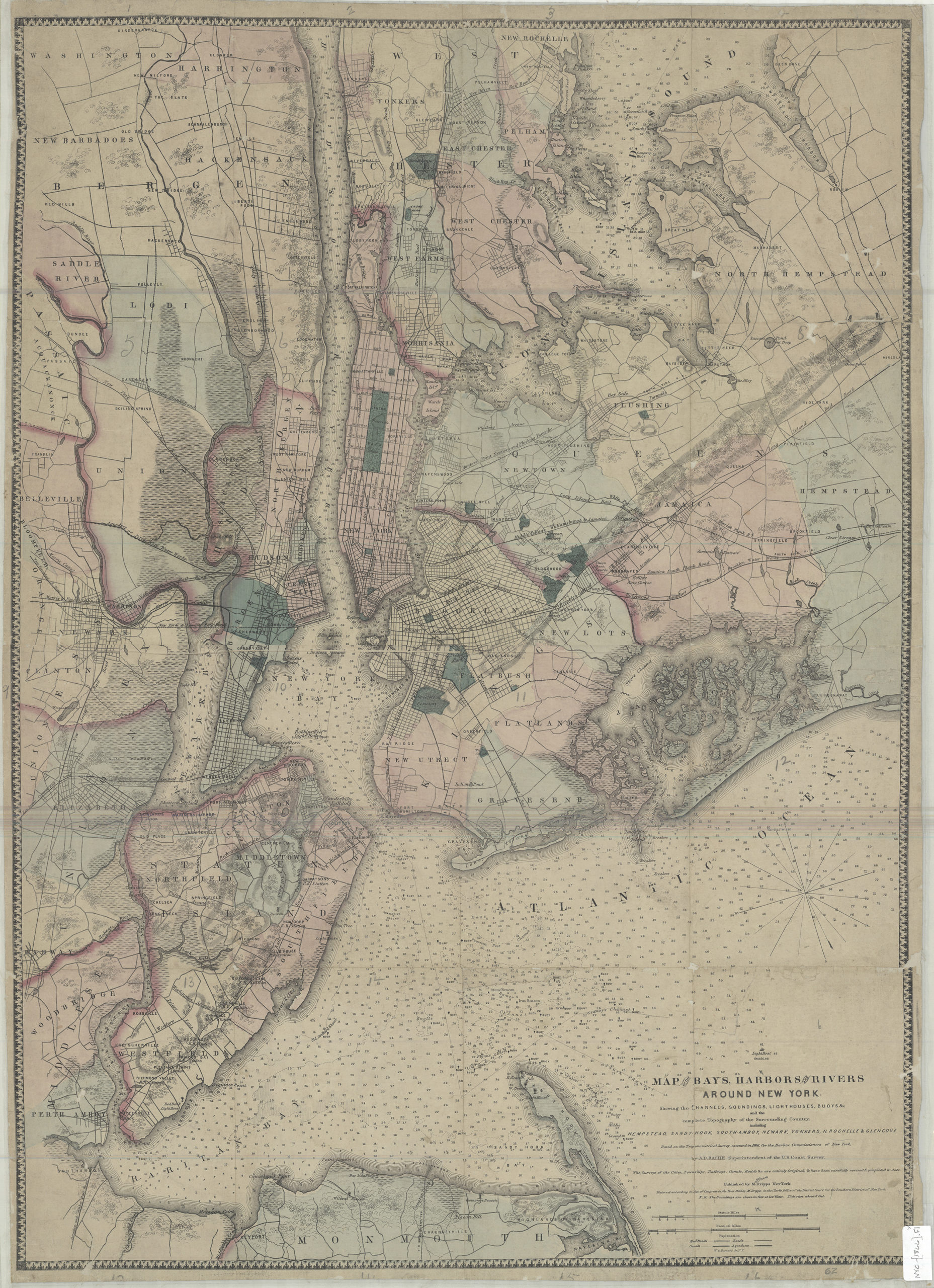
Creator
Bache, A. D.,Publisher
Brooklyn Historical SocietyCitation
Map of the bays, harbors, and rivers around New York: showing the channels, soundings, lighthouses, buoys and the complete topography of the surrounding country. including Hempstead, Sandy-Hook, South-Amboy, Newark, Yonkers, N. Rochelle & Glen Cove; [ca. 1866], Map Collection, NYC-[1866].Fl; Brooklyn Historical Society.Scale
Scale [ca. 1:80,000]Loading zoom image... 