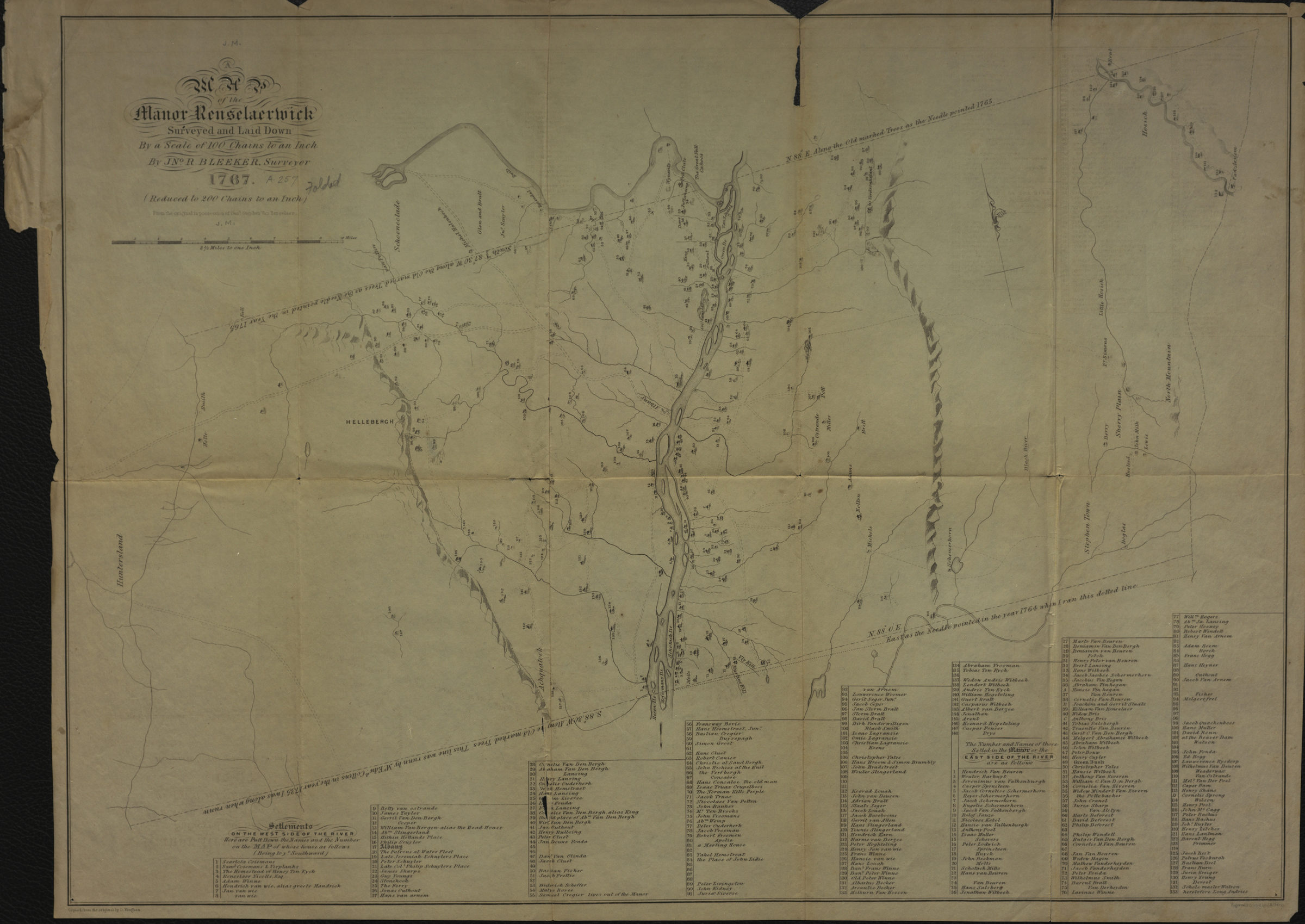
A map of the Manor Renselaerwick: surveyed and laid down by a scale of 100 chains to an inch: by Jno. R. Bleeker, surveyor ; from the original in possession of Genl. Stephen Van Renselaer [sic] ; copied from the original by D. Vaughan [18??]
Map No. NYS-1767 (18--?).Fl c.2;NYS-1767 (18--?).Fl
Shows landforms, drainage, roads, farmstead locations, and names of landowners. Relief shown pictorially. Oriented with north to the upper left. “Reduced to 200 chains to an inch.” Includes key of settlements and notes on coordinates. BHS has 2 copies.
Map area shown
Genre
Cadastral mapsRelation
Full catalog recordSize
38 × 54 cmDownload
Low Resolution Image
Creator
Bleeker, John R.,Publisher
Brooklyn Historical SocietyCitation
A map of the Manor Renselaerwick: surveyed and laid down by a scale of 100 chains to an inch: by Jno. R. Bleeker, surveyor ; from the original in possession of Genl. Stephen Van Renselaer [sic] ; copied from the original by D. Vaughan; [18??], Map Collection, NYS-1767 (18--?).Fl c.2;NYS-1767 (18--?).Fl; Brooklyn Historical Society.Scale
Scale [1:158,400]Loading zoom image... 