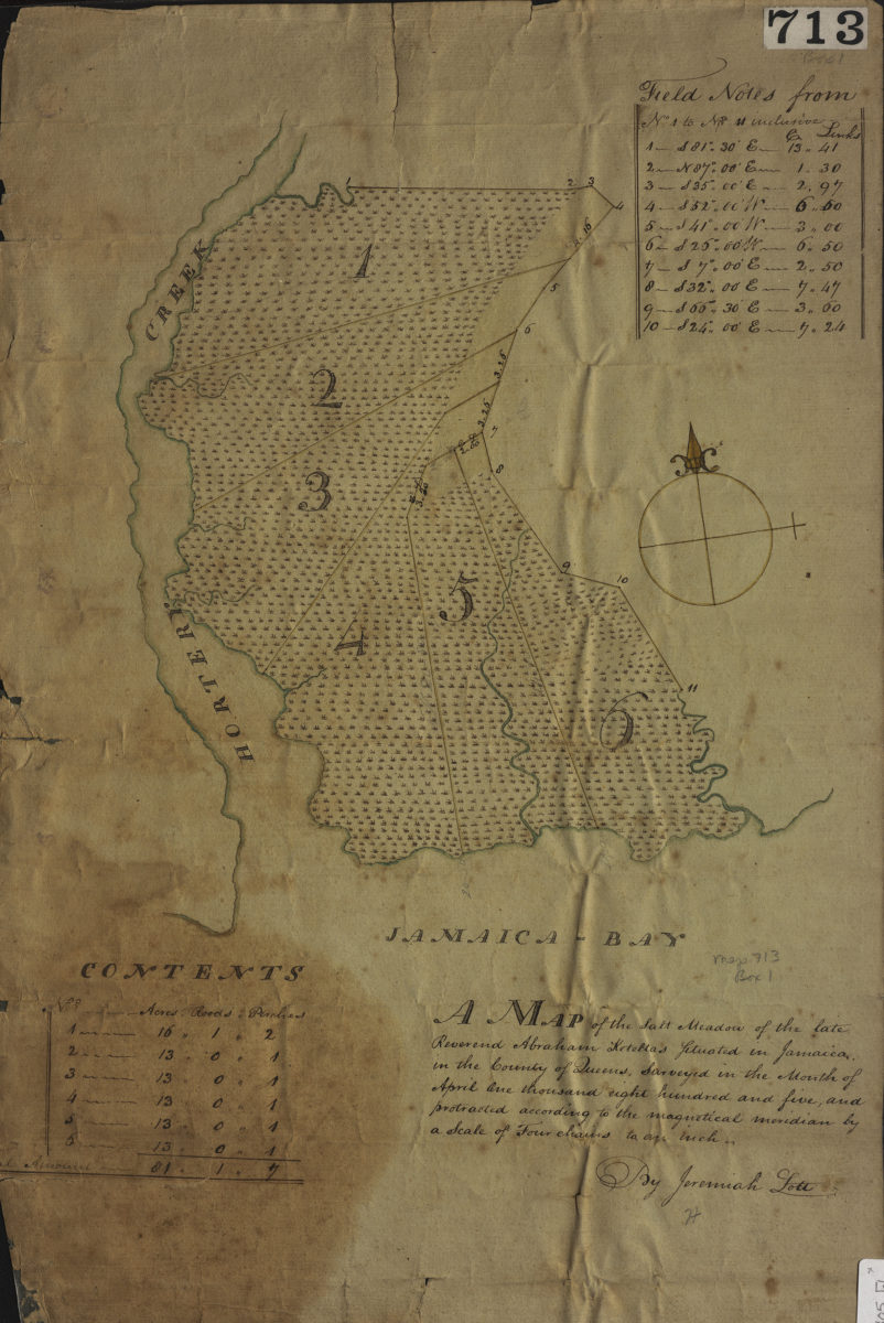
A map of the salt meadow of the late Reverend Abraham Keteltas, situated in Jamaica, in the county of Queens, as surveyed in the month of April: by Jeremiah Lott April 1805
Map No. Q-1805.Fl
Includes “field notes” and table showing “contents.”
Map area shown
Relation
Full catalog recordSize
51 × 34 cmDownload
Low Resolution Image
Creator
Lott, Jeremiah,Publisher
Brooklyn Historical SocietyCitation
A map of the salt meadow of the late Reverend Abraham Keteltas, situated in Jamaica, in the county of Queens, as surveyed in the month of April: by Jeremiah Lott; April 1805, Map Collection, Q-1805.Fl; Brooklyn Historical Society.Scale
Scale [1:3,168] 1 in to 4Loading zoom image...