Center for Brooklyn History
Map Collections
Search
About
Othmer Library & Archives
Submit search query
Refine 4 records
Clear filter
1
Location
Brooklyn (New York, N.Y.)
891
Jamaica (New York, N.Y.)
8
Manhattan (New York, N.Y.)
120
New York (N.Y.)
164
Queens (New York, N.Y.)
83
Subject
Marshes
1
Railroads
72
Shorelines
3
Date
19th Century
945
20th Century
469
or enter range:
from
to
Genres
Historical maps
53
Manuscript maps
365
Physical maps
4
Sort by:
Date (earliest)
Date (most recent)
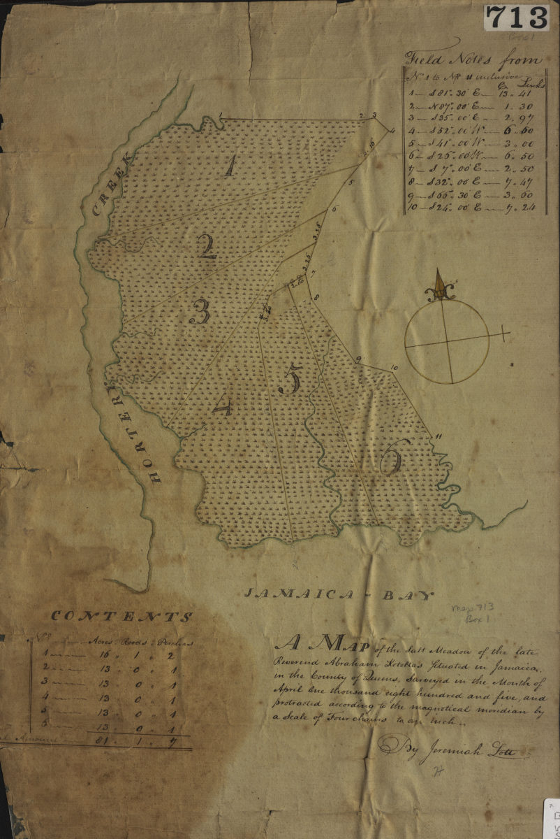
A map of the salt meadow of the late Reverend Abraham Keteltas, situated in Jamaica, in the county of Queens, as surveyed in the month of April: by Jeremiah Lott
A map of the salt meadow of the late Reverend Abraham Keteltas, situated in Jamaica, in the county of Queens, as surveyed in the month of April: by Jeremiah Lott
April 1805
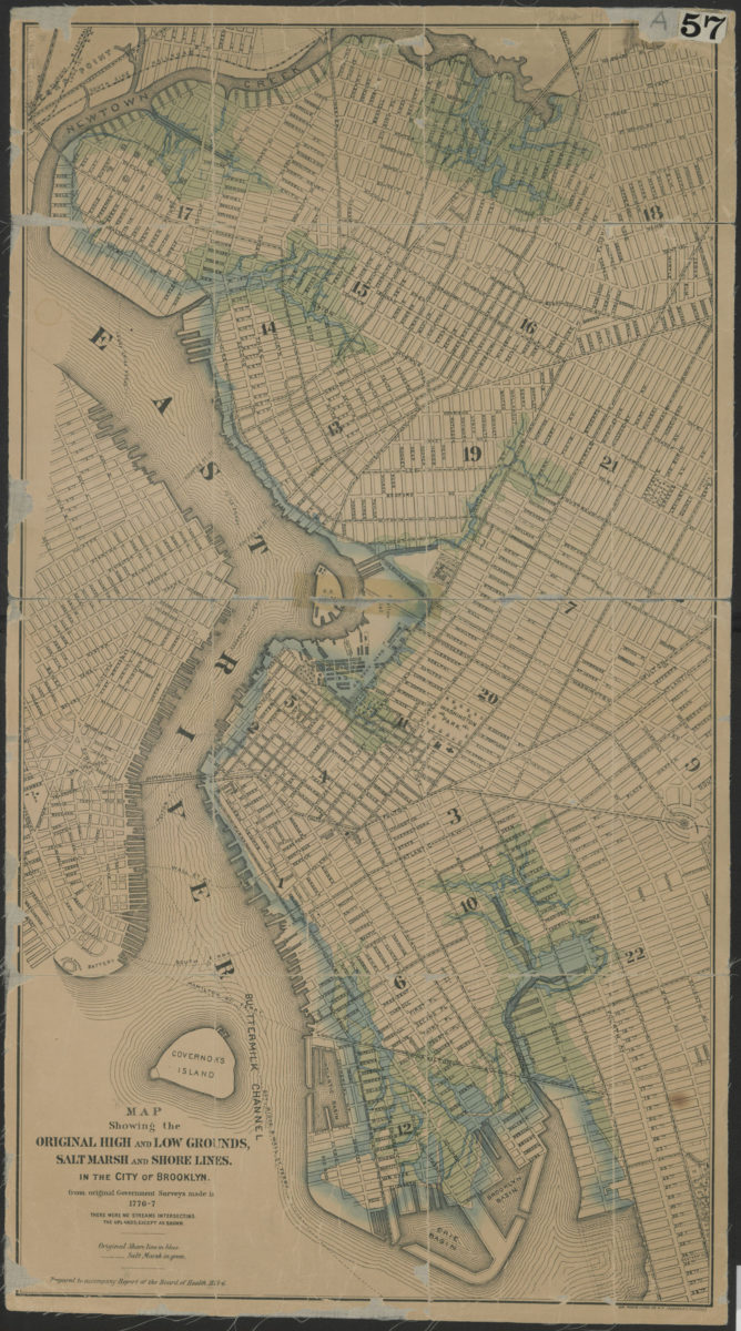
Map showing the original high and low grounds, salt marsh and shore lines in the city of Brooklyn: from original government surveys made in 1776-7
Map showing the original high and low grounds, salt marsh and shore lines in the city of Brooklyn: from original government surveys made in 1776-7
[1876]
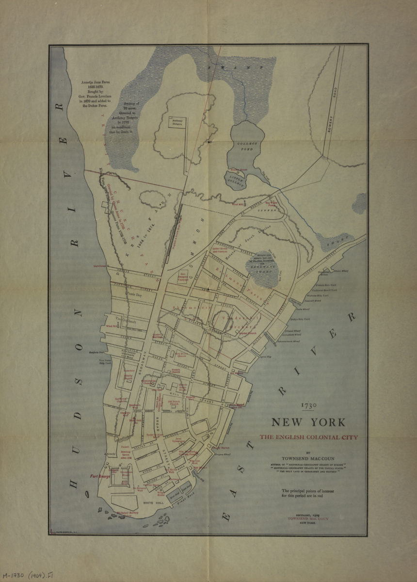
1730 New York, the English colonial city: by Townsend MacCoun
1730 New York, the English colonial city: by Townsend MacCoun
[ca. 1909]
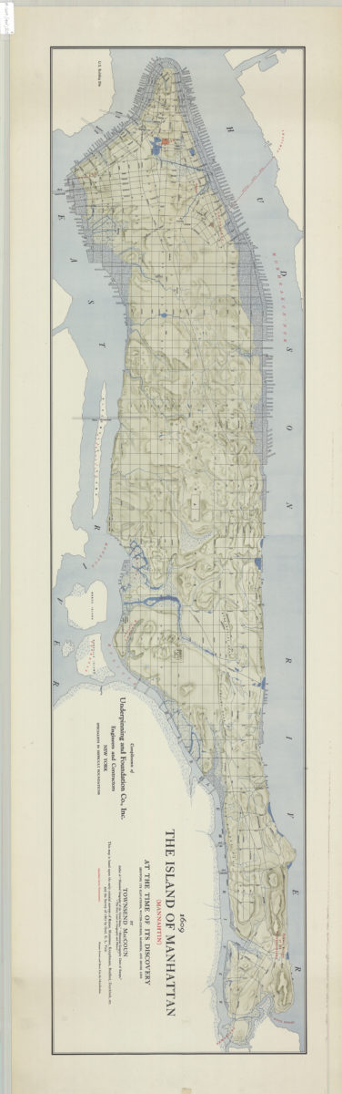
The island of Manhattan (Mannahtin) at the time of its discovery: showing its elevations, water-courses, marshes, and shore line: by Townsend MacCoun ; compliments of Underpinning and Foundation Co., Inc
The island of Manhattan (Mannahtin) at the time of its discovery: showing its elevations, water-courses, marshes, and shore line: by Townsend MacCoun ; compliments of Underpinning and Foundation Co., Inc
[ca. 1909]