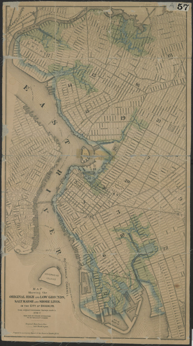
Map showing the original high and low grounds, salt marsh and shore lines in the city of Brooklyn: from original government surveys made in 1776-7 [1876]
Map No. B A-1776-1777 (1876).Fl
Covers ca. 1876 Brooklyn from Newtown Creek south to the Erie Basin, and east to Grand Army Plaza. Also covers a portion of lower Manhattan and southern Queens. Shows wards, railroads, structures, streets, ferry lines and detail ca. 1776-7. “Prepared to accompany Report of the Board of Health, 1875-6.” Includes note and key. BHS copy mounted on linen.
Map area shown
Genre
Physical mapsRelation
Full catalog recordSize
69 × 38 cmDownload
Low Resolution Image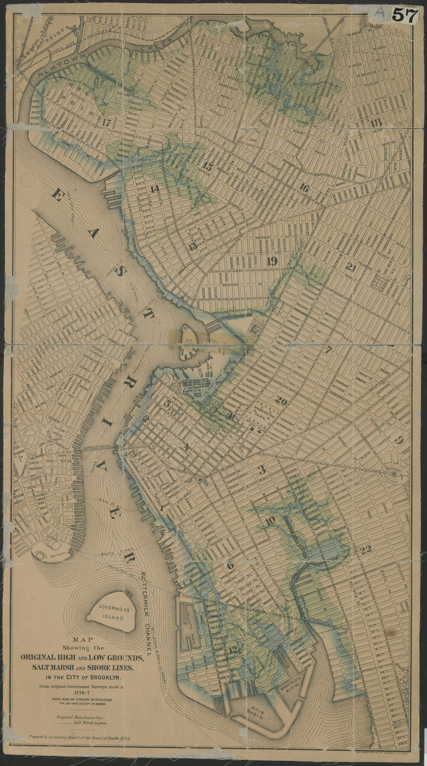
Creator
American Photo-Lithographic Company; Brooklyn (New York, N.Y.),Publisher
Brooklyn Historical SocietyCitation
Map showing the original high and low grounds, salt marsh and shore lines in the city of Brooklyn: from original government surveys made in 1776-7; [1876], Map Collection, B A-1776-1777 (1876).Fl; Brooklyn Historical Society.Scale
Scale not givenLoading zoom image...