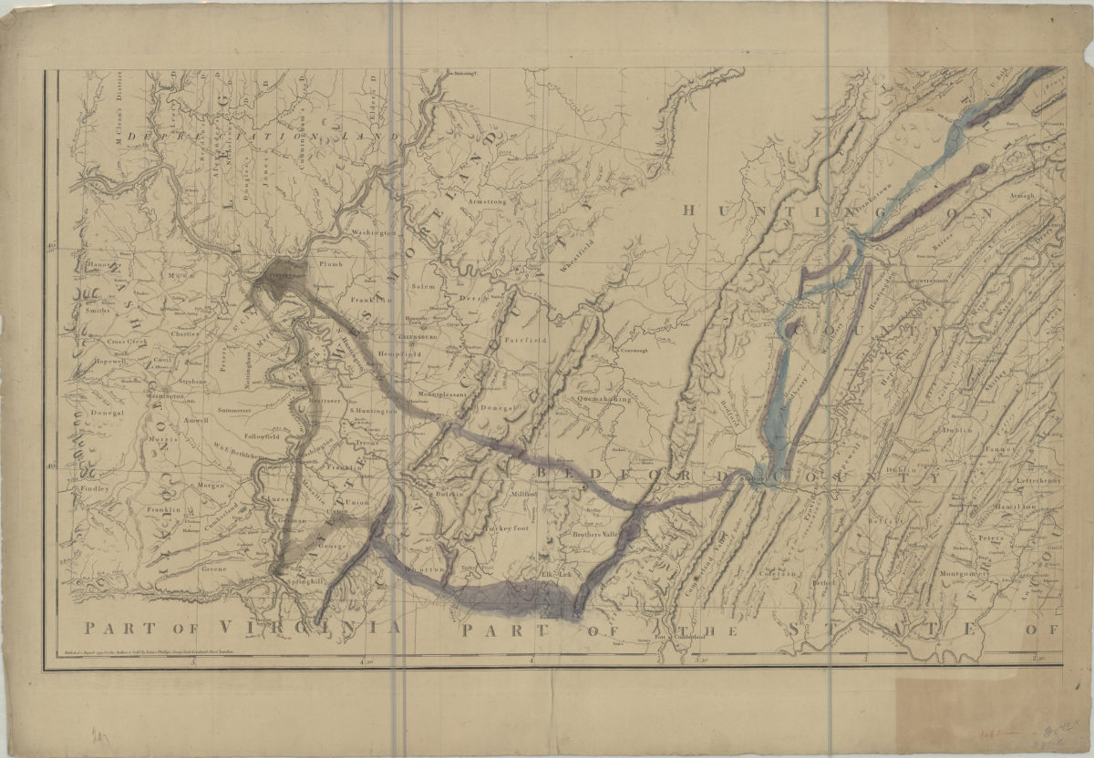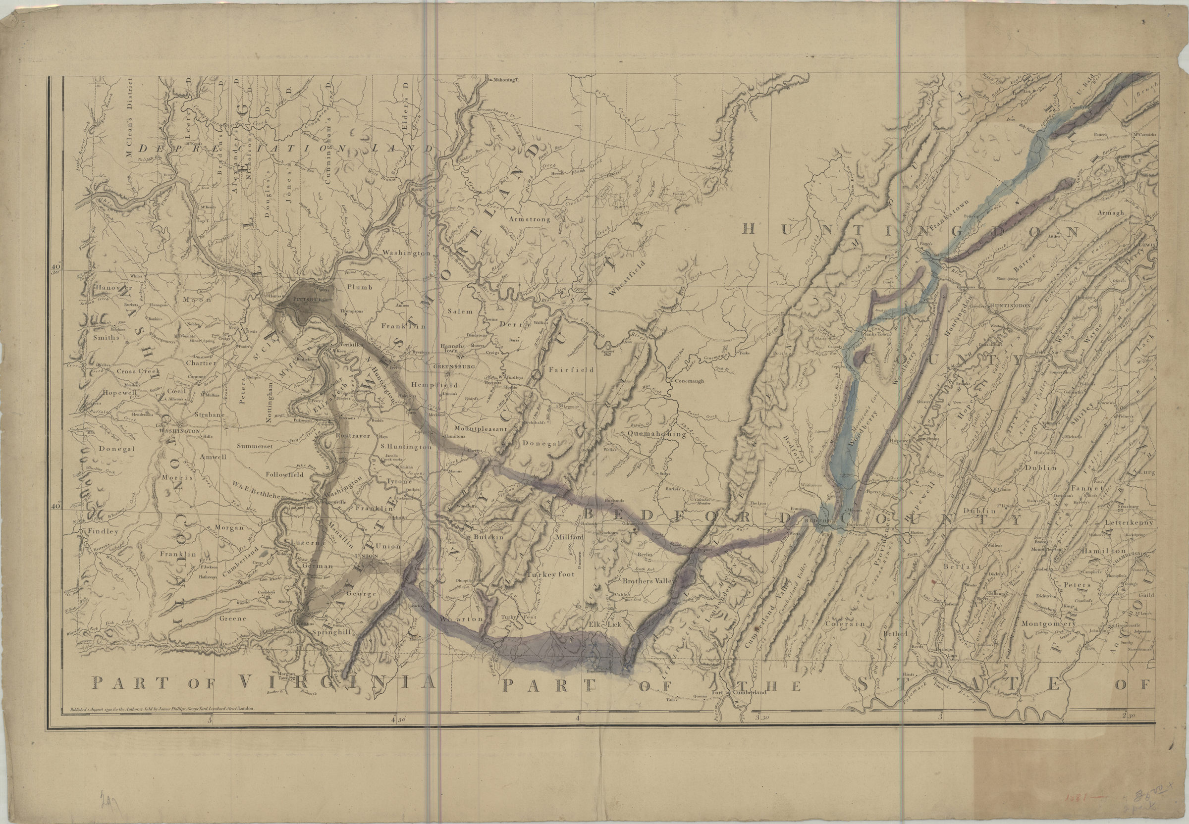
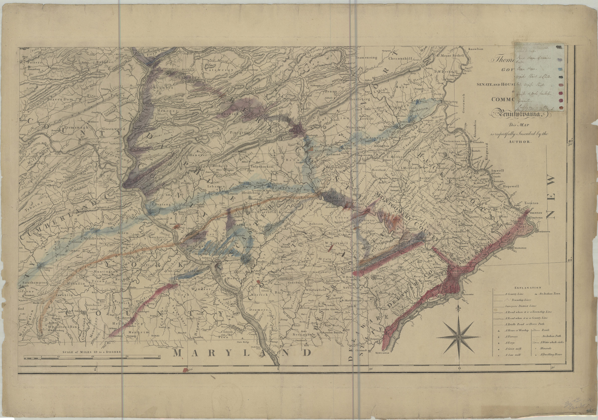
A map of the state of Pennsylvania: by Reading Howell August 1, 1792
Map No. PA-1792.Fl.RA
Relief shown by hachures. Shows county boundaries, towns, villages, forges, mills, houses, roads, inland navigation, and names of some landowners. Includes text and statement of dedication. BHS copy contains 2 of 4 sheets (lower half of map). Other sheets missing. Handwritten key to geogological features pasted over part of dedication on BHS copy.
Map area shown
Genre
Early mapsRelation
Full catalog recordSize
92 × 156 cmDownload
Low Resolution Image
Creator
Howell, Reading,Publisher
Brooklyn Historical SocietyCitation
A map of the state of Pennsylvania: by Reading Howell; August 1, 1792, Map Collection, PA-1792.Fl.RA; Brooklyn Historical Society.Scale
Scale [ca. 1:325,000] ScaLoading zoom image...