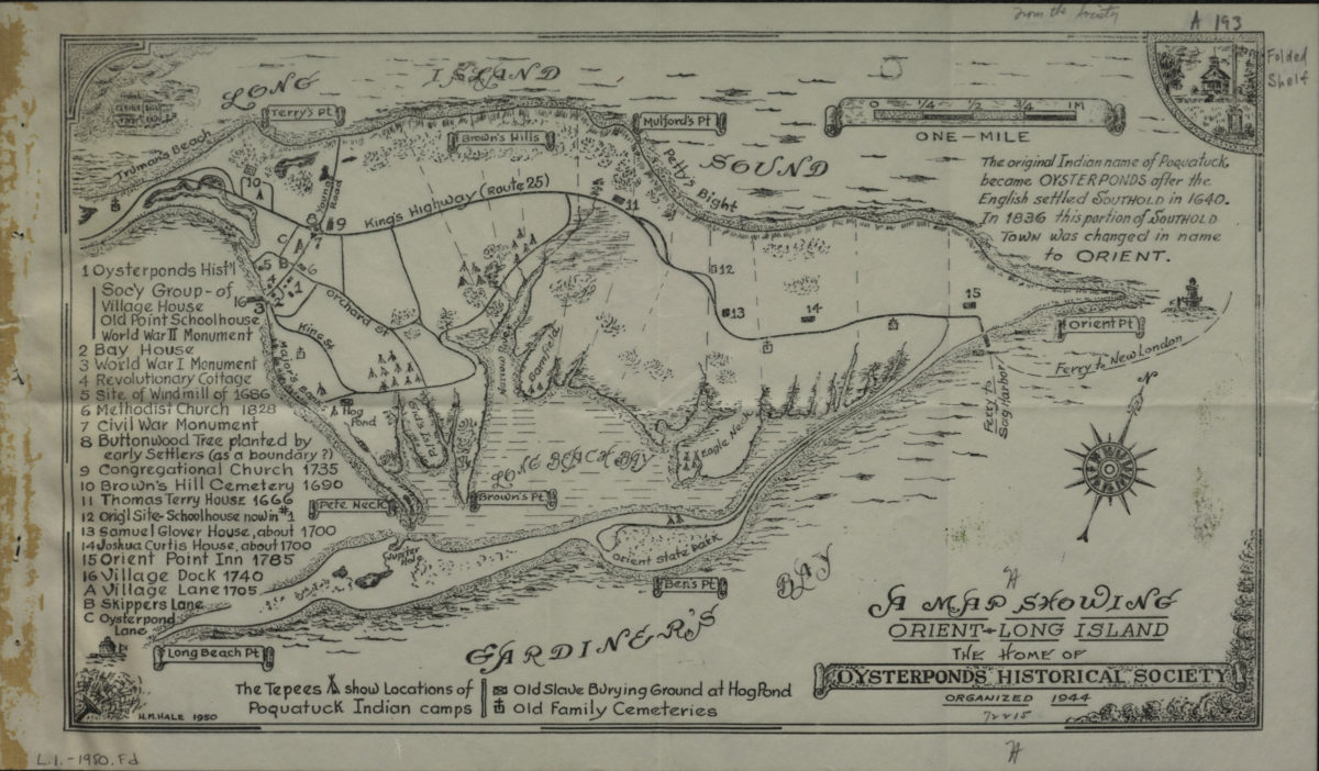
A map showing Orient, Long Island: the home of Oysterponds Historical Society: H.M. Hale 1950
Map No. L.I.-1950.Fl
Map indicates points of interest including Poquatuck Indian camps. Center point longitude: -72.2750. Center point latitude: 41.1358.
Map area shown
Genre
Tourist mapsRelation
Full catalog recordSize
22 × 38 cmDownload
Low Resolution ImageCreator
Hale, H. M.,Publisher
Brooklyn Historical SocietyCitation
A map showing Orient, Long Island: the home of Oysterponds Historical Society: H.M. Hale; 1950, Map Collection, L.I.-1950.Fl; Brooklyn Historical Society.Scale
Scale [1:25,000]Loading zoom image...