An historical map of Paumanacke and our own Wallage: compiled and drawn by George L. Whittle [ca. 1940, 1961]
Map No. L.I.-18th-19th century.Fl
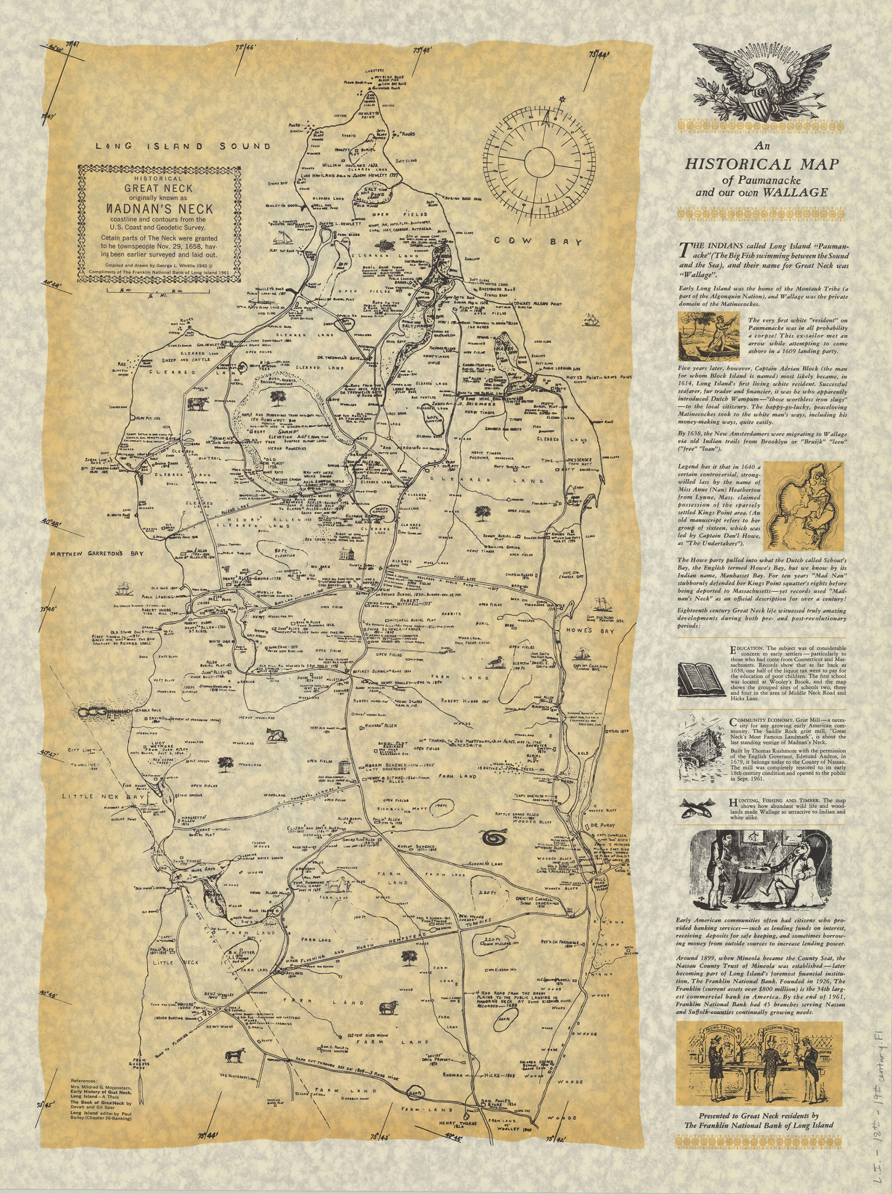
Cadastral map. Shows property, names of landowners, historical land ownership, and landscape details. Relief shown by spot heights in feet. “Compliments of The Franklin National Bank of Long Island 1961.” “Coastline and contours from the U.S. Coast and Geodetic Survey.” Includes text and ill.
Map area shown
Relation
Full catalog recordSize
62 × 46 cmDownload
Low Resolution Image
Creator
Whittle, George L.,Publisher
Brooklyn Historical SocietyCitation
An historical map of Paumanacke and our own Wallage: compiled and drawn by George L. Whittle; [ca. 1940, 1961], Map Collection, L.I.-18th-19th century.Fl; Brooklyn Historical Society.Scale
Scale [ca. 1:15,840]Loading zoom image... 