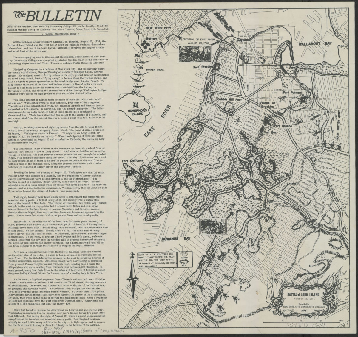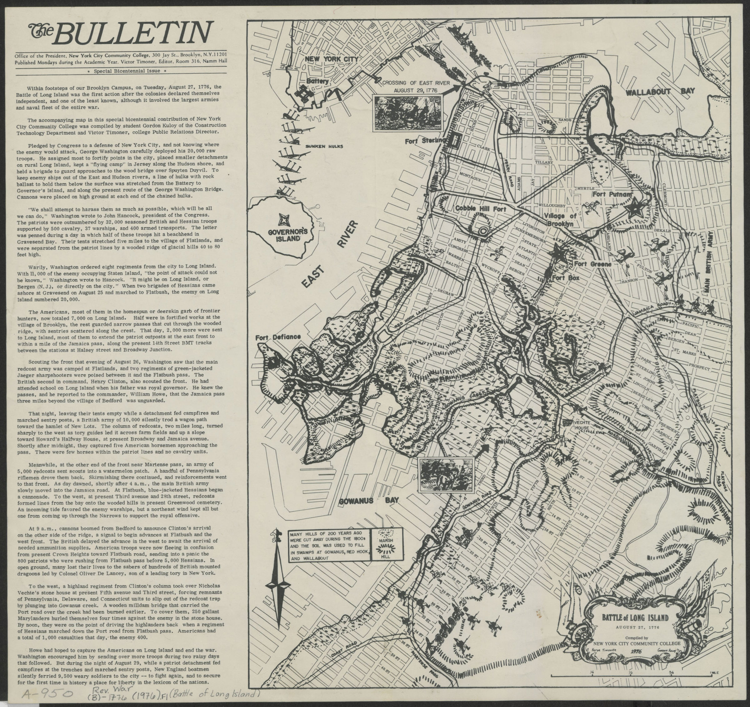
Battle of Long Island, August 27, 1776: compiled by New York City Community College 1976
Map No. Rev.War-1776(1976).Fl
Covers Brooklyn south from Greenpoint to the Gowanus Bay and east to approximately modern-day Crown Heights. Shows troop movements, camps, and forts. Relief shown by hachures. Includes text. Extracted from: The bulletin, special bicentennial issue. Vol. 29, no. 30 (Apr. 19, 1976). Also issued in smaller (26 x 20 cm) version.
Map area shown
Genre
Military mapsRelation
Full catalog recordSize
39 × 40 cmDownload
Low Resolution Image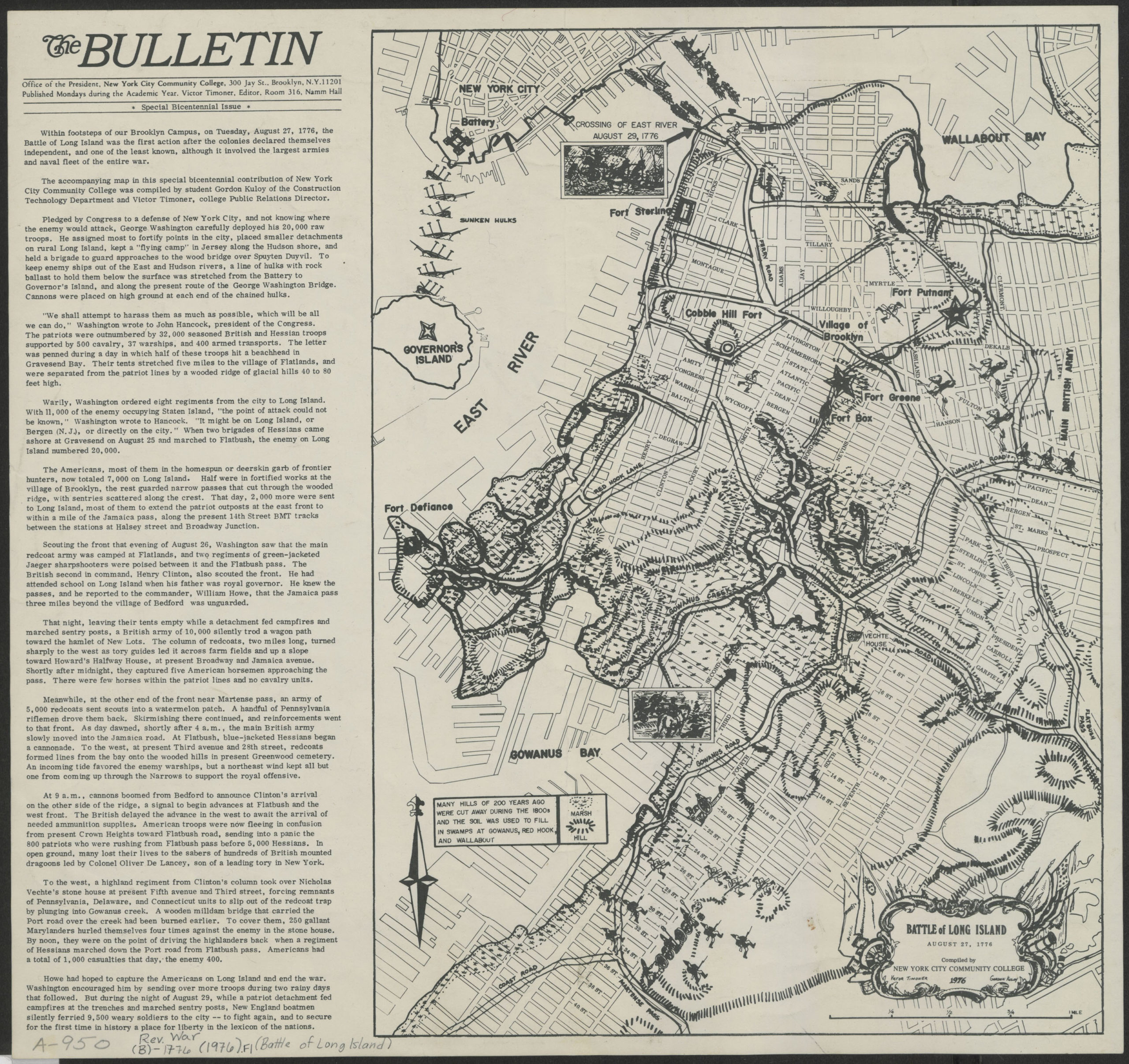
Creator
New York City Community College; Office of the President,Publisher
Brooklyn Historical SocietyCitation
Battle of Long Island, August 27, 1776: compiled by New York City Community College; 1976, Map Collection, Rev.War-1776(1976).Fl; Brooklyn Historical Society.Scale
Scale approximately 1:17,Loading zoom image...