Center for Brooklyn History
Map Collections
Search
About
Othmer Library & Archives
Submit search query
Refine 23 records
Clear filter
1
Location
Bronx (New York, N.Y.)
10
Brooklyn (New York, N.Y.)
891
Brooklyn Heights (New York, N.Y.)
76
Fort Brooklyn (New York, N.Y.)
1
Fort Washington (New York, N.Y.)
2
Long Island (N.Y.)
197
Long Island, Battle of, New York, N.Y., 1776
4
Manhattan (New York, N.Y.)
120
New Jersey
27
New York (N.Y.)
164
New York (State)
95
New York Metropolitan Area
40
New York Region
5
United States
10
Westchester County (N.Y.)
11
White Plains (N.Y.)
1
Subject
Fortification
7
Long Island, Battle of, New York, N.Y. , 1776
7
New York Metropolitan Area
1
Swamps
2
White Plains, Battle of, White Plains, N.Y., 1776
3
Date
18th Century
12
19th Century
945
20th Century
469
or enter range:
from
to
Genres
Early maps
35
Historical maps
53
Military maps
23
Topographic maps
70
Sort by:
Date (earliest)
Date (most recent)
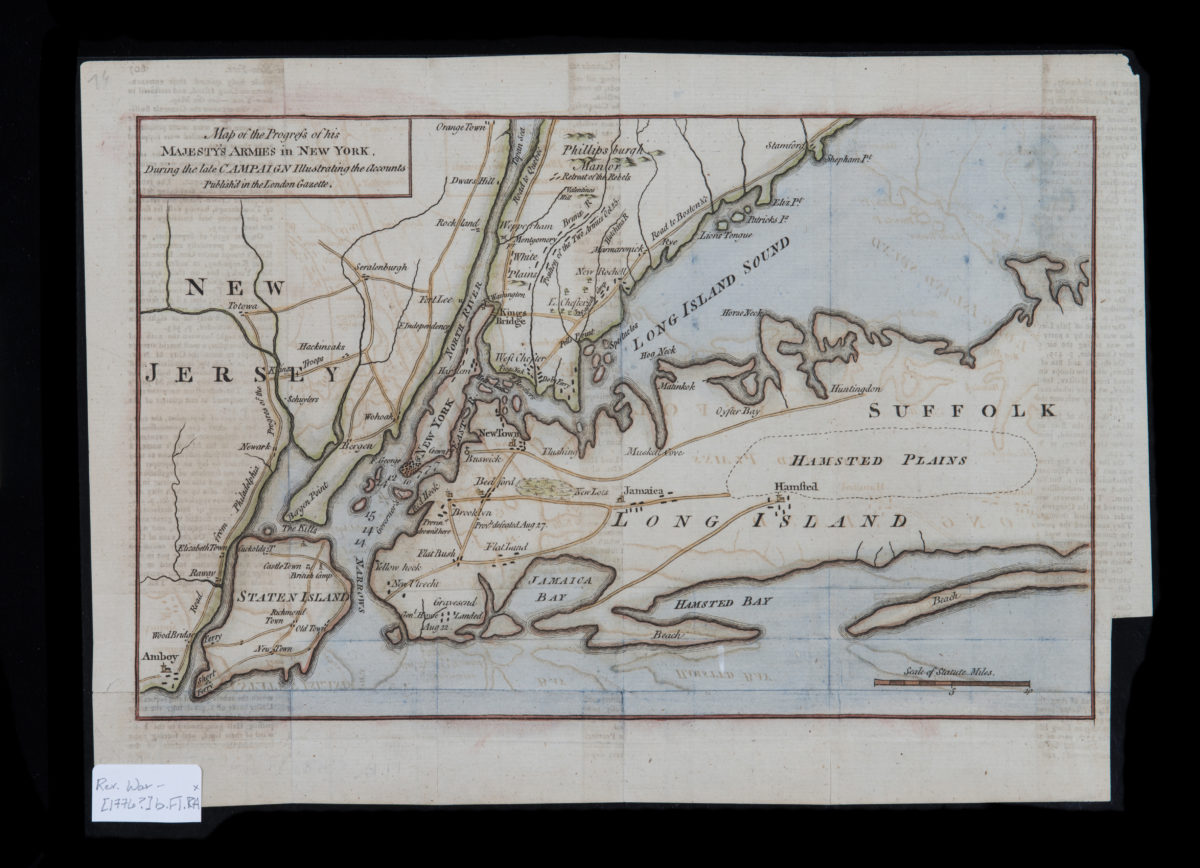
Map of the progress of His Majesty’s armies in New York, during the late campaign: illustrating the accounts published in the London Gazette
Map of the progress of His Majesty’s armies in New York, during the late campaign: illustrating the accounts published in the London Gazette
[1776]
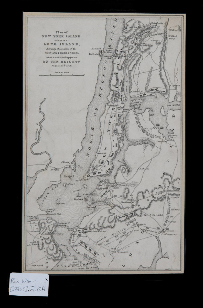
Plan of New York Island and part of Long Island, showing the position of the American & British armies before, at, & after the Engagement on the Heights, August 27th, 1776
Plan of New York Island and part of Long Island, showing the position of the American & British armies before, at, & after the Engagement on the Heights, August 27th, 1776
[1776]
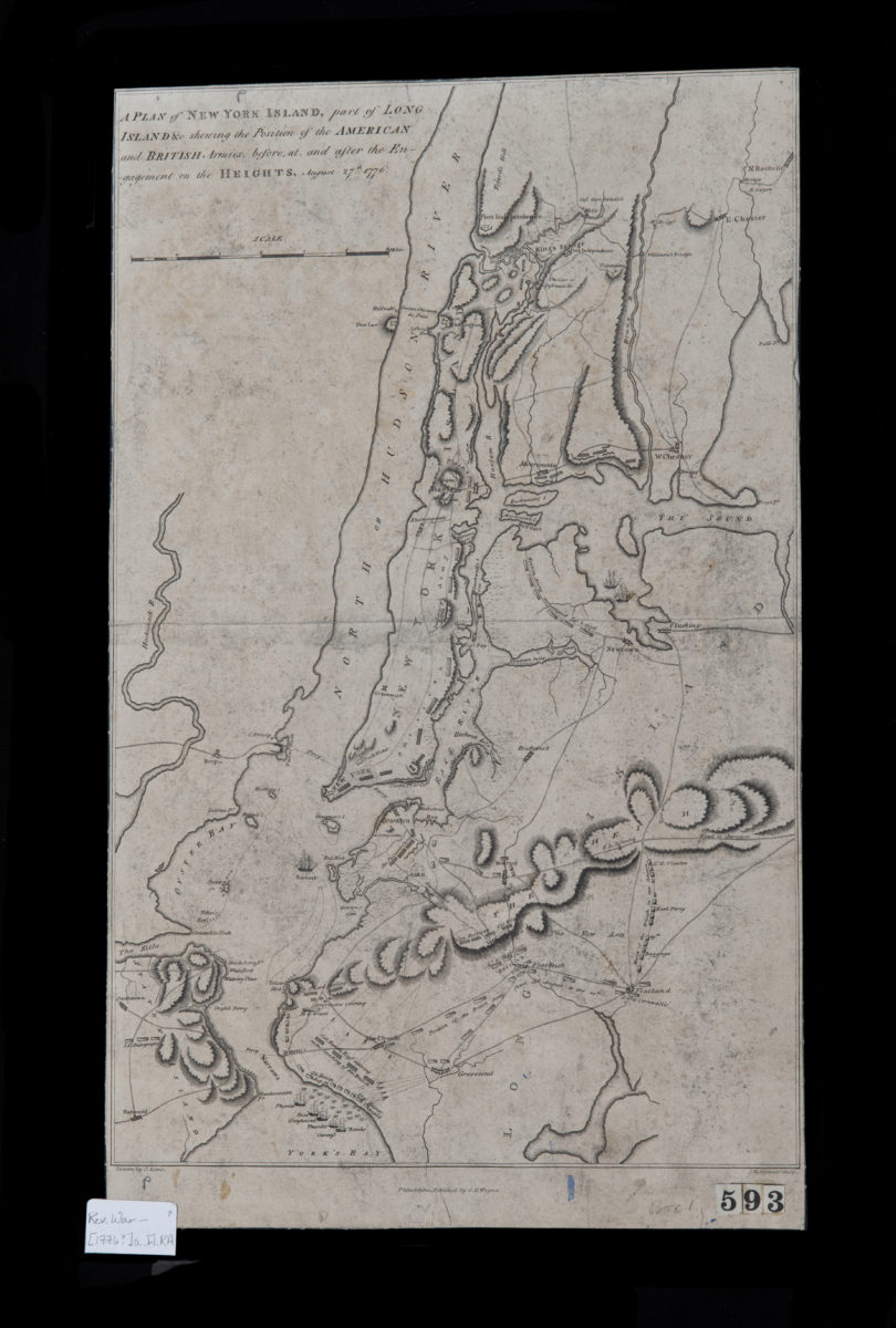
A plan of New York Island, part of Long Island &c., shewing the position of the American and British armies before, at, and after the Engagement on the Heights, August 27th, 1776: drawn by S. Lewis
A plan of New York Island, part of Long Island &c., shewing the position of the American and British armies before, at, and after the Engagement on the Heights, August 27th, 1776: drawn by S. Lewis
[1776]
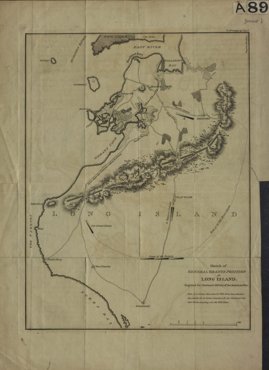
Sketch of General Grants [sic] position on Long Island: engraved for Stedman’s History of the American war
Sketch of General Grants [sic] position on Long Island: engraved for Stedman’s History of the American war
[1793]
Plan of the Battle of Long Island and of the Brooklyn defences, August 27th, 1776: compiled by Henry P. Johnston ; F. von Egloffstein, del
Plan of the Battle of Long Island and of the Brooklyn defences, August 27th, 1776: compiled by Henry P. Johnston ; F. von Egloffstein, del
[18??]
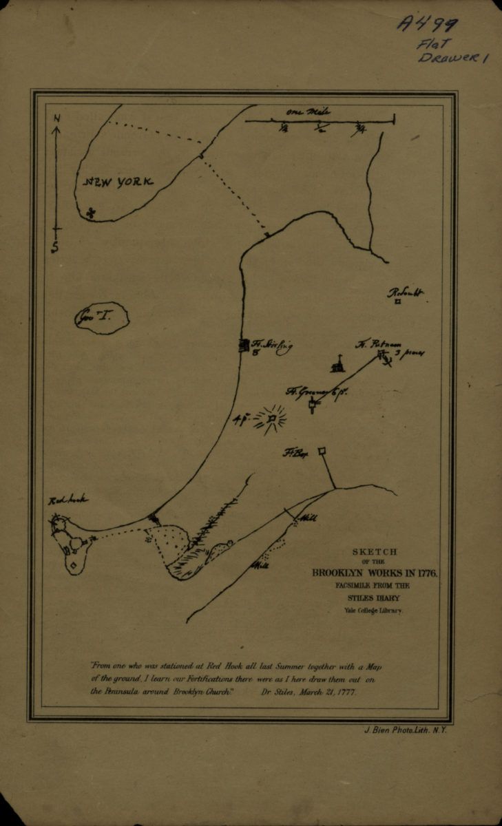
Sketch of the Brooklyn Works in 1776
Sketch of the Brooklyn Works in 1776
[18??]
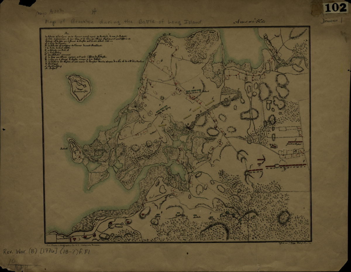
[Map of Brooklyn during the Battle of Long Island]
[Map of Brooklyn during the Battle of Long Island]
[18??]
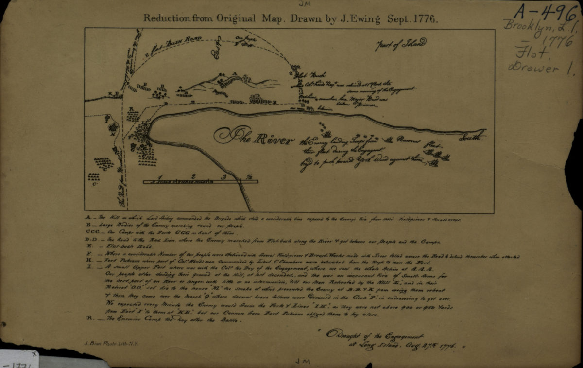
Draught of the Engagement at Long Island, Aug. 27th, 1776: drawn by J. Ewing
Draught of the Engagement at Long Island, Aug. 27th, 1776: drawn by J. Ewing
[18??]
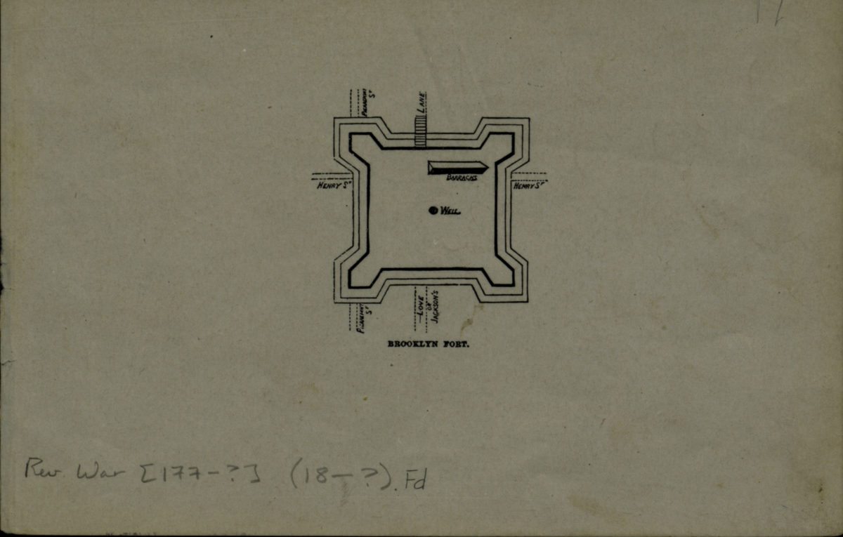
Brooklyn fort
Brooklyn fort
[18??]
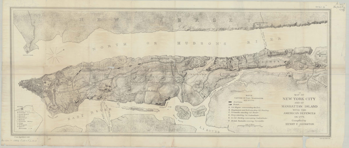
Map of New York City and of Manhattan Island with the American defences in 1776: compiled by Henry P. Johnston ; F. von Egloffstein del
Map of New York City and of Manhattan Island with the American defences in 1776: compiled by Henry P. Johnston ; F. von Egloffstein del
[18??]
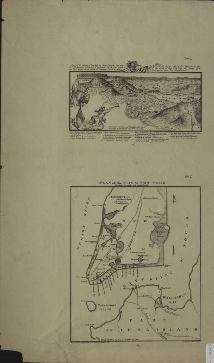
Plan of the island of New York in North America, but only Fort Washington, afterwards Knypausen, which was taken in but first drawn in the month of January 1781 in the hut from the eastern side in the vicinity of the late the month of May 1779
Plan of the island of New York in North America, but only Fort Washington, afterwards Knypausen, which was taken in but first drawn in the month of January 1781 in the hut from the eastern side in the vicinity of the late the month of May 1779
[1856]
A topographical map of the north part of New-York Island: exhibiting the plan of Fort Washington now Fort Knyphausen, with the rebels lines to the southward which where [sic] forced by the troops, 16th. Novr. 1776
A topographical map of the north part of New-York Island: exhibiting the plan of Fort Washington now Fort Knyphausen, with the rebels lines to the southward which where [sic] forced by the troops, 16th. Novr. 1776
[1859]
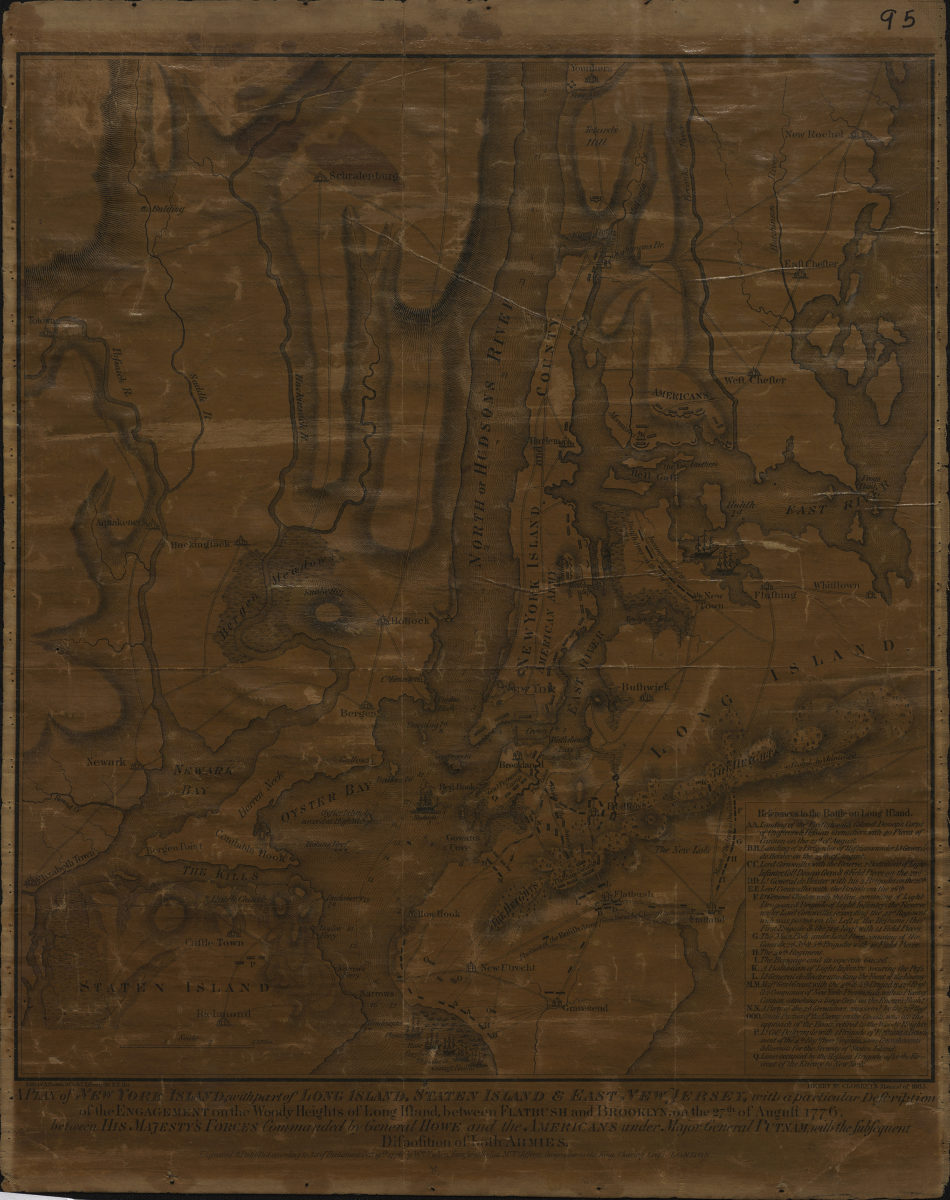
A plan of New York Island, with part of Long Island, Staten Island & East New Jersey: with a particular description of the Engagement on the Woody Heights of Long Island, between Flatbush and Brooklyn, on the 27th of August 1776
A plan of New York Island, with part of Long Island, Staten Island & East New Jersey: with a particular description of the Engagement on the Woody Heights of Long Island, between Flatbush and Brooklyn, on the 27th of August 1776
[1865]
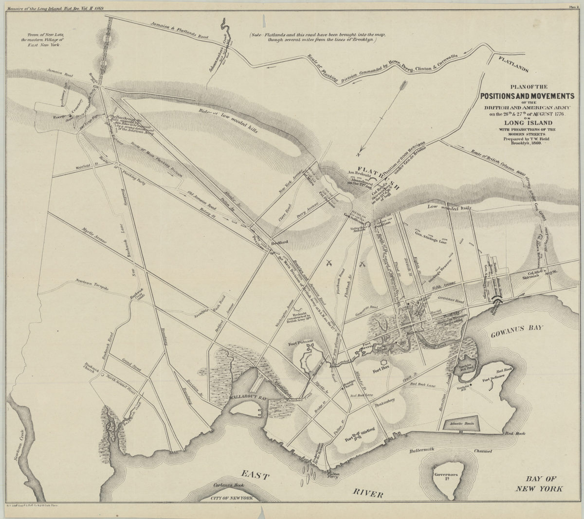
Plan of the positions and movements of the British and American army on the 26th & 27th of August 1776, on Long Island, with projects of the modern streets: prepared by T.W. Field
Plan of the positions and movements of the British and American army on the 26th & 27th of August 1776, on Long Island, with projects of the modern streets: prepared by T.W. Field
1869
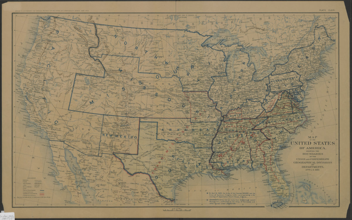
Map of the United States of America, showing the boundaries of the Union and Confederate geographical divisions and departments, April 9, 1865
Map of the United States of America, showing the boundaries of the Union and Confederate geographical divisions and departments, April 9, 1865
[188?]
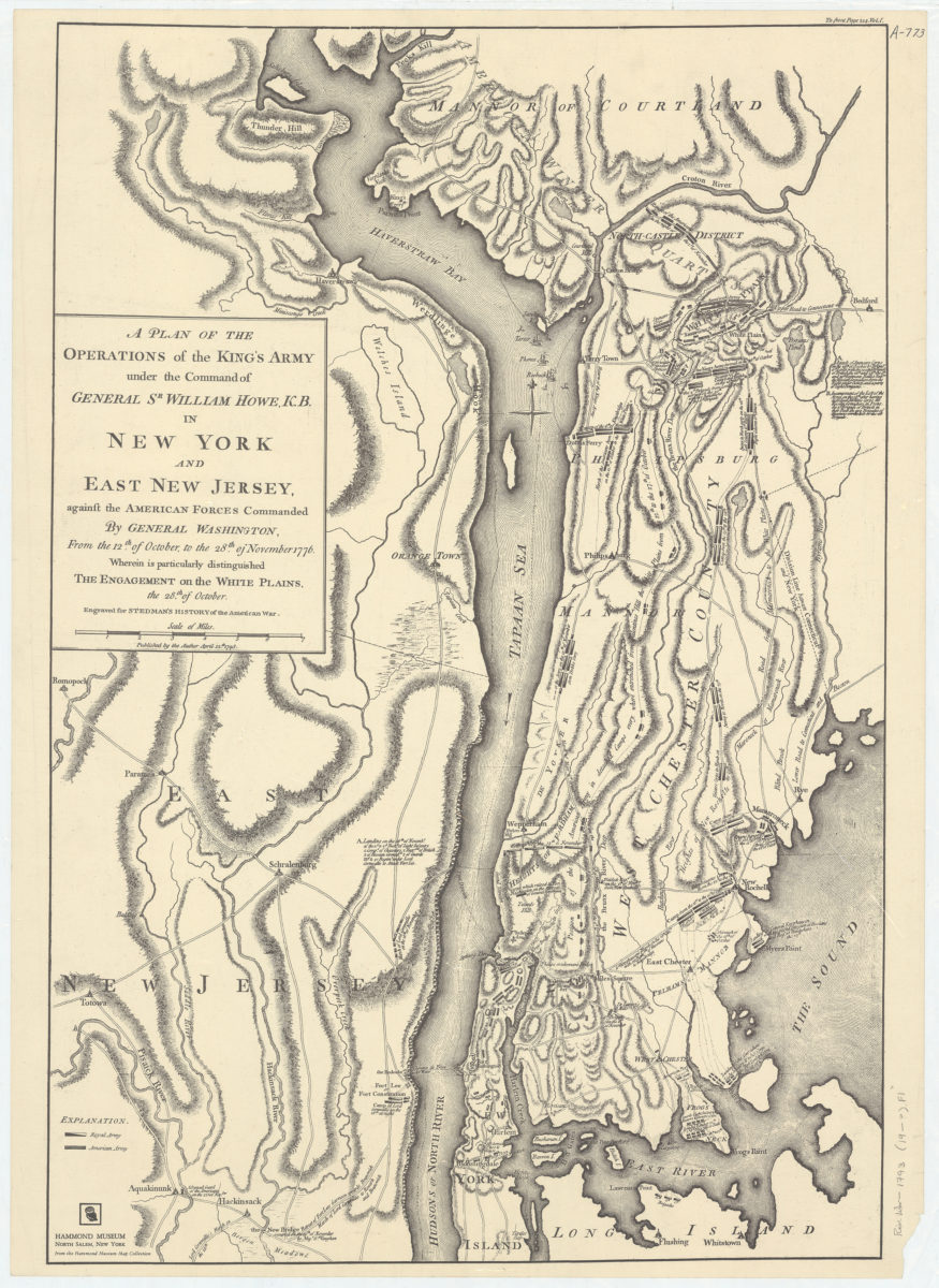
A plan of the operations of the King’s army under the command of General Sr. William Howe, K.B., in New York and East New Jersey against the American forces commanded by General Washington, from the 12th of October, to the 28th of November 1776
A plan of the operations of the King’s army under the command of General Sr. William Howe, K.B., in New York and East New Jersey against the American forces commanded by General Washington, from the 12th of October, to the 28th of November 1776
[19??]
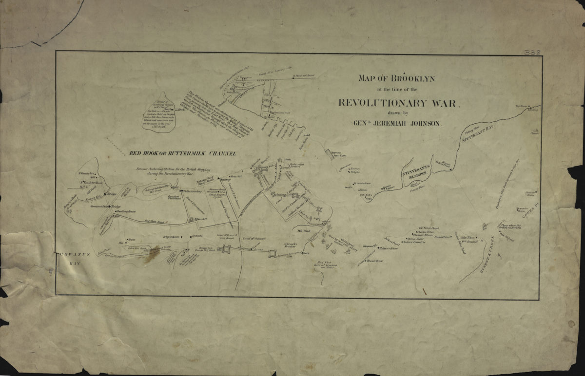
Map of Brooklyn at the time of the Revolutionary War: drawn by Genl. Jeremiah Johnson
Map of Brooklyn at the time of the Revolutionary War: drawn by Genl. Jeremiah Johnson
[19??]
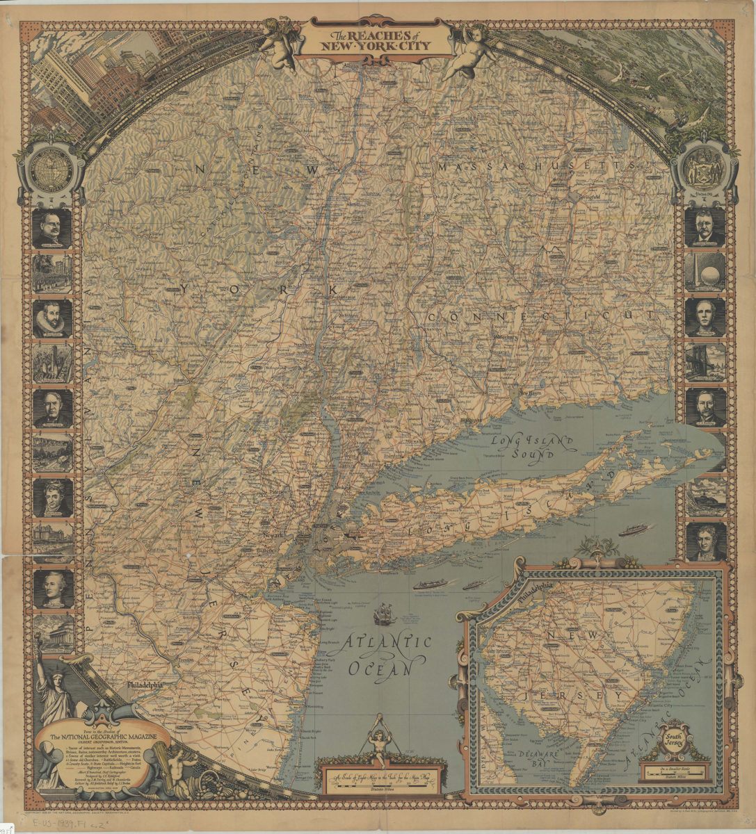
The reaches of New York City: done in the studios of the National Geographic Magazine ; Gilbert Grosvenor, ed. ; Albert H. Bumstead, chief cartographer ; designed by C.E. Riddiford ; research by J.M. Darley and W. Chamberlin
The reaches of New York City: done in the studios of the National Geographic Magazine ; Gilbert Grosvenor, ed. ; Albert H. Bumstead, chief cartographer ; designed by C.E. Riddiford ; research by J.M. Darley and W. Chamberlin
1939
A sketch of the operations of His Majesty’s fleet and army under the command of Vice Admiral the Rt. Hble Lord Viscount Howe and Gen. Wm. Howe, K.B. in 1776
A sketch of the operations of His Majesty’s fleet and army under the command of Vice Admiral the Rt. Hble Lord Viscount Howe and Gen. Wm. Howe, K.B. in 1776
[ca. 1968]
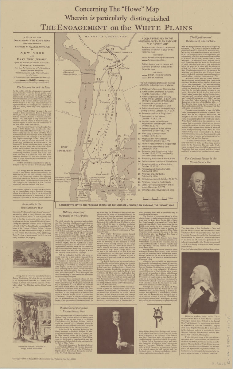
Concerning the “Howe” map, wherein is particularly distinguished the engagement on the White Plains
Concerning the “Howe” map, wherein is particularly distinguished the engagement on the White Plains
[ca. 1975]
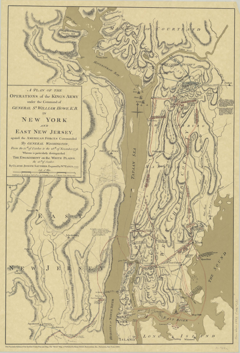
A plan of the operations of the King’s army under the command of General Sr. William Howe, K.B. in New York and East New Jersey against the American forces commanded by General Washington, from the 12th of October, to the 28th of November 1776
A plan of the operations of the King’s army under the command of General Sr. William Howe, K.B. in New York and East New Jersey against the American forces commanded by General Washington, from the 12th of October, to the 28th of November 1776
[ca. 1976]
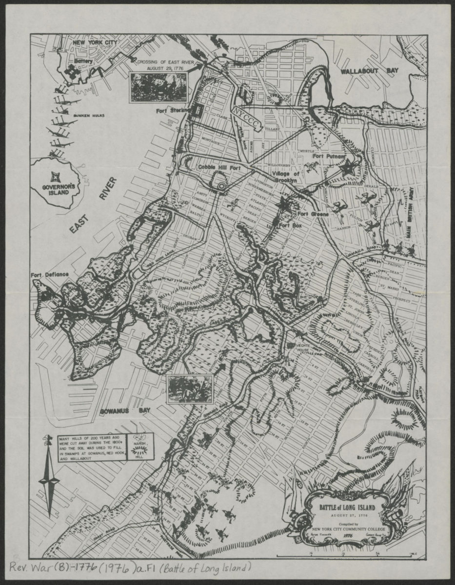
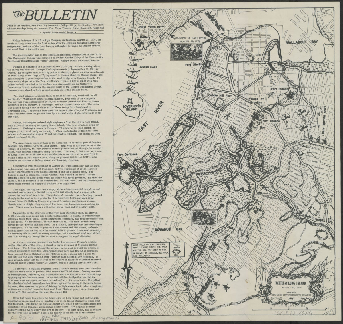
Battle of Long Island, August 27, 1776: compiled by New York City Community College
Battle of Long Island, August 27, 1776: compiled by New York City Community College
[1976]
Battle of Long Island, August 27, 1776: compiled by New York City Community College
Battle of Long Island, August 27, 1776: compiled by New York City Community College
1976