
A sketch of the operations of His Majesty’s fleet and army under the command of Vice Admiral the Rt. Hble Lord Viscount Howe and Gen. Wm. Howe, K.B. in 1776 [ca. 1968]
Map No. Rev. War-1777 (1968).Fl
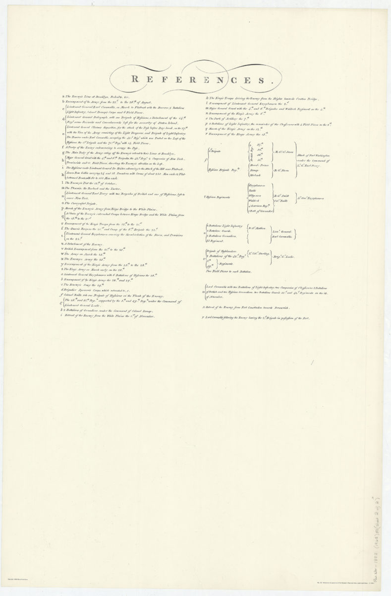
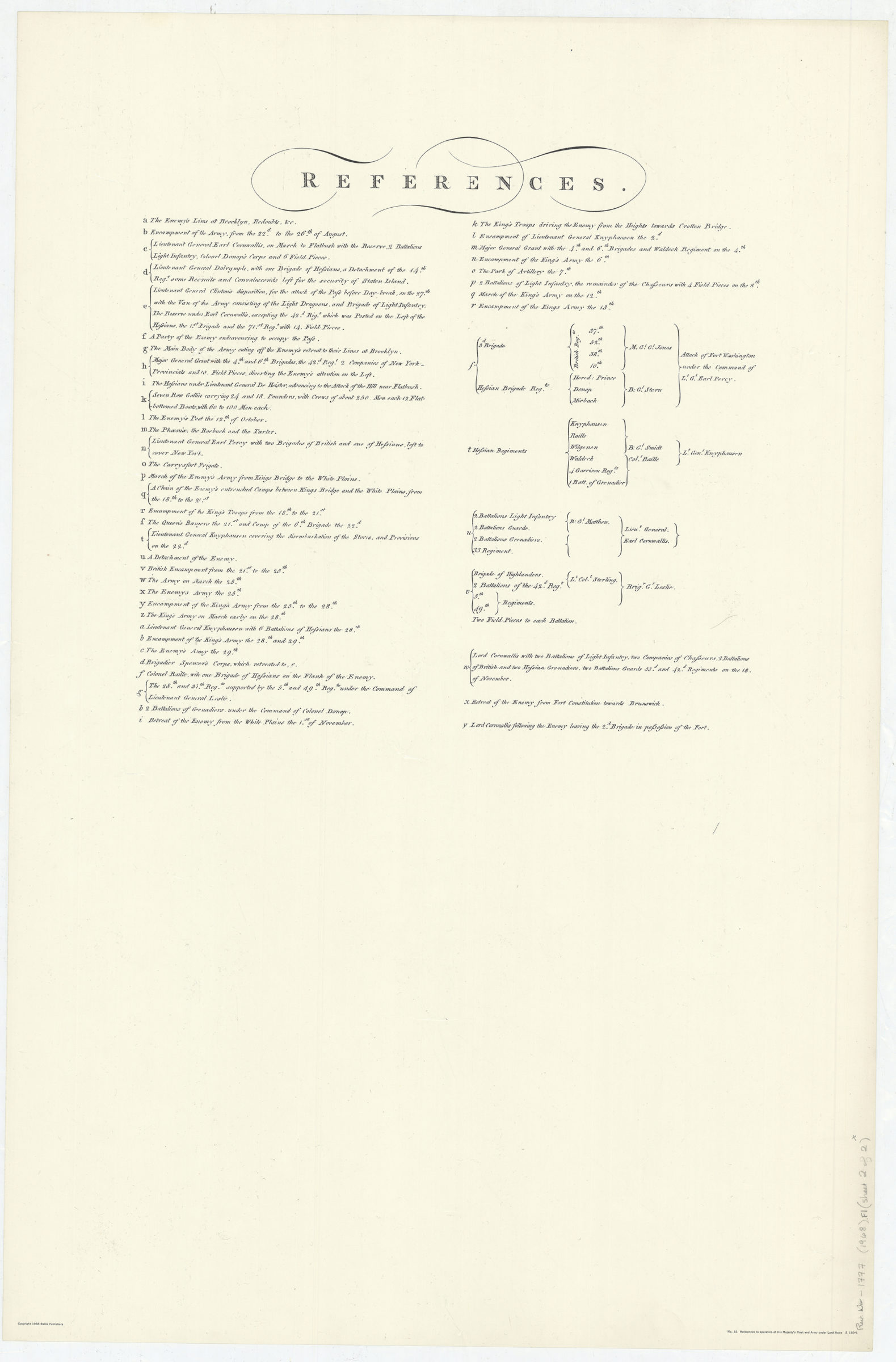
Facsimile covering New York metropolitan area from Rariton Bay north to Haverstraw Bay. Shows New Jersey south to Sandy Hook and and east to Brunswick, Staten Island, Long Island east to Jamaica, Manhattan, the Bronx, and part of Westchester County. Also shows roads, populated areas, fortifications, and troop movements. Relief shown by shading and hachures. Depths shown by soundings. Includes ill. and indexes on sheet 1 and sheet 2. “No. 32.” “S 149-2”–Lower right corner of sheet 1. “S 150-1”–Lower right corner of sheet 2.
Map area shown
Genre
Military mapsRelation
Full catalog recordSize
89 × 59 cmDownload
Low Resolution Image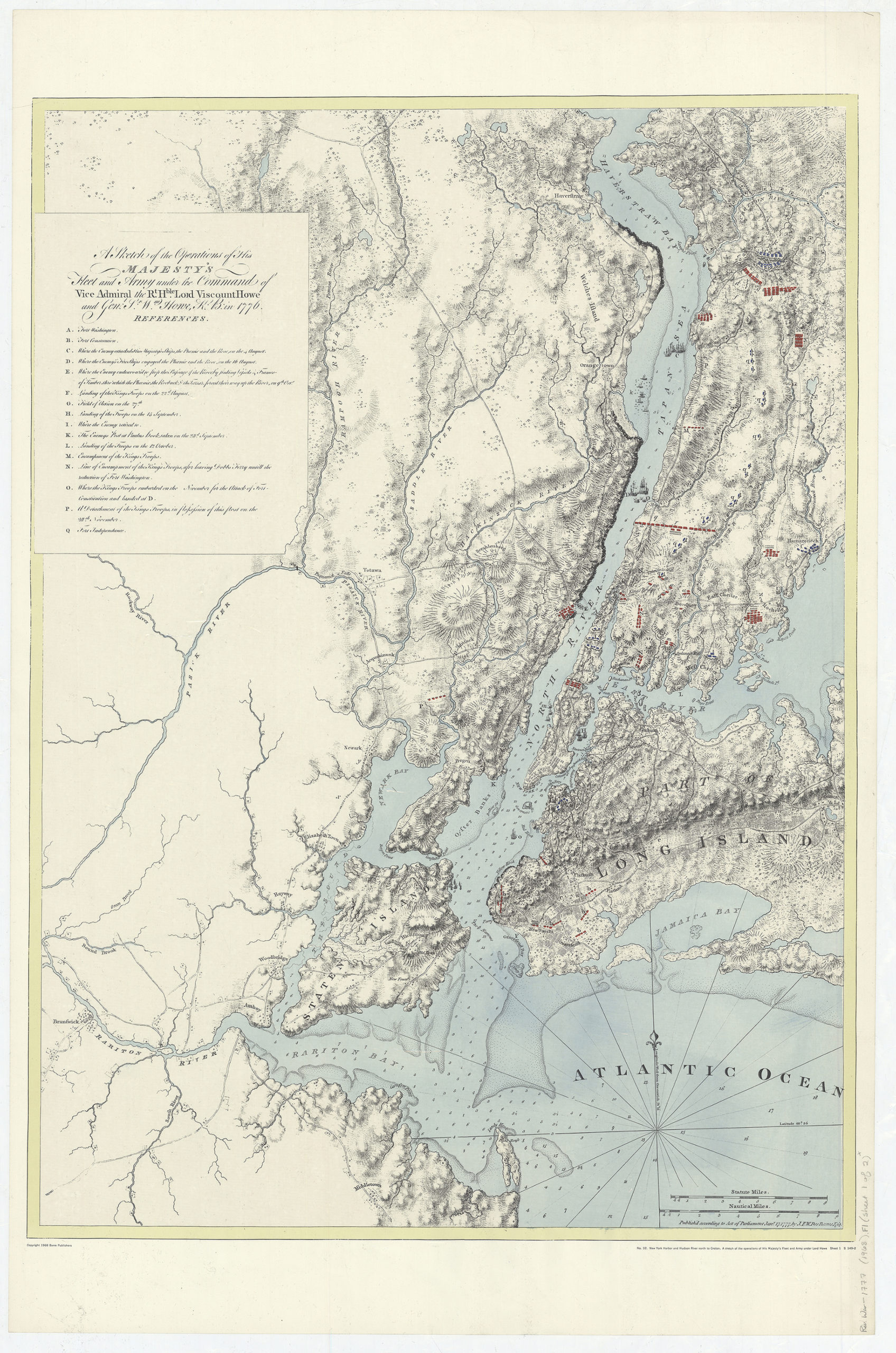
Creator
Des Barres, Joseph F. W.; Barre Publishers,Publisher
Brooklyn Historical SocietyCitation
A sketch of the operations of His Majesty’s fleet and army under the command of Vice Admiral the Rt. Hble Lord Viscount Howe and Gen. Wm. Howe, K.B. in 1776; [ca. 1968], Map Collection, Rev. War-1777 (1968).Fl; Brooklyn Historical Society.Scale
Scale [ca. 1:134174]Loading zoom image...