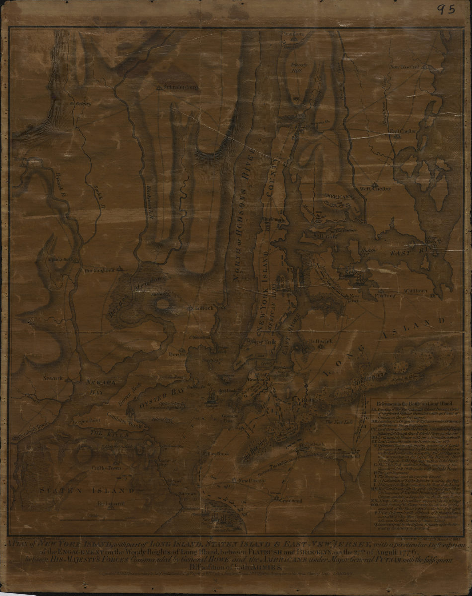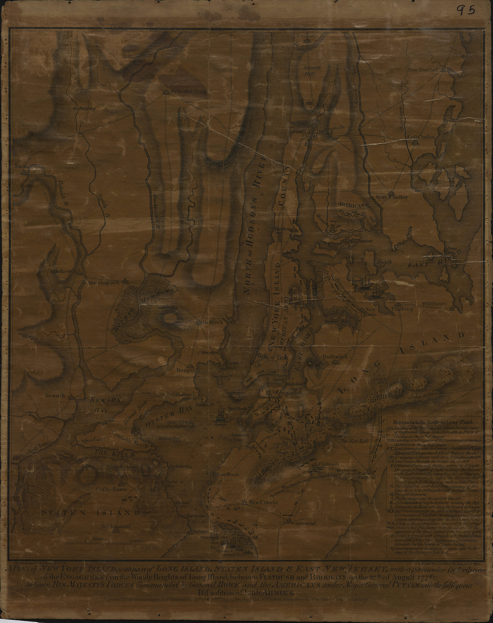
A plan of New York Island, with part of Long Island, Staten Island & East New Jersey: with a particular description of the Engagement on the Woody Heights of Long Island, between Flatbush and Brooklyn, on the 27th of August 1776 [1865]
Map No. Rev. War-1776 (1865).Fl
Facsimile. Covers Brooklyn north from the Narrows to Greepoint and east to approximately Flatlands. Also covers Manhattan and portions of Queens, the Bronx, Staten Island, New Jersey. Relief shown pictorially and by hachures. Depths shown by soundings. “Lith. of A. Brown & Co., 65 Liberty St., N.Y. for Henry McCloskey’s Manual of 1865.” Issued in: Manual of the Common Council of the City of Brooklyn, 1865. Includes index to the Battle on Long Island.
Subjects
Places
Map area shown
Relation
Full catalog recordSize
31 × 27 cmDownload
Low Resolution Image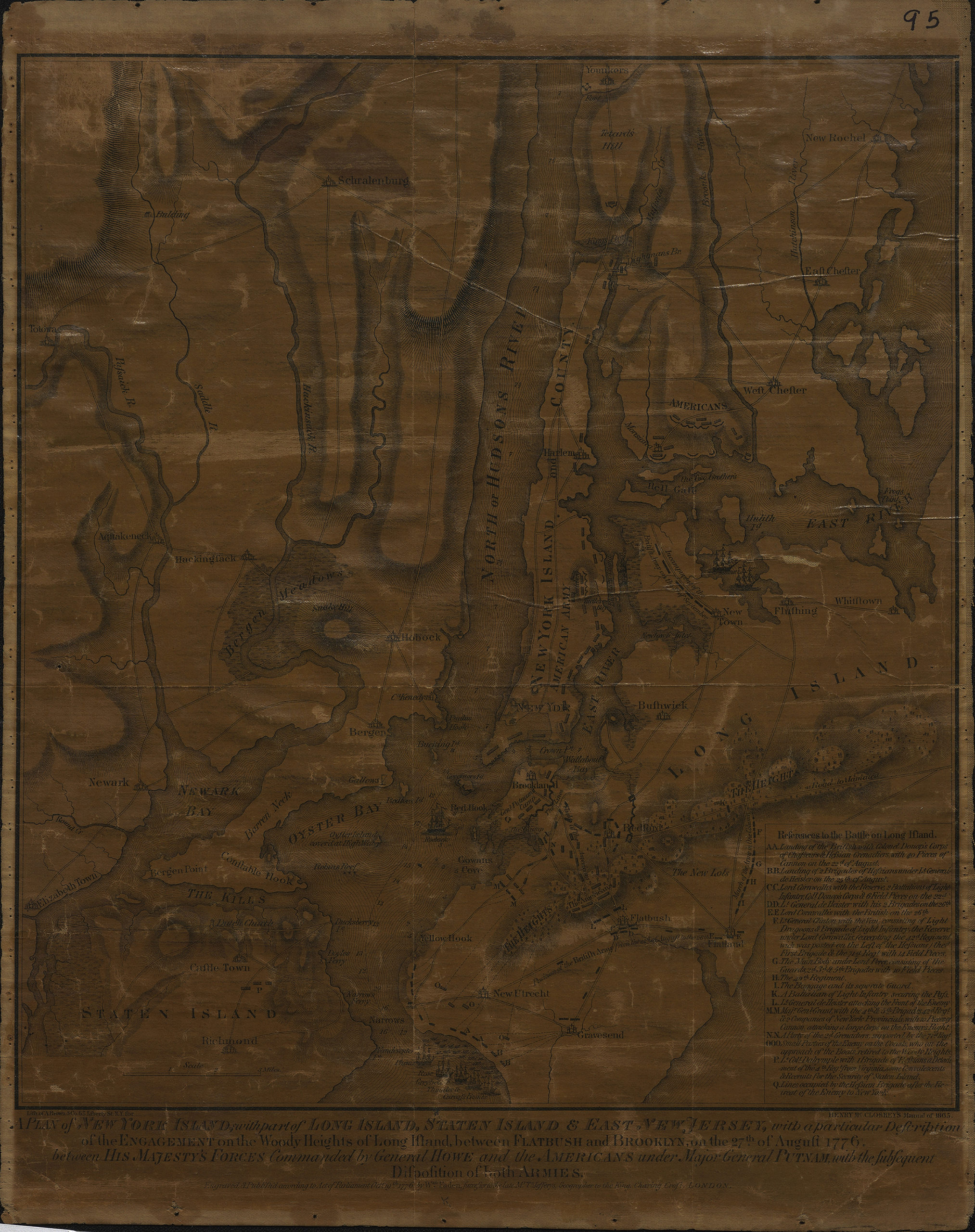
Creator
Faden, William,Publisher
Brooklyn Historical SocietyCitation
A plan of New York Island, with part of Long Island, Staten Island & East New Jersey: with a particular description of the Engagement on the Woody Heights of Long Island, between Flatbush and Brooklyn, on the 27th of August 1776; [1865], Map Collection, Rev. War-1776 (1865).Fl; Brooklyn Historical Society.Scale
Scale [ca. 1:130,000]Loading zoom image...