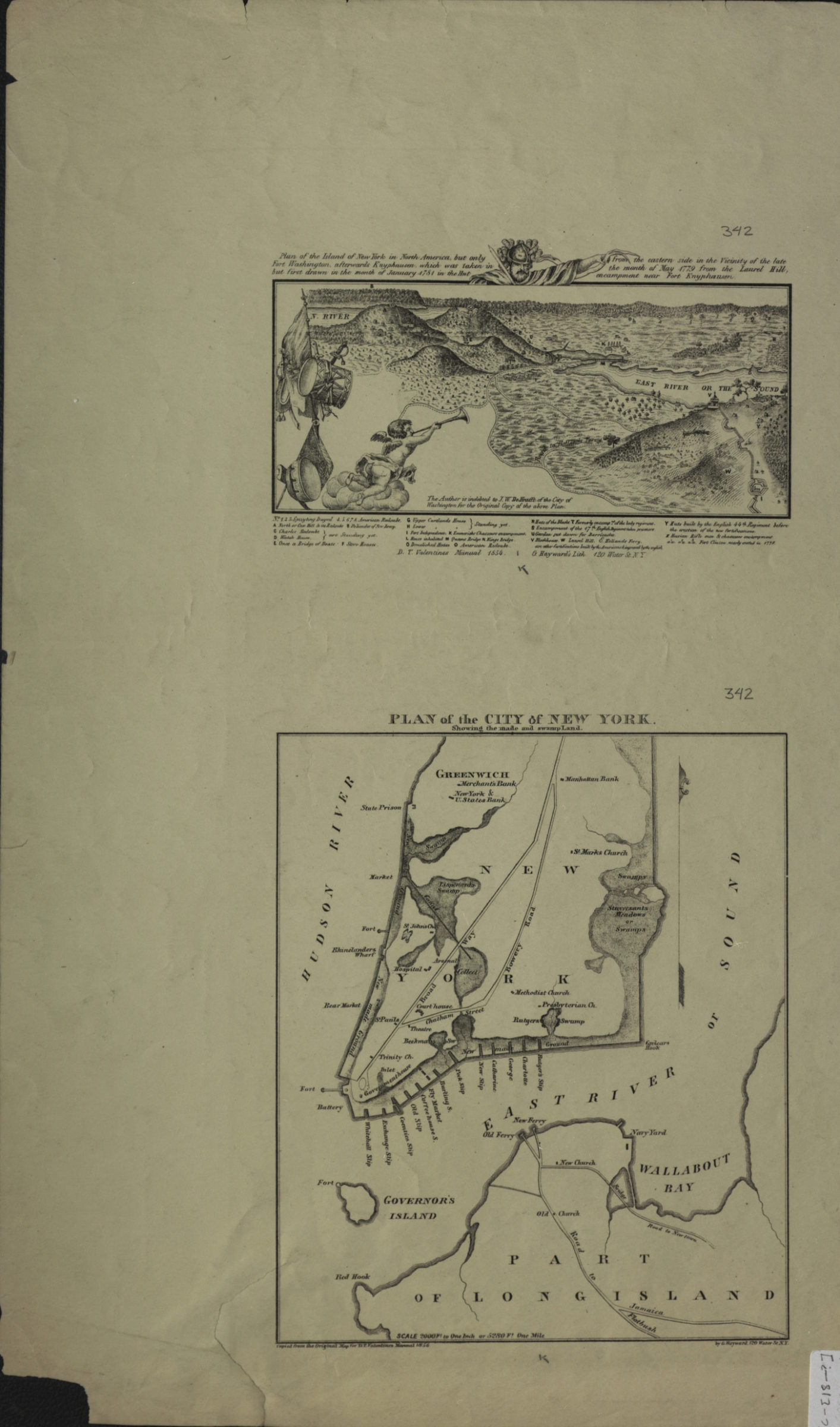

Plan of the island of New York in North America, but only Fort Washington, afterwards Knypausen, which was taken in but first drawn in the month of January 1781 in the hut from the eastern side in the vicinity of the late the month of May 1779 [1856]
Facsimiles. “Plan of the island of New York …” shows landscape details, forts, and military camps includes ill. and index. “Plan of the city of New York …” covers Manhattan north from the Battery to Greenwich Village also covers Brooklyn north from Red Hook to Wallabout Bay. Shows churches, banks, slips, ferries, markets, and hospitals. Relief shown pictorially and by shading on “Plan of the island of New York …” Publication information for individual maps differs publication of maps as a unit not given. Publication information for “Plan of the island of New York …”: D.T. Valentine’s Manual 1854 … G. Hayward’s Lith. Publication information for “Plan of the city of New York …”: Copied from an original map for D.T. Valentine’s manual 1856 by G. Hayward, 120 Water St. N.Y.
Map area shown
Relation
Full catalog recordSize
53 × 29 cmDownload
Low Resolution Image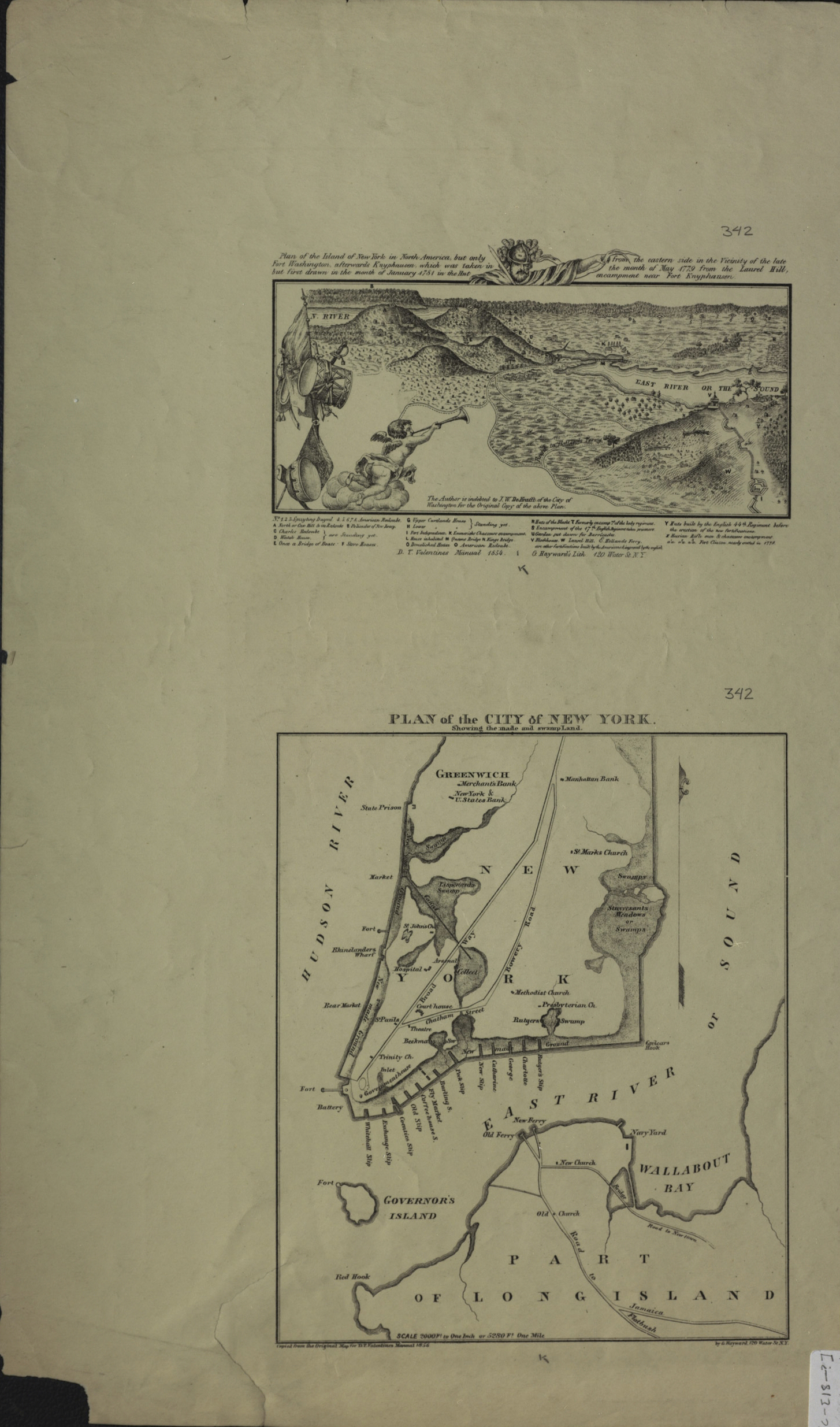
Creator
Hayward, George; Valentine, D. T.; New York (N.Y.); New York (N.Y.), Hayward, George; Valentine, D. T.; New York (N.Y.); New York (N.Y.),Publisher
Brooklyn Historical Society, Brooklyn Historical SocietyCitation
Plan of the island of New York in North America, but only Fort Washington, afterwards Knypausen, which was taken in but first drawn in the month of January 1781 in the hut from the eastern side in the vicinity of the late the month of May 1779; [1856], Map Collection, NYC-[18--?] (1856?).Fl; Brooklyn Historical Society.Scale
Scales differ