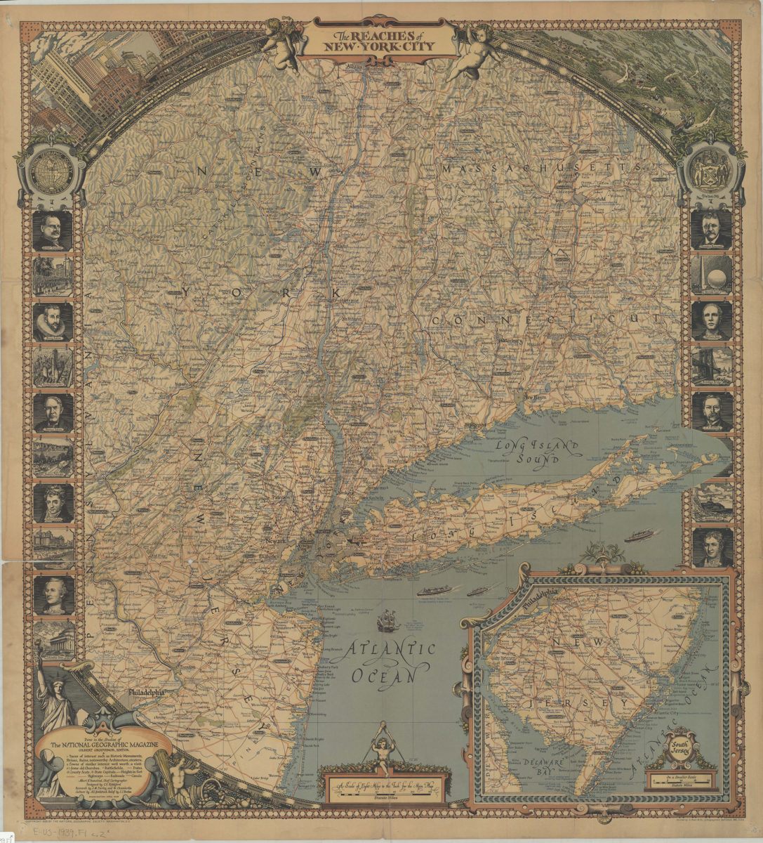
The reaches of New York City: done in the studios of the National Geographic Magazine ; Gilbert Grosvenor, ed. ; Albert H. Bumstead, chief cartographer ; designed by C.E. Riddiford ; research by J.M. Darley and W. Chamberlin 1939
Map No. E-US-1939.Fl;E-US-1939.Fl c.2
Covers west as far as Honesdale, Pennsylvania north as far as Albany, New York east as far as Montauk Point, Long Island, New York and south as far as Cape May, New Jersey (on inset). Shows places of interest, towns, some old churches, battlefields, historic sites/dates, county seats, capitals, highways, railroads, canals, ferry routes, and military bases. Relief shown by hachures, spot heights in feet, and landform drawings. “April 1939.” Title in decorative cartouche. Includes portraits of famous New Yorkers, other ill., and inset continuation map of “South Jersey” (Scale [ca. 1:67,000]). BHS copy accompanied by sheet of text: The Society’s map of the reaches of New York City ([1] p. 26 cm.).
Map area shown
Relation
Full catalog recordSize
70 × 64 cmDownload
Low Resolution Image
Creator
National Geographic Society (U.S.).; Cartographic Section,Publisher
Brooklyn Historical SocietyCitation
The reaches of New York City: done in the studios of the National Geographic Magazine ; Gilbert Grosvenor, ed. ; Albert H. Bumstead, chief cartographer ; designed by C.E. Riddiford ; research by J.M. Darley and W. Chamberlin; 1939, Map Collection, E-US-1939.Fl;E-US-1939.Fl c.2; Brooklyn Historical Society.Scale
Scale [1:506,880] 1 in toLoading zoom image...