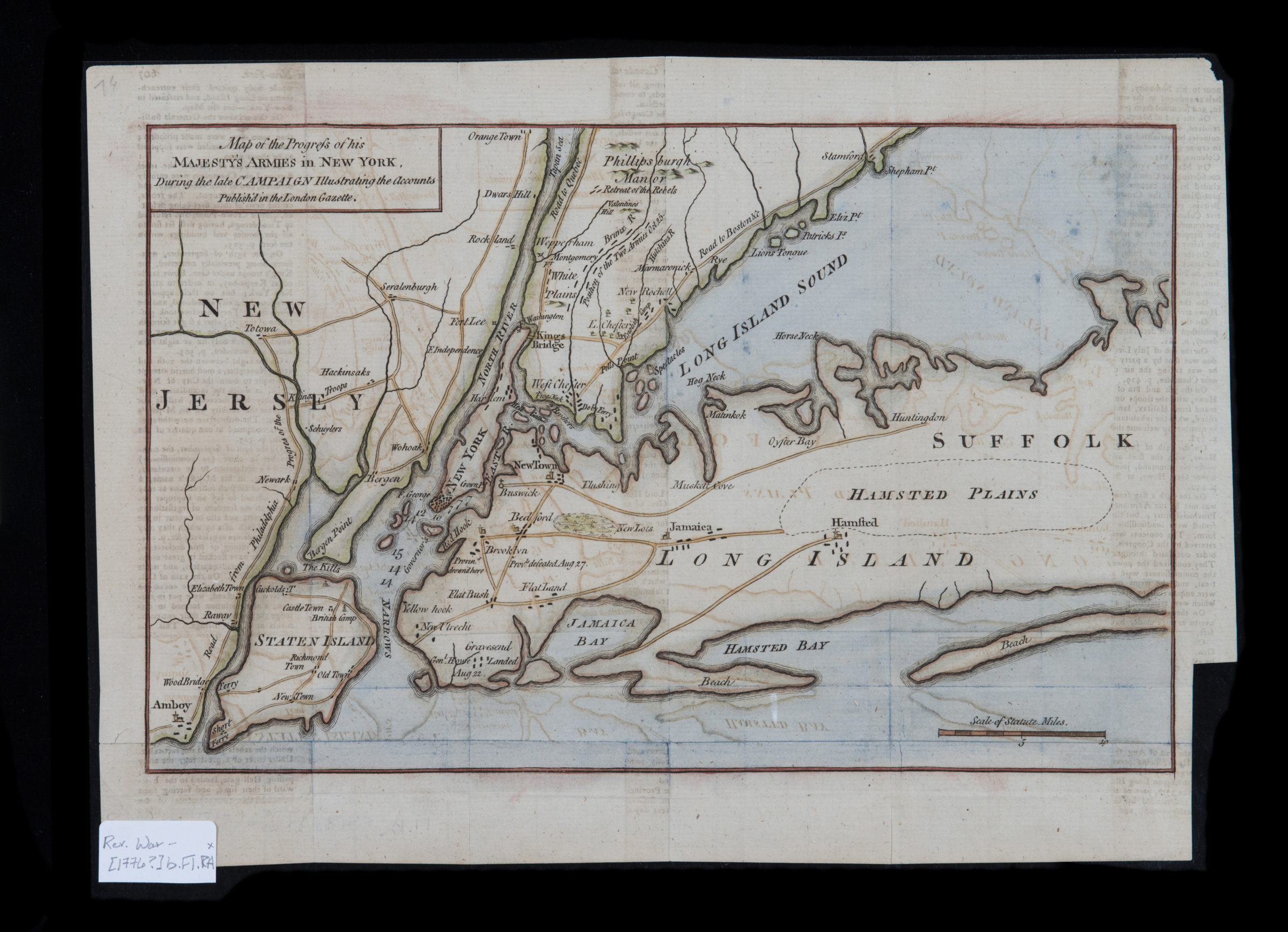
Map of the progress of His Majesty’s armies in New York, during the late campaign: illustrating the accounts published in the London Gazette [1776]
Map No. Rev. War-[1776?]b.Fl.RA
Covers New York City and vicinity, including Staten Island, eastern New Jersey, southern Westchester County, and the western half of Long Island. Relief shown pictorially. Depths shown by soundings. Likely extracted from: Gentleman’s magazine, v. 46, suppl. for 1776. M006050. M006011.
Map area shown
Relation
Full catalog recordSize
20 × 31 cmDownload
Low Resolution Image
Creator
Publisher
Brooklyn Historical SocietyCitation
Map of the progress of His Majesty’s armies in New York, during the late campaign: illustrating the accounts published in the London Gazette; [1776], Map Collection, Rev. War-[1776?]b.Fl.RA; Brooklyn Historical Society.Scale
Scale [ca. 1:316,800]Loading zoom image... 