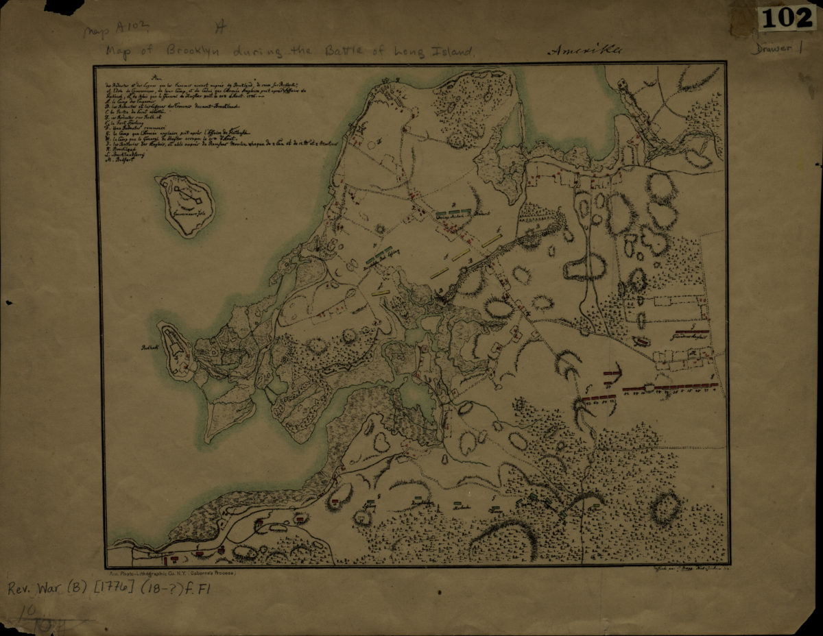
[Map of Brooklyn during the Battle of Long Island] [18??]
Map No. Rev. War-[1776] (18--?).Fl;Rev. War-[1776] (18--?).Fl c.2
Facsimile of manuscript map. Covers Brooklyn south from Greenpoint to the Gowanus Bay and east to approximately modern-day Crown Heights. Shows troop movements, camps, and forts. Relief shown by hachures. Title devised by cataloger. Includes index. Illegible text in upper and lower right margins. BHS has 2 copies.
Map area shown
Genre
Military mapsRelation
Full catalog recordSize
21 × 26 cmDownload
Low Resolution Image
Creator
American Photo-Lithographic Company,Publisher
Brooklyn Historical SocietyCitation
[Map of Brooklyn during the Battle of Long Island]; [18??], Map Collection, Rev. War-[1776] (18--?).Fl;Rev. War-[1776] (18--?).Fl c.2; Brooklyn Historical Society.Scale
Scale not givenLoading zoom image...