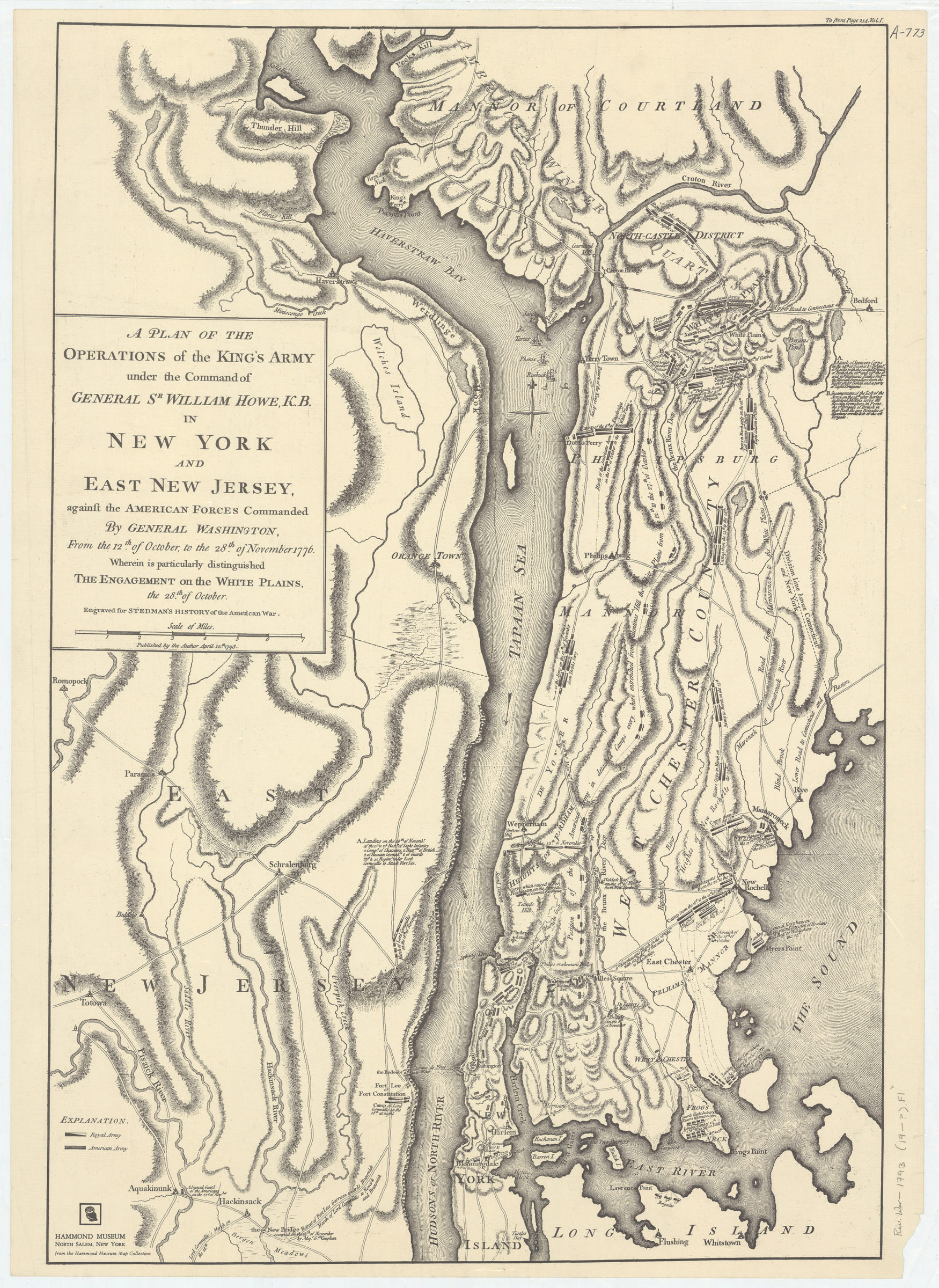
A plan of the operations of the King’s army under the command of General Sr. William Howe, K.B., in New York and East New Jersey against the American forces commanded by General Washington, from the 12th of October, to the 28th of November 1776 [19??]
Map No. Rev. War-1793 (19--?).Fl;Rev. War-1793 (19--?).Fl c.2
Facsimile. Shows Manhattan north of Turtle Bay, the Bronx, Eastern New Jersey south to Hackensack, Westchester County and Rockland County. Also shows marching routes, camps, forts, and sites of battle-related events. Relief shown by hachures. “From the Hammond Museum Map Collection.” Includes index and key.
Map area shown
Genre
Military mapsRelation
Full catalog recordSize
72 × 49 cmDownload
Low Resolution Image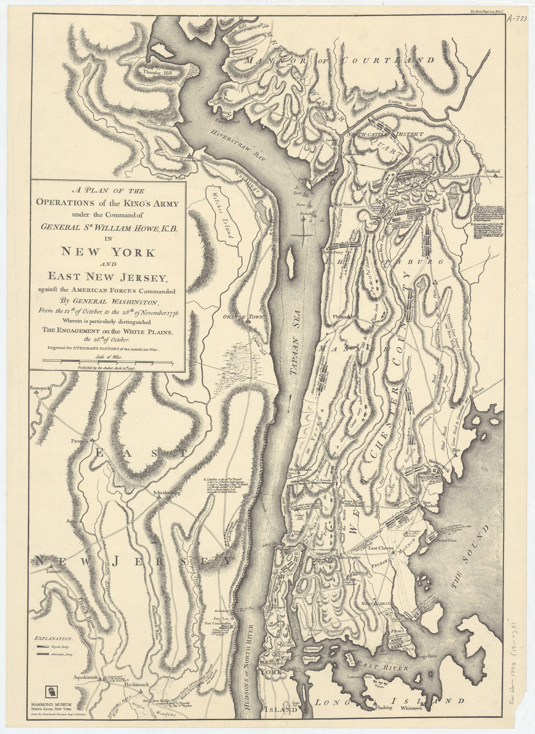
Creator
Sauthier, Claude Joseph,Publisher
Brooklyn Historical SocietyCitation
A plan of the operations of the King’s army under the command of General Sr. William Howe, K.B., in New York and East New Jersey against the American forces commanded by General Washington, from the 12th of October, to the 28th of November 1776; [19??], Map Collection, Rev. War-1793 (19--?).Fl;Rev. War-1793 (19--?).Fl c.2; Brooklyn Historical Society.Scale
Scale [ca. 1:85,000]Loading zoom image... 