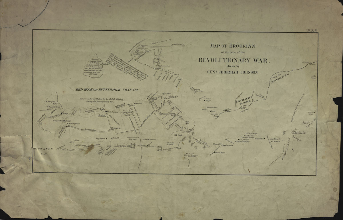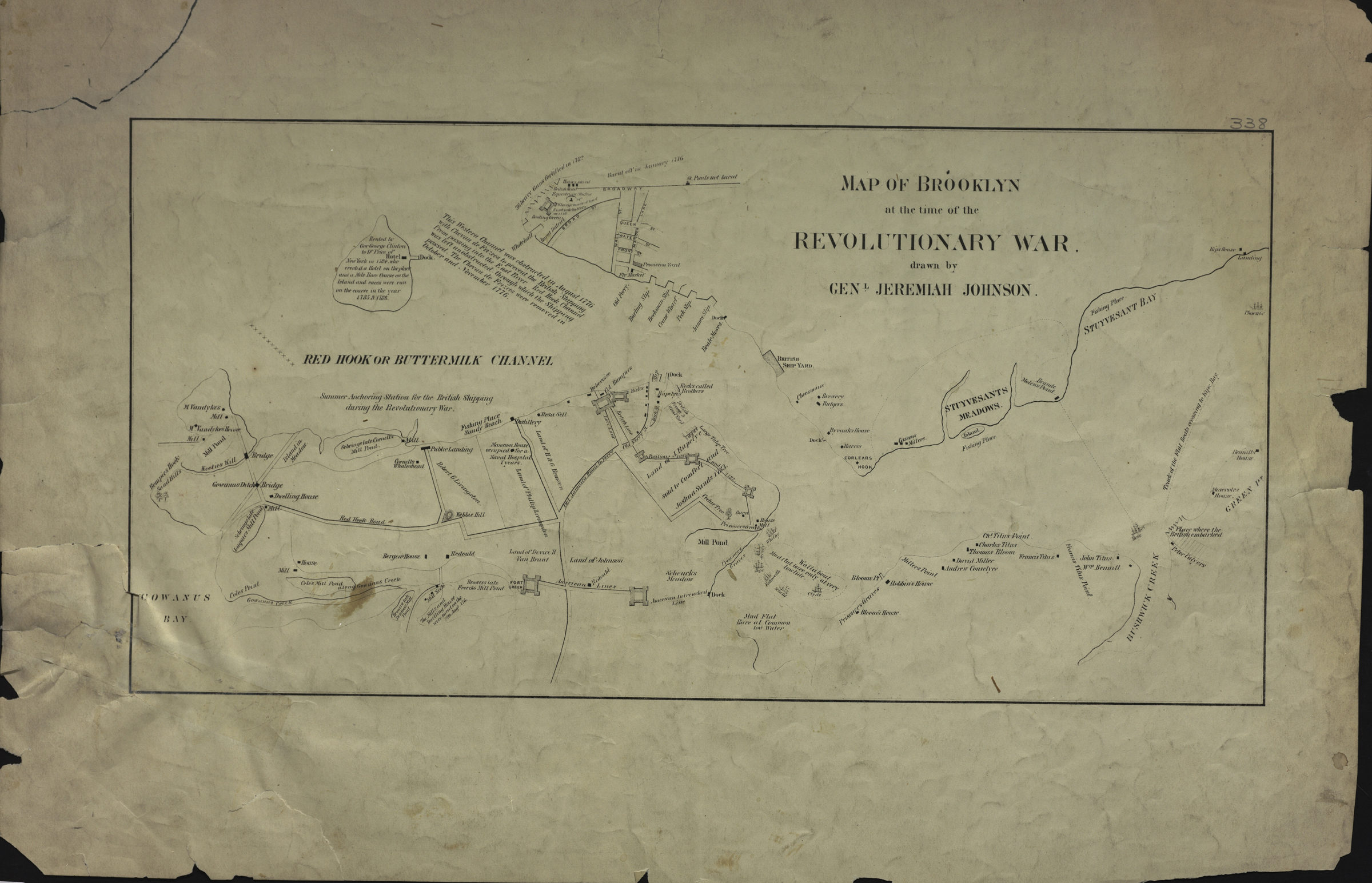
Map of Brooklyn at the time of the Revolutionary War: drawn by Genl. Jeremiah Johnson [19??]
Map No. Rev. War-[1776] (18--?)d.Fl
Covers the eastern coast of Brooklyn north from Red Hook to Greenpoint. Also covers Manhattan north from the Battery to approximately Stuyvesant Bay. Shows military sites, forts, docks, slips, buildings, and names of some property owners. Relief shown by hachures. Ships shown pictorially. Oriented with north to the right. Includes notes.
Map area shown
Relation
Full catalog recordSize
19 × 38 cmDownload
Low Resolution Image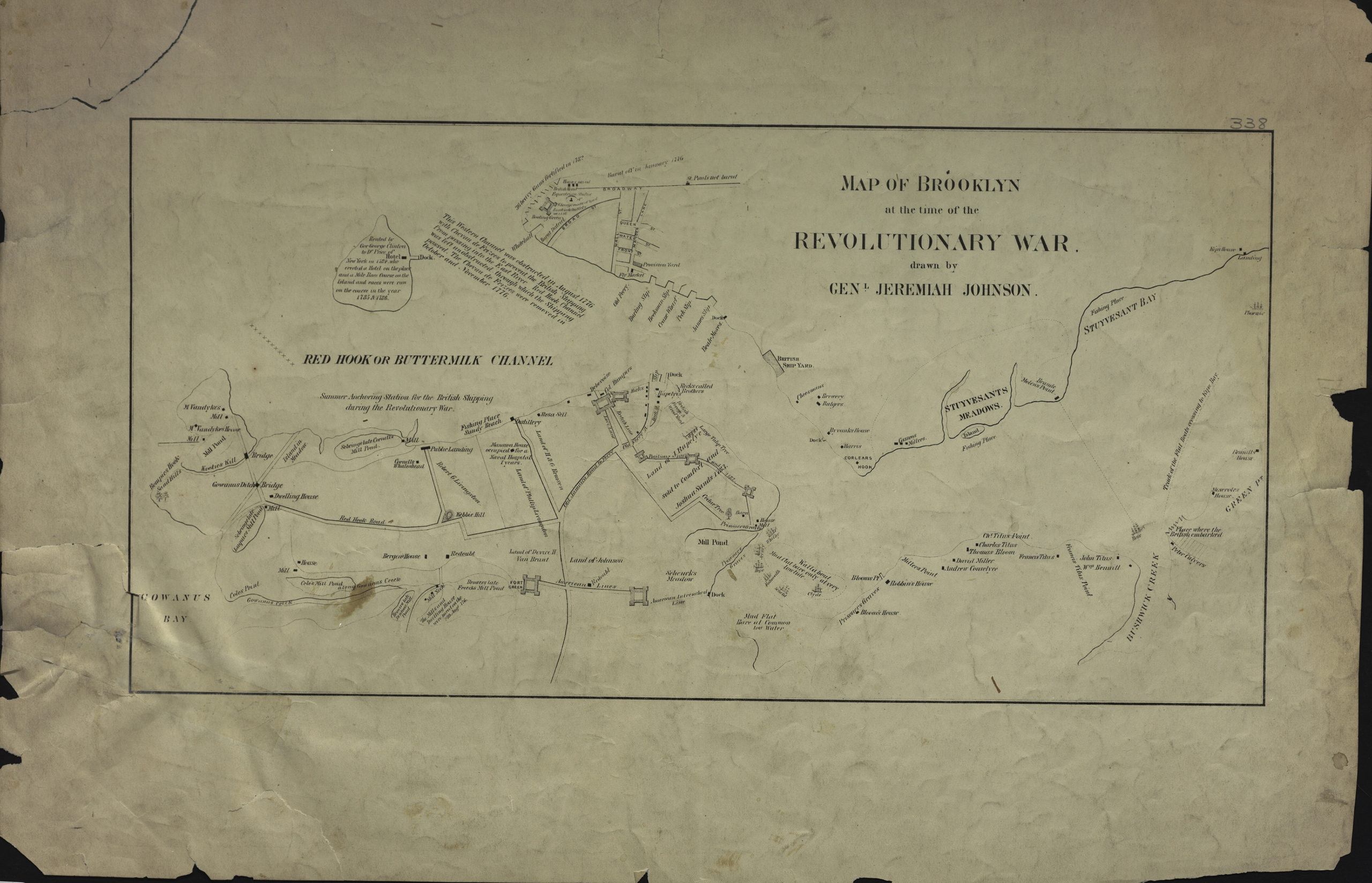
Creator
Johnson, Jeremiah,Publisher
Brooklyn Historical SocietyCitation
Map of Brooklyn at the time of the Revolutionary War: drawn by Genl. Jeremiah Johnson; [19??], Map Collection, Rev. War-[1776] (18--?)d.Fl; Brooklyn Historical Society.Scale
Scale not givenLoading zoom image...