
Map of the United States of America, showing the boundaries of the Union and Confederate geographical divisions and departments, April 9, 1865 [188?]
Map No. Civ. War-1865 (188-?).Fl
Relief shown by hachures and spot heights in feet. Prime meridians: Greenwich and Washington, D.C. In upper left margin: Atlas to accompany the official records of the Union and Confederate armies 1861-1865. In upper right margin: Plate CLXXI. Includes key and notes.
Places
Map area shown
Genre
Military mapsRelation
Full catalog recordSize
42 × 70 cmDownload
Low Resolution Image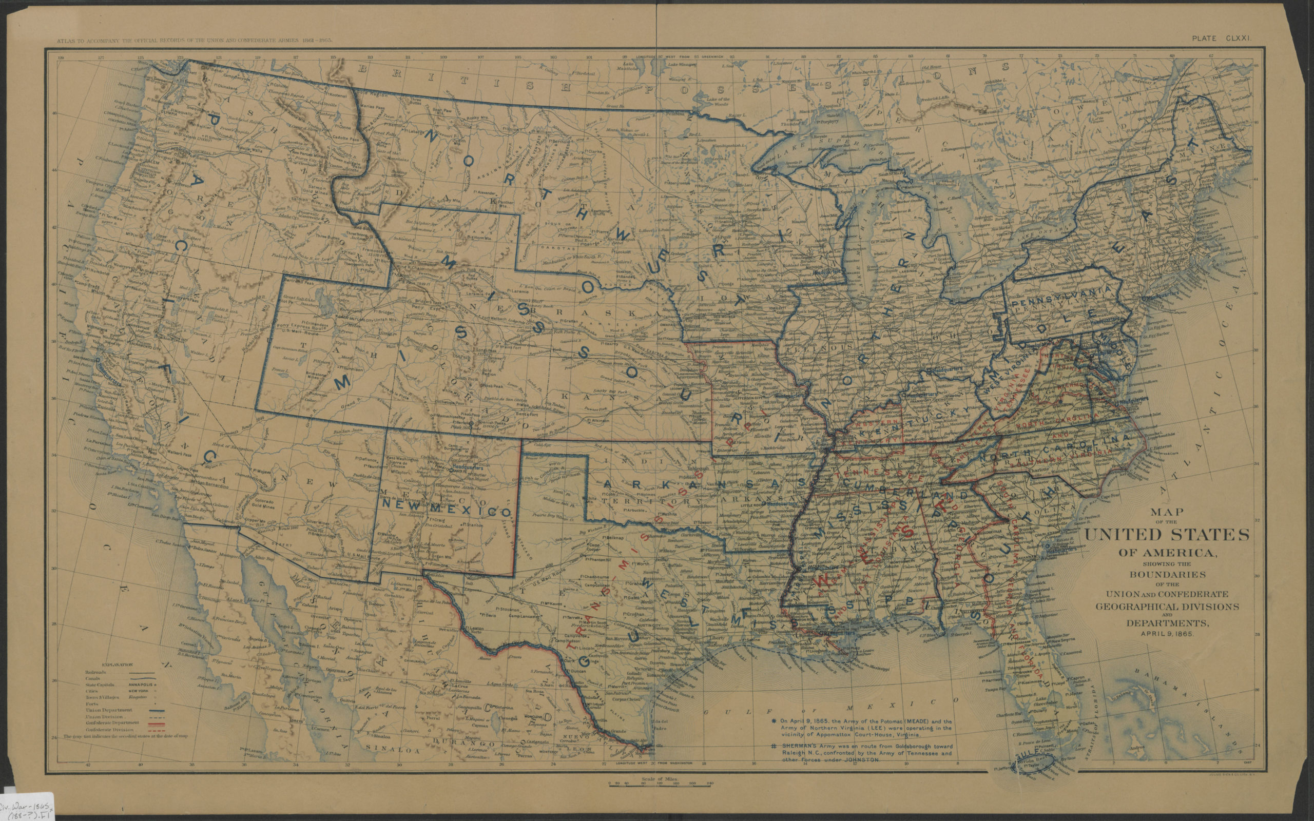
Creator
Julius Bien & Co.,Publisher
Brooklyn Historical SocietyCitation
Map of the United States of America, showing the boundaries of the Union and Confederate geographical divisions and departments, April 9, 1865; [188?], Map Collection, Civ. War-1865 (188-?).Fl; Brooklyn Historical Society.Scale
Scale [ca. 1:6,600,000]Loading zoom image... 