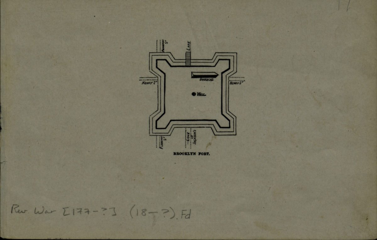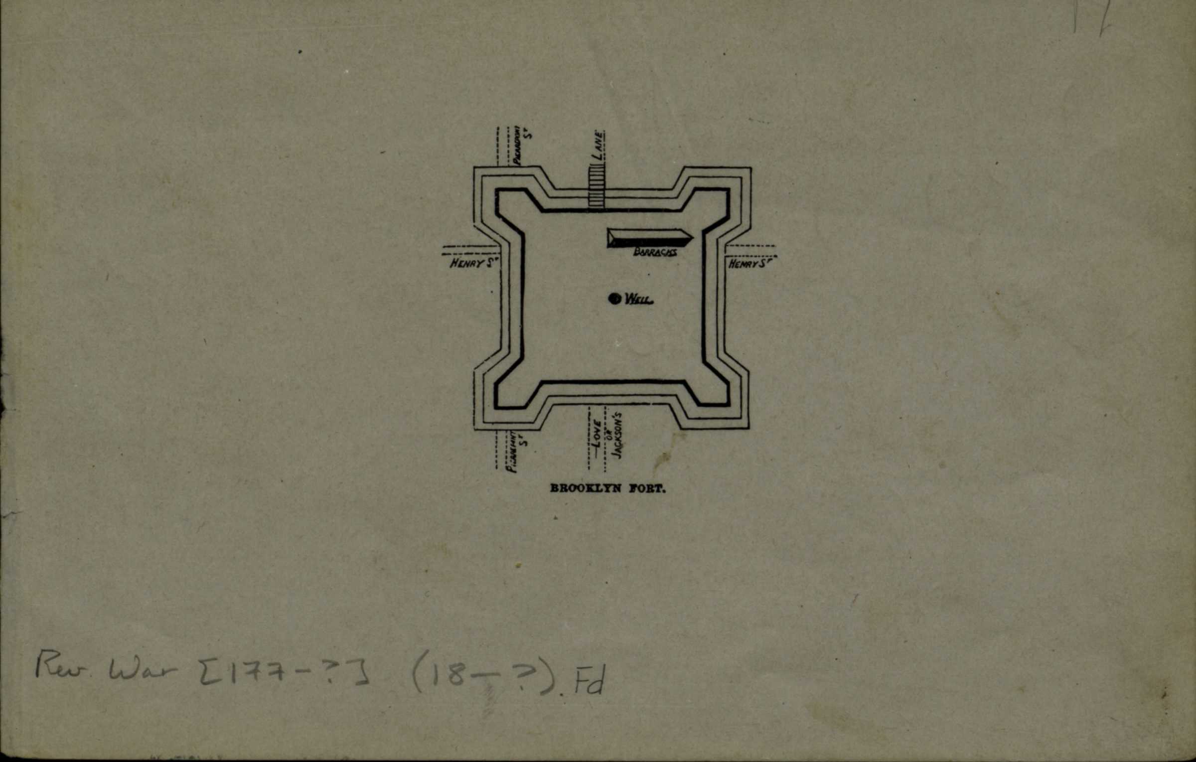
Brooklyn fort [18??]
Map No. Rev. War-[177-?] (18--?).Fl
Shows Fort Brooklyn near modern-day Henry St. and Pierrepont St. in Brooklyn Heights. Extracted from unknown work.
Subjects
Places
Map area shown
Genre
Military mapsRelation
Full catalog recordSize
13 × 19 cmDownload
Low Resolution Image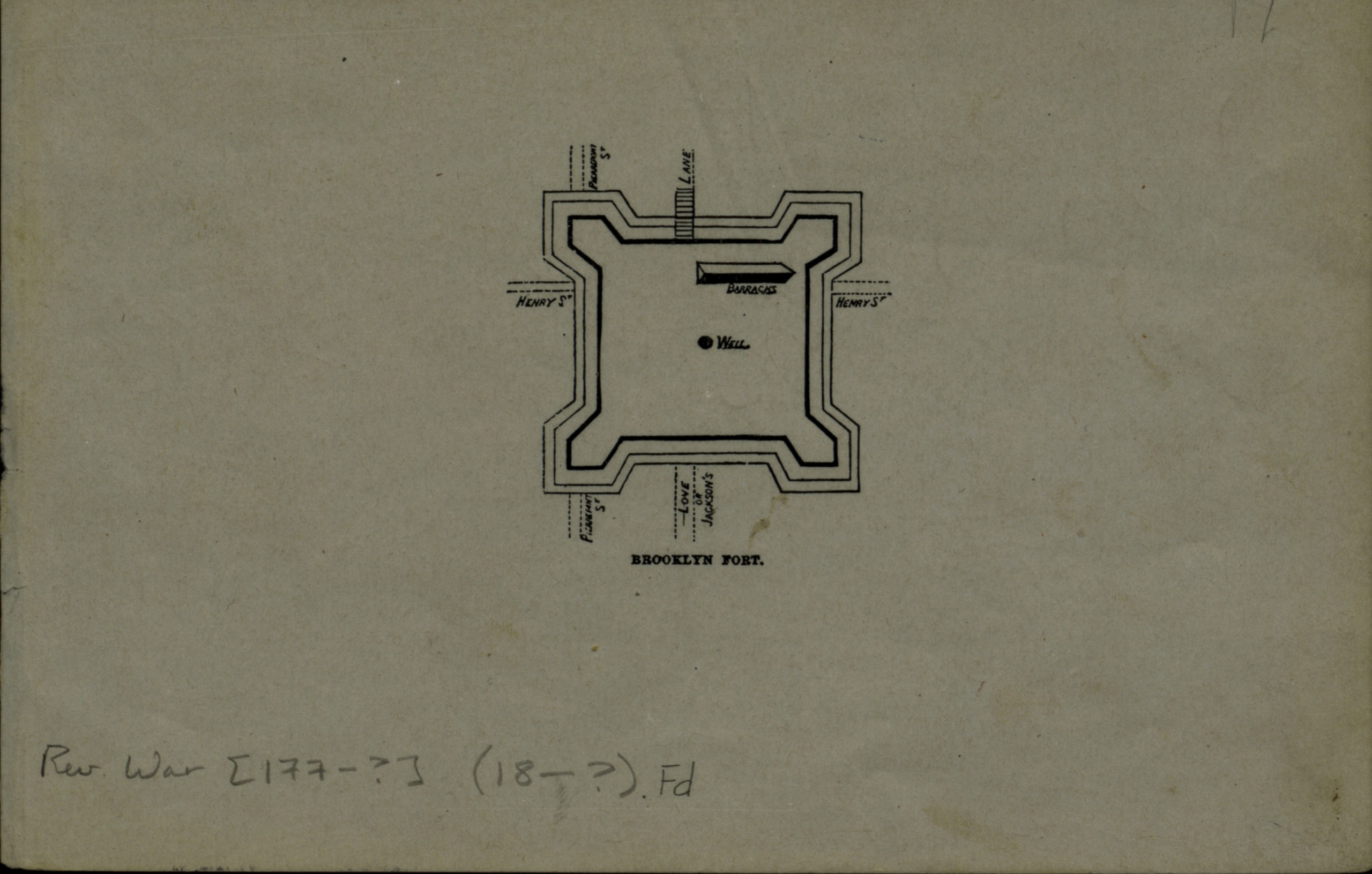
Creator
Publisher
Brooklyn Historical SocietyCitation
Brooklyn fort; [18??], Map Collection, Rev. War-[177-?] (18--?).Fl; Brooklyn Historical Society.Scale
Scale not givenLoading zoom image...