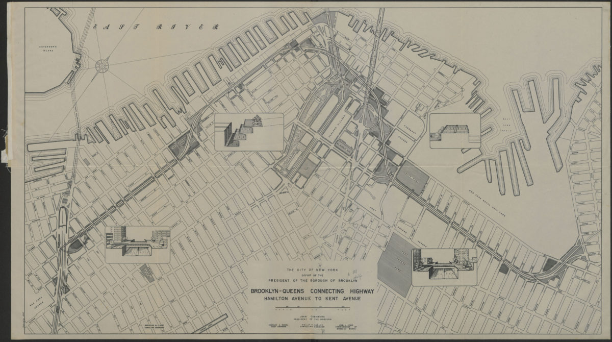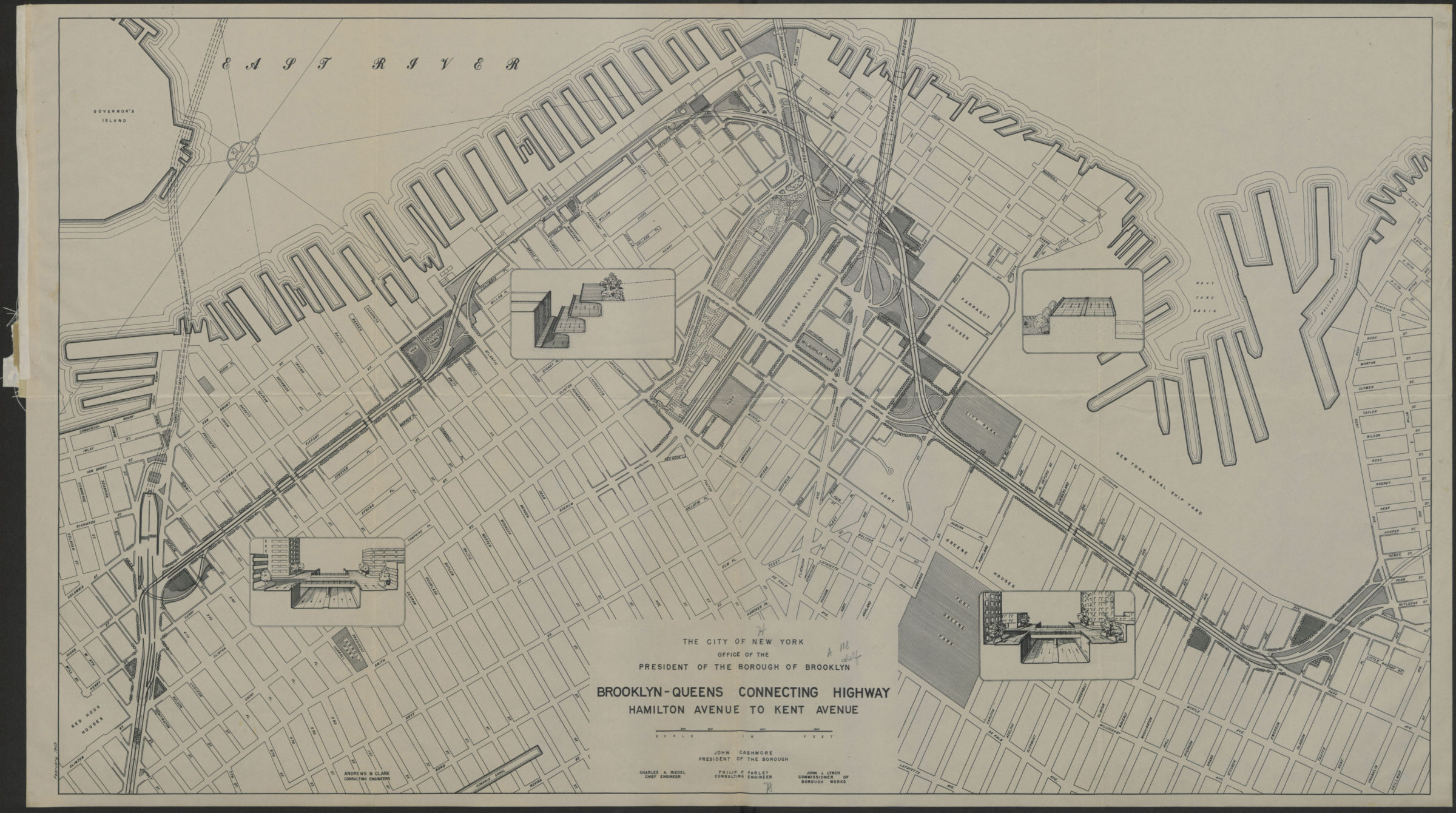
Brooklyn-Queens connecting highway: Hamilton Avenue to Kent Avenue 1949
Map No. B C-1949.Fl
Shows the portion of the Brooklyn-Queens Connecting Highway (BQE) that runs through Red Hook, Carrol Gardens, Columbia Street Waterfront District, Brooklyn Heights, Downtown Brooklyn, Brooklyn Navy Yard, and Williamsburg. Includes 4 inset illustrations of cross-sections at key locations. Also issued in smaller (37 x 65 cm) version.
Subjects
Places
Map area shown
Genre
Road mapsRelation
Full catalog recordSize
44 × 78 cmDownload
Low Resolution Image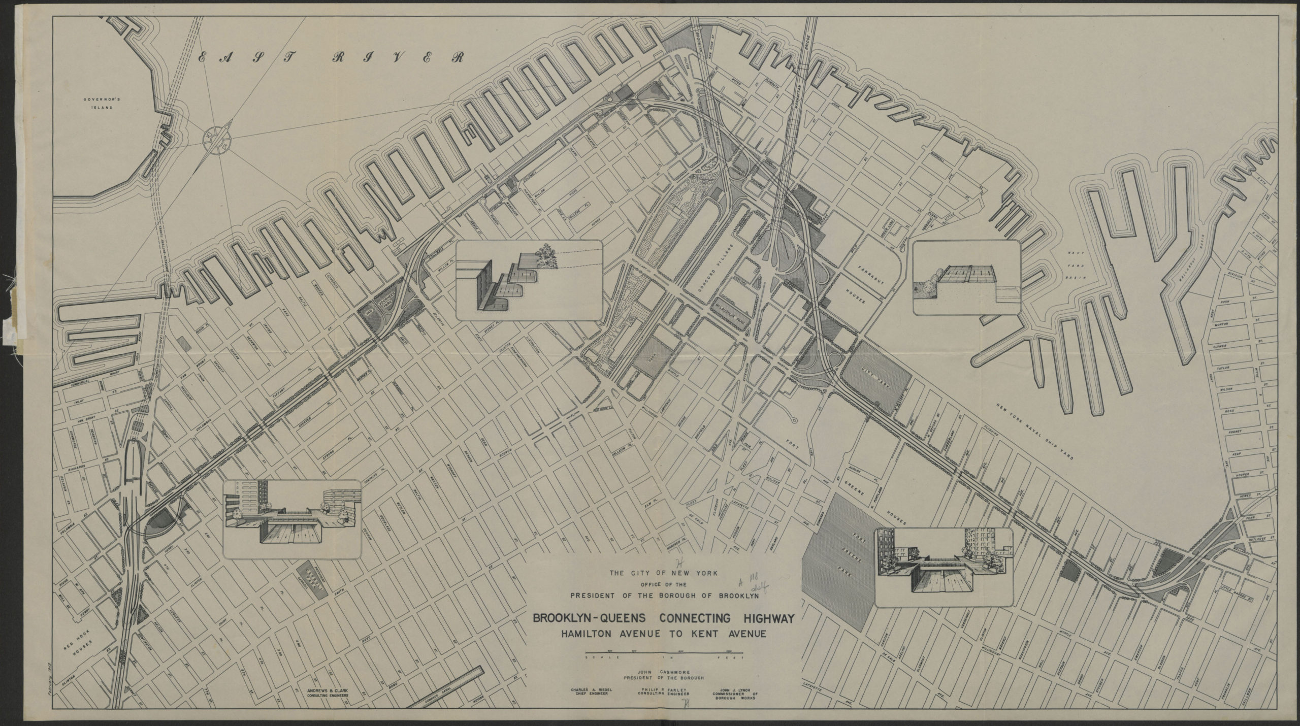
Creator
Brooklyn (New York, N.Y.).; Office of Brooklyn Borough President,Publisher
Brooklyn Historical SocietyCitation
Brooklyn-Queens connecting highway: Hamilton Avenue to Kent Avenue; 1949, Map Collection, B C-1949.Fl; Brooklyn Historical Society.Scale
Scale approximately 1:610Loading zoom image...