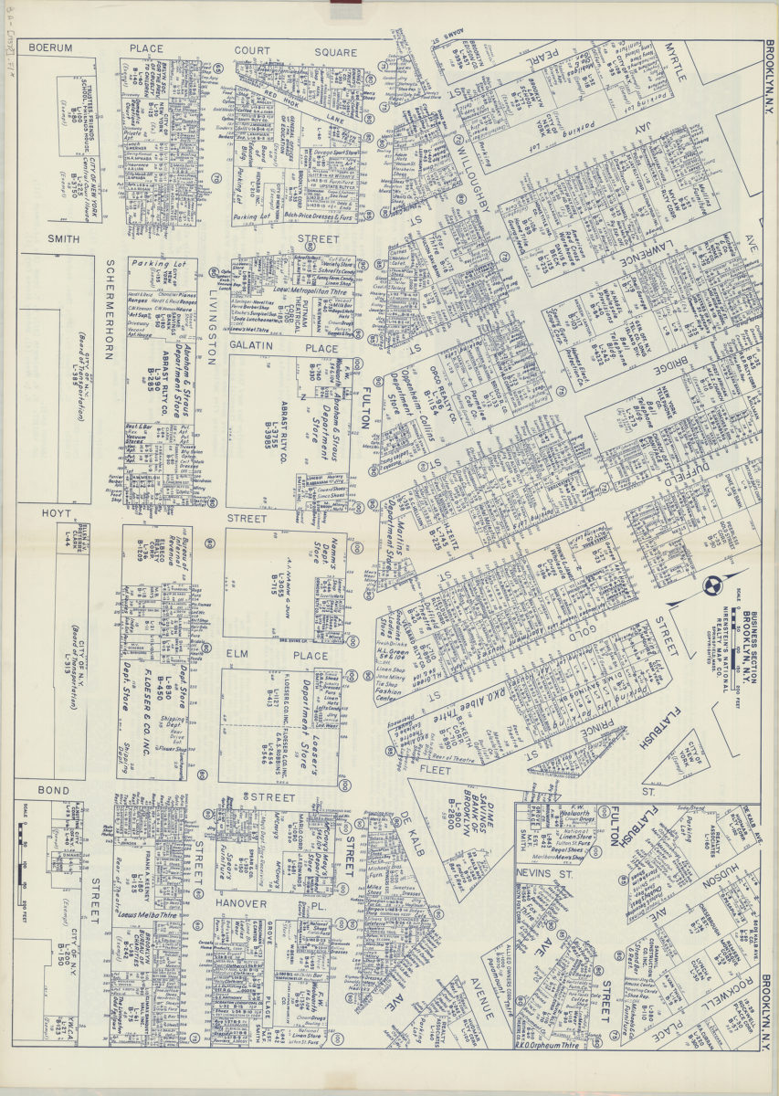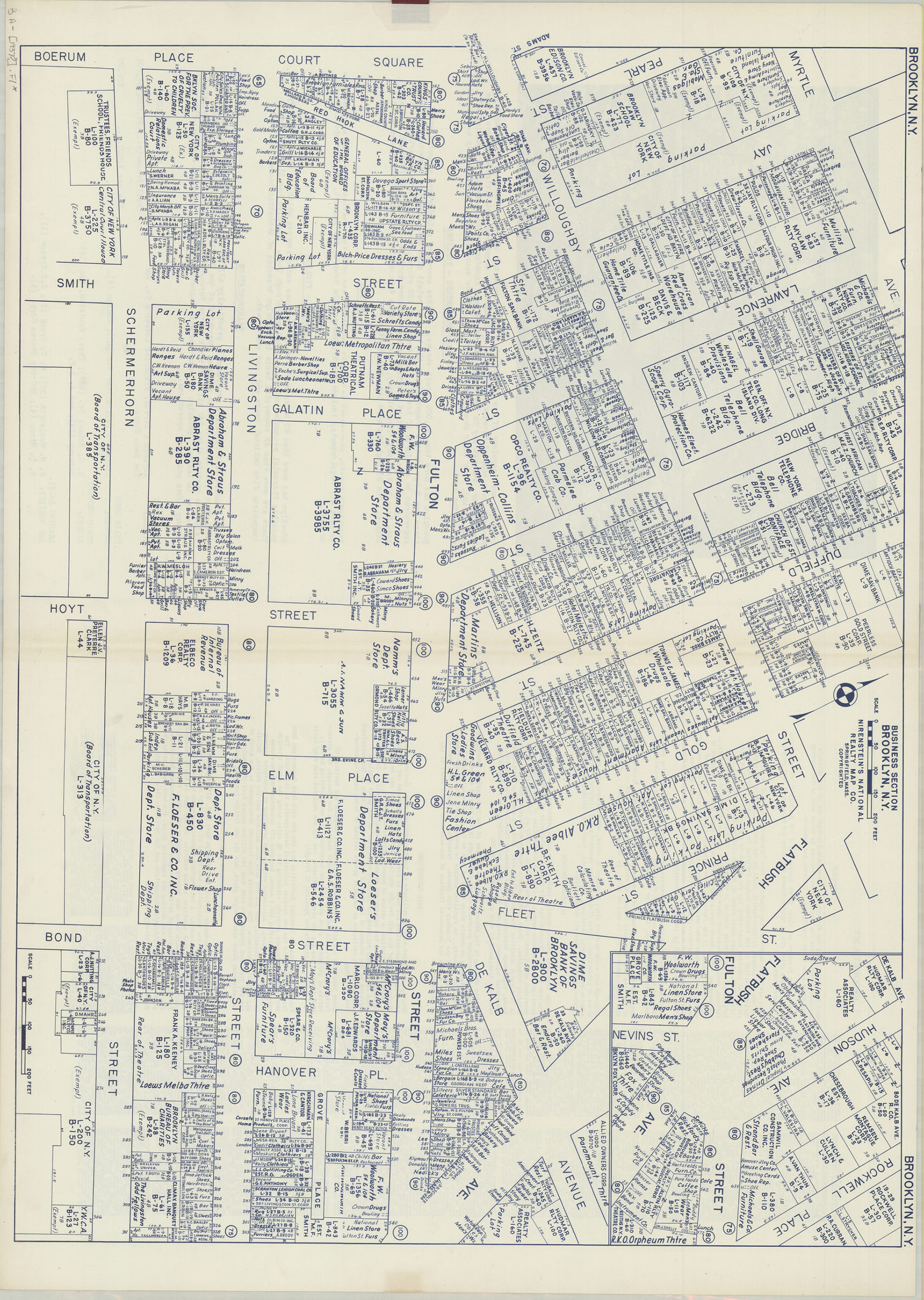

Business section, Brooklyn, N.Y.: Nirenstein’s National Realty Map Co [1937]
Map No. B A-[1937?].Fl
Cadastral map with business or personal names of landowners, street address numbers, and lot sizes given. Printed in blue ink. Oriented with north toward the upper left. On verso: text describing the city, its businesses, setting, population makeup, industries, and 1 illustration.
Map area shown
Genre
Cadastral mapsRelation
Full catalog recordSize
69 × 96 cmDownload
Low Resolution Image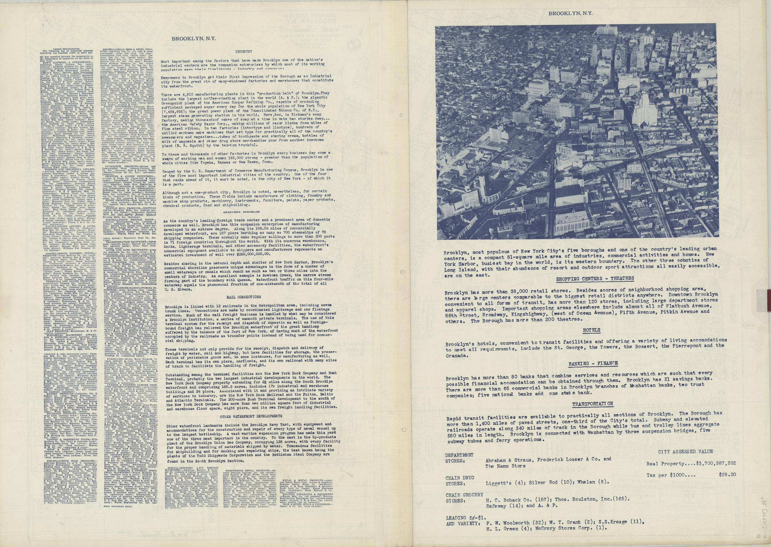
Creator
Nirenstein's National Realty Map Company,Publisher
Brooklyn Historical SocietyCitation
Business section, Brooklyn, N.Y.: Nirenstein’s National Realty Map Co; [1937], Map Collection, B A-[1937?].Fl; Brooklyn Historical Society.Scale
Scale approximately 1:835Loading zoom image...