Center for Brooklyn History
Map Collections
Search
About
Othmer Library & Archives
Submit search query
Refine 10 records
Clear filter
1
Location
Brooklyn (New York, N.Y.)
891
Brooklyn Heights (New York, N.Y.)
76
Downtown Brooklyn (New York, N.Y.)
29
Manhattan (New York, N.Y.)
120
Park Slope (New York, N.Y.)
16
Subject
Advertising
4
Bus lines
20
Bus travel
22
Central business districts
10
Electric railroads
5
Land use
5
Landowners
434
Local transit
63
Real property
619
Roads
117
Streets
46
Subways
55
Date
20th Century
469
21th Century
66
or enter range:
from
to
Genres
Cadastral maps
597
Map
191
Pictorial maps
38
Road maps
83
Tourist maps
55
Transportation maps
120
Zoning maps
55
Sort by:
Date (earliest)
Date (most recent)
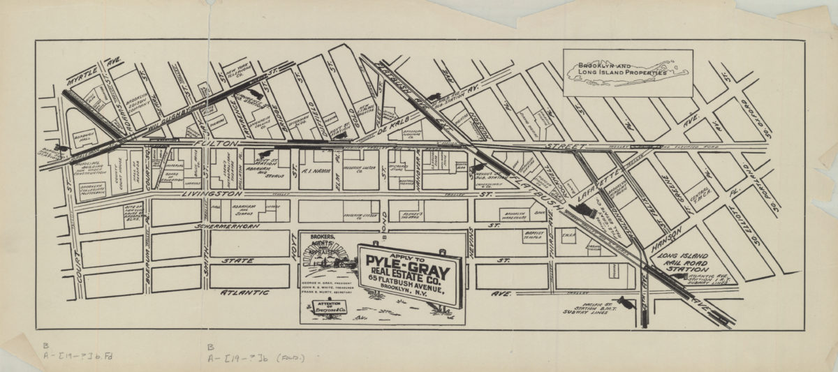
[Map of the Fulton Street area in downtown Brooklyn]
[Map of the Fulton Street area in downtown Brooklyn]
[19??]
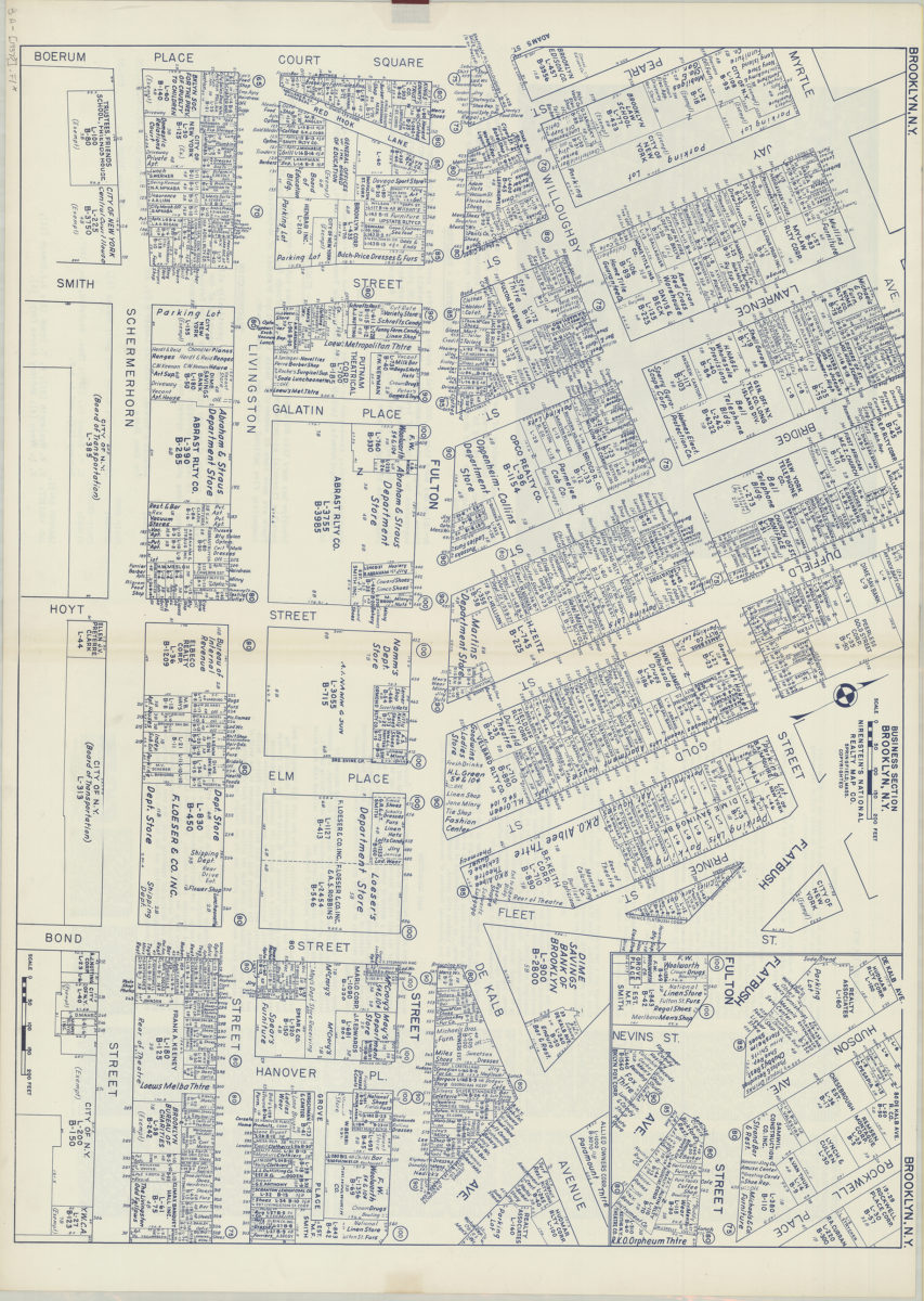
Business section, Brooklyn, N.Y.: Nirenstein’s National Realty Map Co
Business section, Brooklyn, N.Y.: Nirenstein’s National Realty Map Co
[1937]
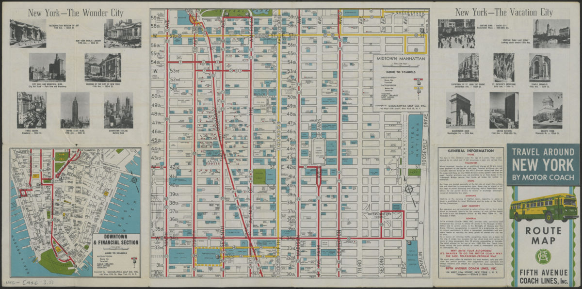
Travel around New York by motorcoach: route map, Fifth Avenue Coach Lines, Inc
Travel around New York by motorcoach: route map, Fifth Avenue Coach Lines, Inc
[1956-1962]
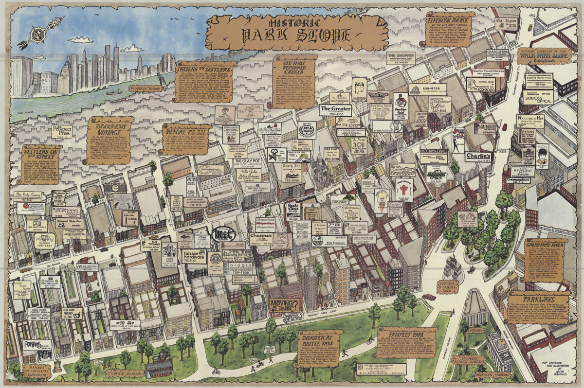
Historic Park Slope: map designed and ilustrated by Kathy Diamond
Historic Park Slope: map designed and ilustrated by Kathy Diamond
[1984; 1984]
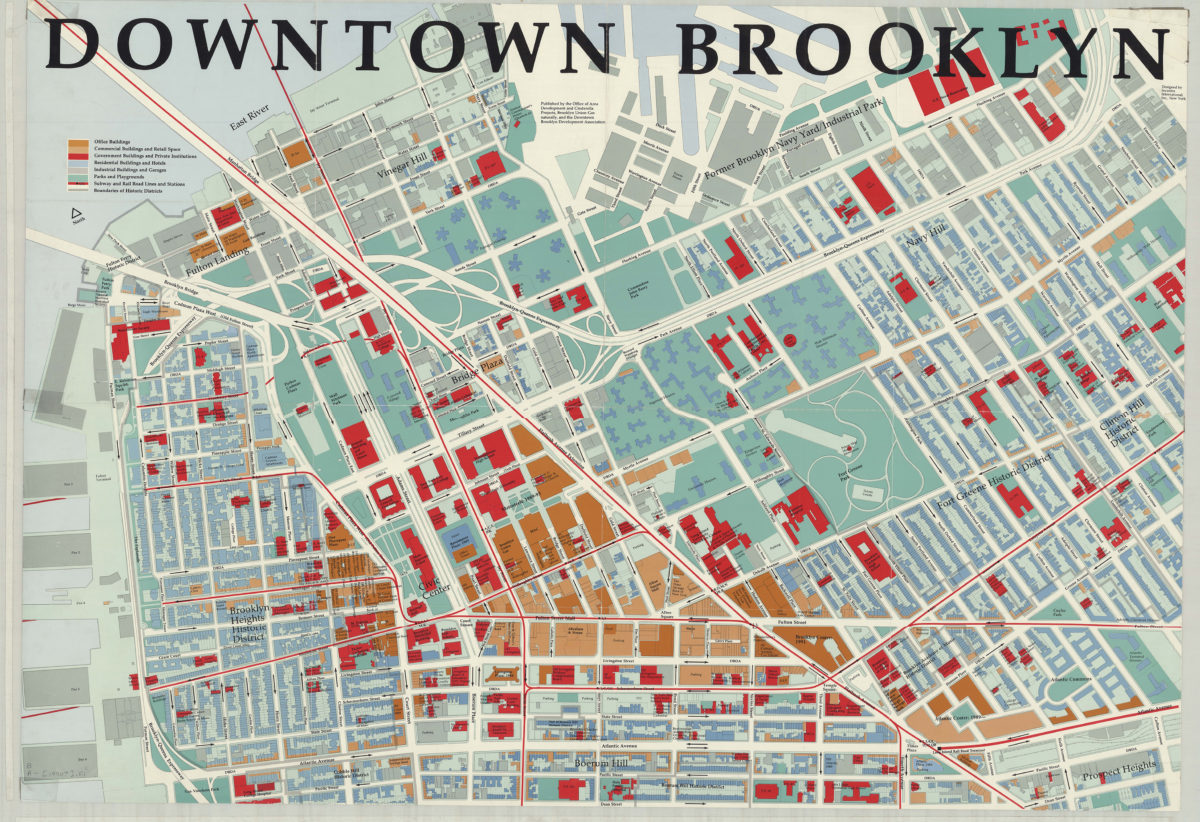
Downtown Brooklyn: designed by Incentra International, Inc
Downtown Brooklyn: designed by Incentra International, Inc
[1990]
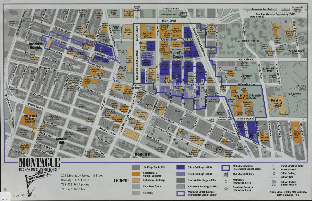
Montague Business Improvement District
Montague Business Improvement District
[2003; 2003]
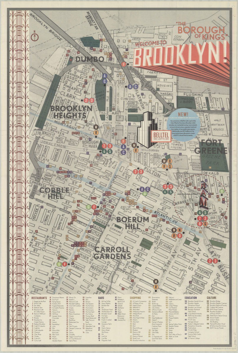
Welcome to Brooklyn!: “the borough of kings”
Welcome to Brooklyn!: “the borough of kings”
[2006]
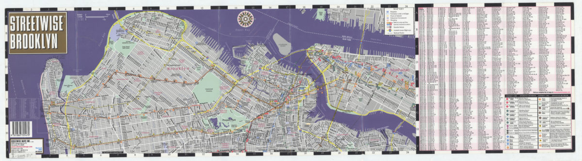
Streetwise Brooklyn: Streetwise Maps, Inc
Streetwise Brooklyn: Streetwise Maps, Inc
[2008; ca. 2000]
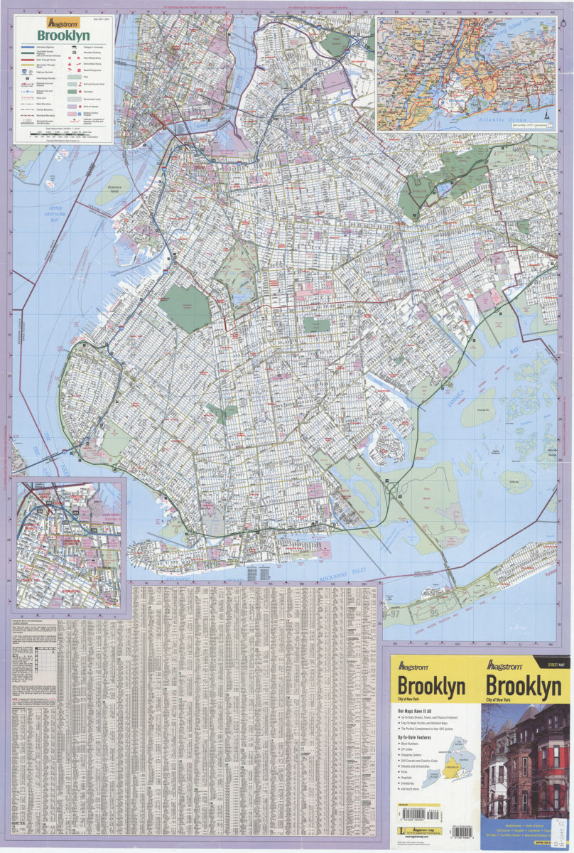
Hagstrom Brooklyn: Hagstrom Map
Hagstrom Brooklyn: Hagstrom Map
[ca. 2009]
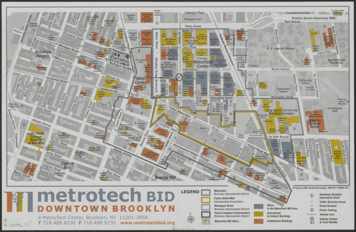
MetroTech BID: Downtown Brooklyn
MetroTech BID: Downtown Brooklyn
[2009; 2009]