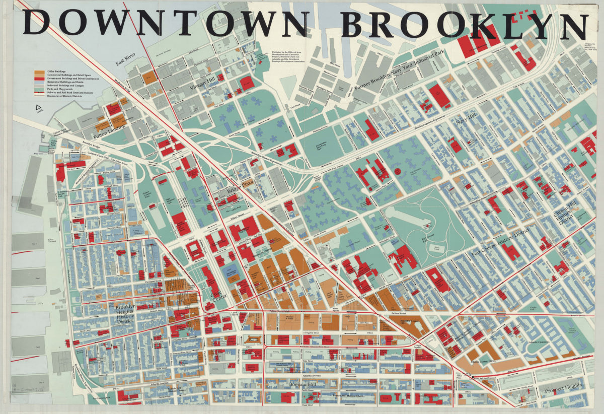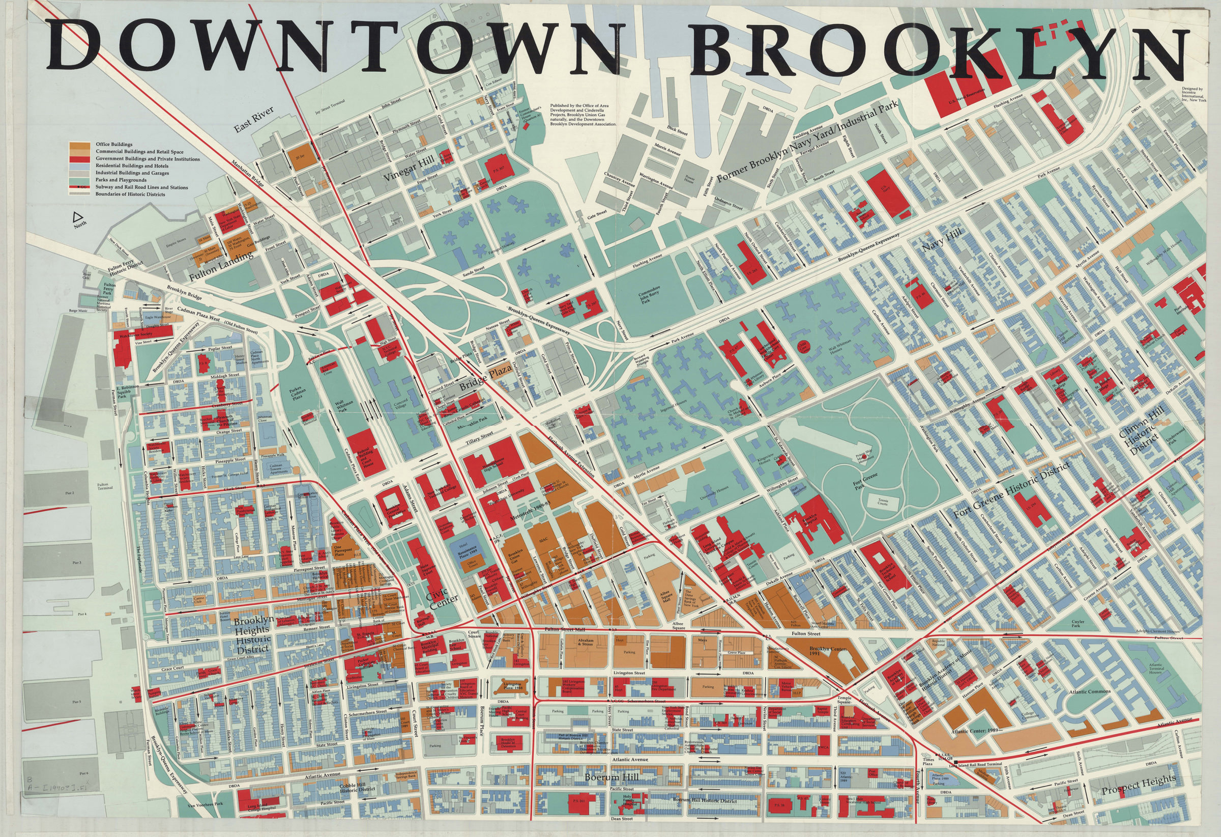
Downtown Brooklyn: designed by Incentra International, Inc [1990]
Map No. B A-[1990?].Fl
Covers Brooklyn Heights, Fulton Landing, Vinegar Hill, Cobble Hill, Downtown, Boerum Hill, Brooklyn Navy Yard, Navy Hill, Fort Greene, Clinton Hill and Prospect Heights. Shows streets, structures, parks, subway and railroad lines and stations, and boundaries of historic districts. Oriented with north to the upper left. Includes key.
Map area shown
Relation
Full catalog recordSize
69 × 100 cm,Download
Low Resolution Image
Creator
Incentra International, Inc.,Publisher
Brooklyn Historical SocietyCitation
Downtown Brooklyn: designed by Incentra International, Inc; [1990], Map Collection, B A-[1990?].Fl; Brooklyn Historical Society.Scale
Scale not givenLoading zoom image...