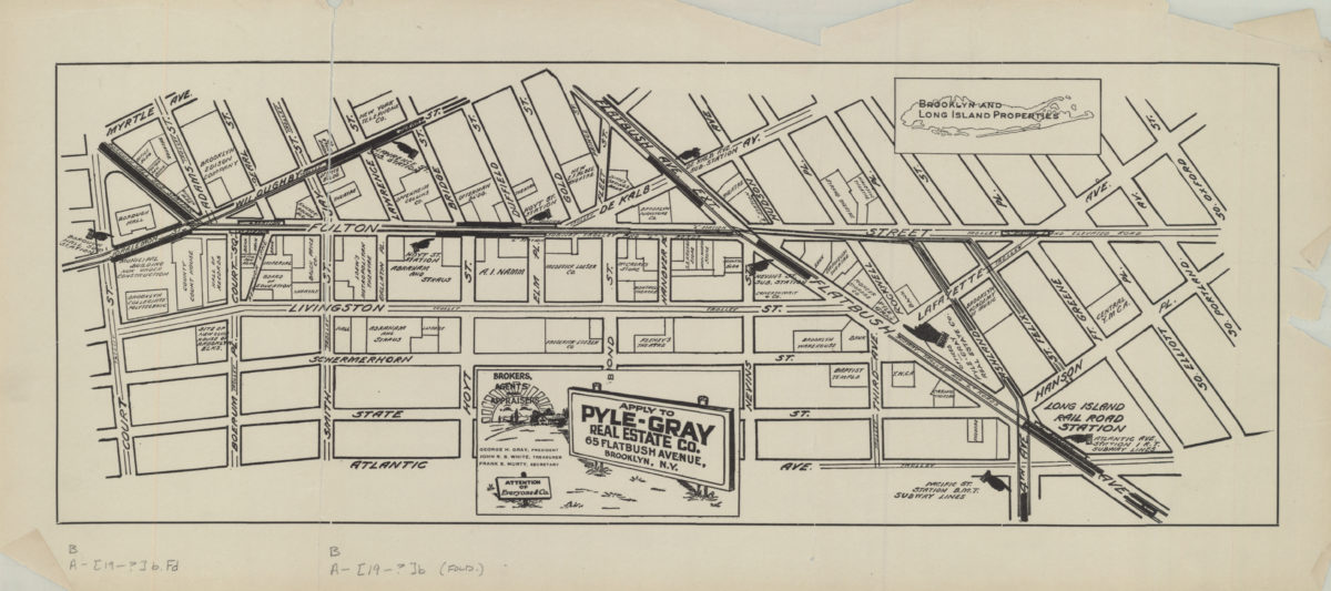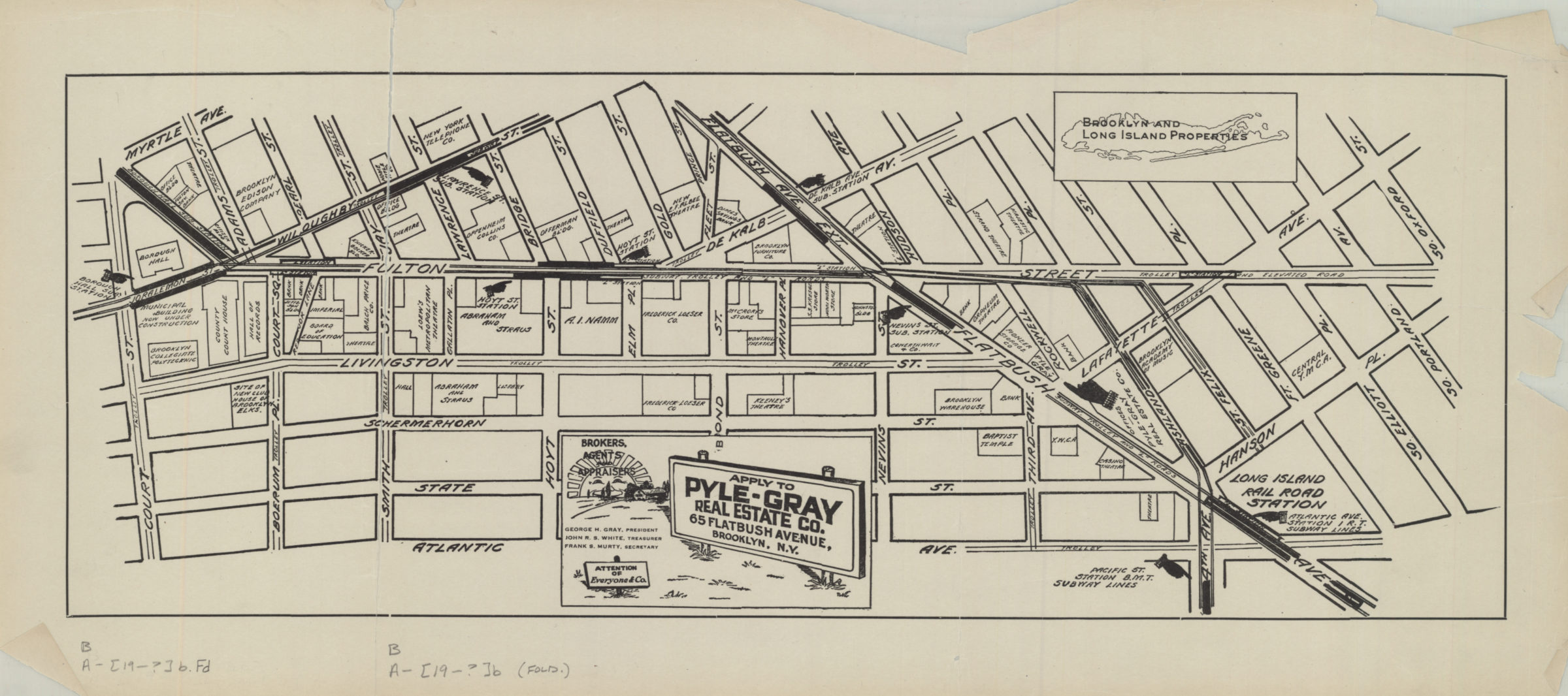
[Map of the Fulton Street area in downtown Brooklyn] [19??]
Map No. B A-[19--?]b.Fl
Title devised by cataloger. Advertising map showing central business corridor of downtown Brooklyn, following Fulton Street, and including several surrounding blocks, from Court Street to South Oxford Street. Shows businesses, trolley lines, and subway stops.
Subjects
Places
Map area shown
Genre
Tourist mapsRelation
Full catalog recordSize
24 × 54 cmDownload
Low Resolution Image
Creator
Pyle-Gray Real Estate Co.,Publisher
Brooklyn Historical SocietyCitation
[Map of the Fulton Street area in downtown Brooklyn]; [19??], Map Collection, B A-[19--?]b.Fl; Brooklyn Historical Society.Scale
Scale not givenLoading zoom image...