Center for Brooklyn History
Map Collections
Search
About
Othmer Library & Archives
Submit search query
Refine 9 records
Clear filters
2
Location
Brooklyn (New York, N.Y.)
891
Brooklyn Heights (New York, N.Y.)
76
Downtown Brooklyn (New York, N.Y.)
29
Park Slope (New York, N.Y.)
16
Subject
Advertising
4
Central business districts
10
Electric railroads
5
Land use
5
Landowners
434
Real property
619
Roads
117
Streets
46
Subways
55
Date
20th Century
469
21th Century
66
or enter range:
from
to
Genres
Cadastral maps
597
Map
191
Pictorial maps
38
Road maps
83
Tourist maps
55
Transportation maps
120
Zoning maps
55
Sort by:
Date (earliest)
Date (most recent)
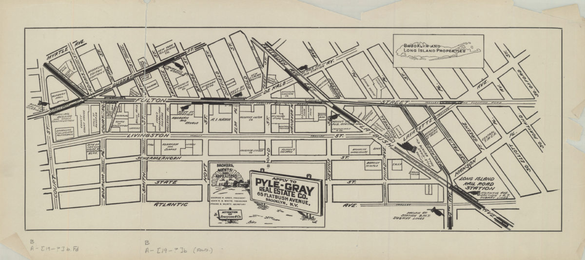
[Map of the Fulton Street area in downtown Brooklyn]
[Map of the Fulton Street area in downtown Brooklyn]
[19??]
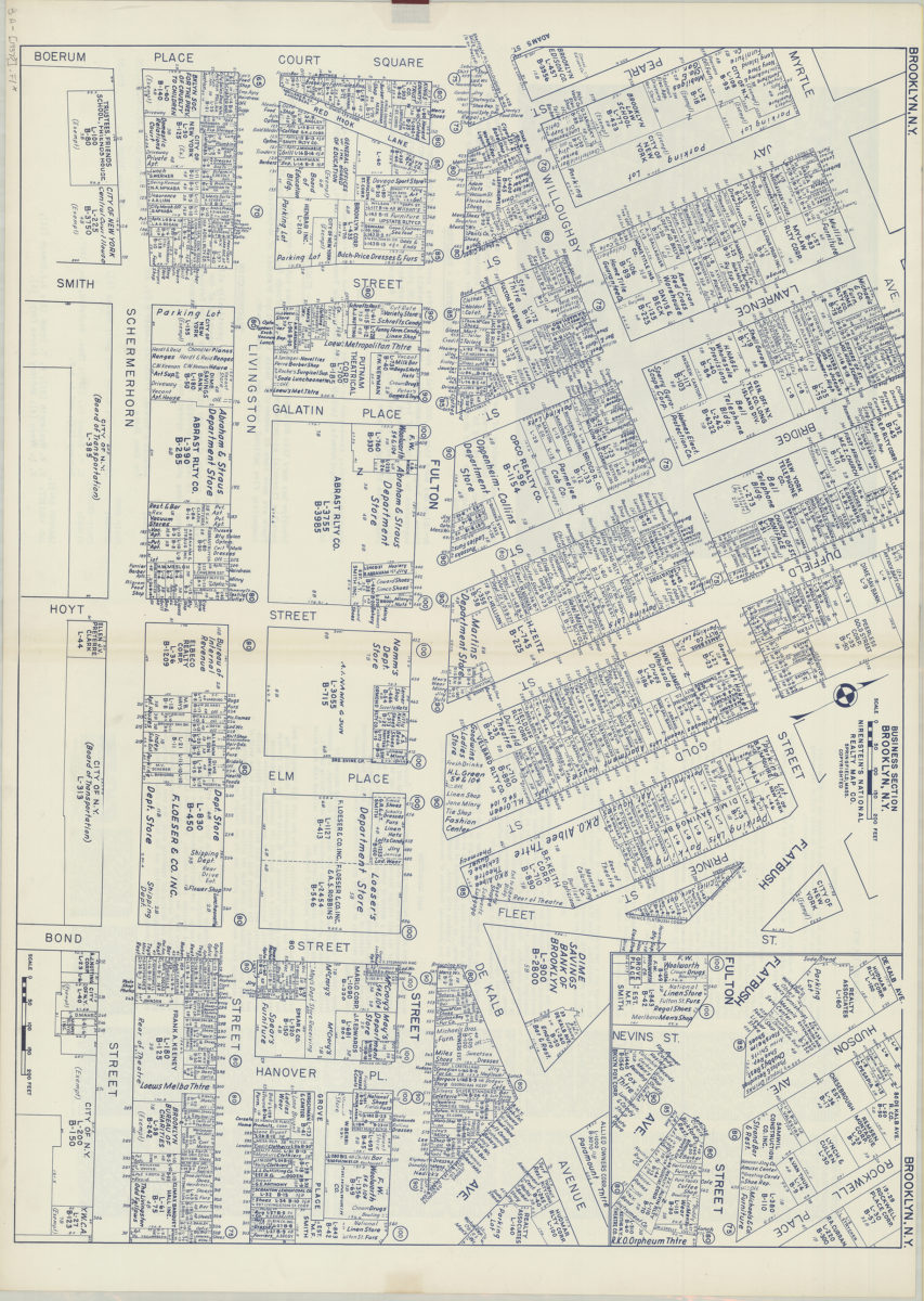
Business section, Brooklyn, N.Y.: Nirenstein’s National Realty Map Co
Business section, Brooklyn, N.Y.: Nirenstein’s National Realty Map Co
[1937]
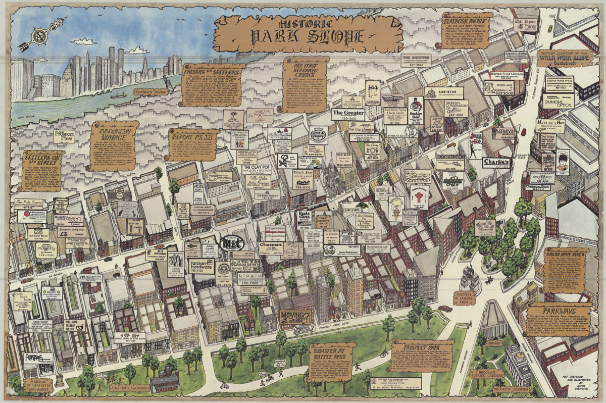
Historic Park Slope: map designed and ilustrated by Kathy Diamond
Historic Park Slope: map designed and ilustrated by Kathy Diamond
[1984; 1984]
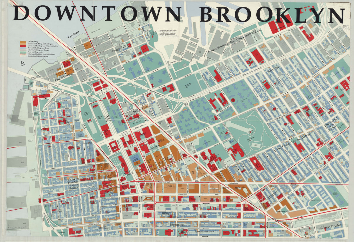
Downtown Brooklyn: designed by Incentra International, Inc
Downtown Brooklyn: designed by Incentra International, Inc
[1990]
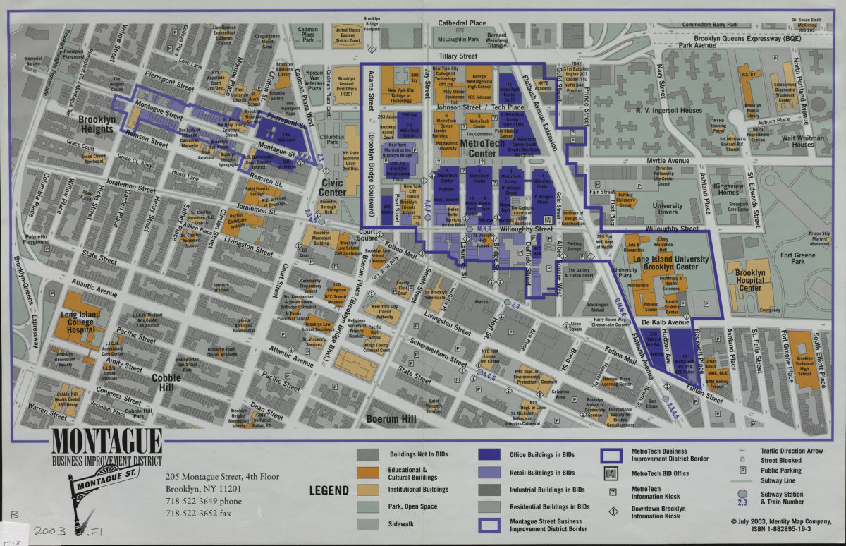
Montague Business Improvement District
Montague Business Improvement District
[2003; 2003]
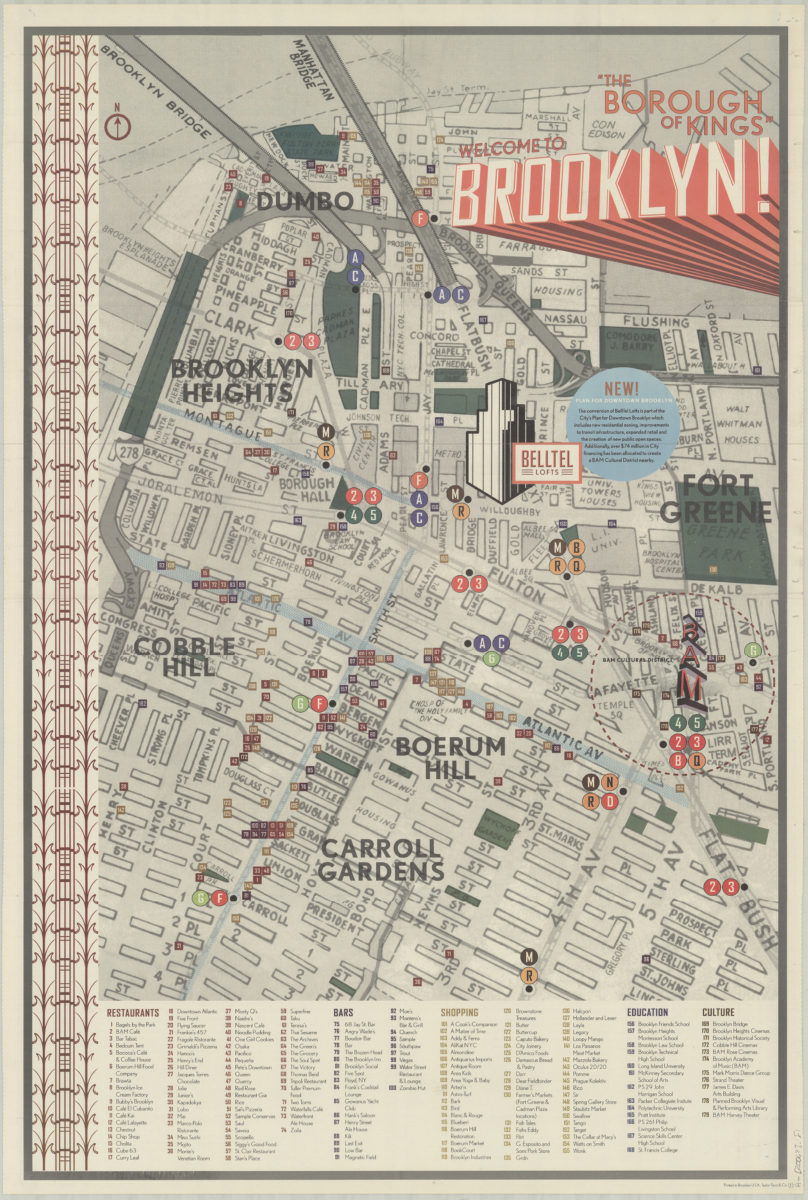
Welcome to Brooklyn!: “the borough of kings”
Welcome to Brooklyn!: “the borough of kings”
[2006]
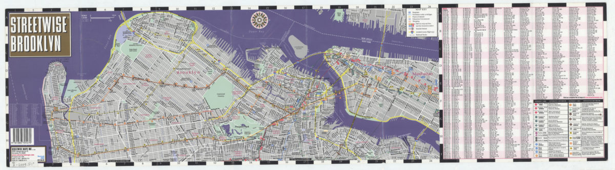
Streetwise Brooklyn: Streetwise Maps, Inc
Streetwise Brooklyn: Streetwise Maps, Inc
[2008; ca. 2000]
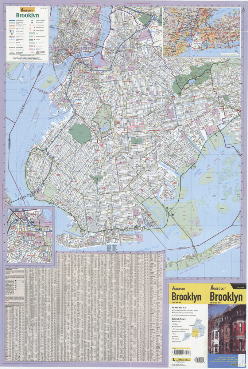
Hagstrom Brooklyn: Hagstrom Map
Hagstrom Brooklyn: Hagstrom Map
[ca. 2009]
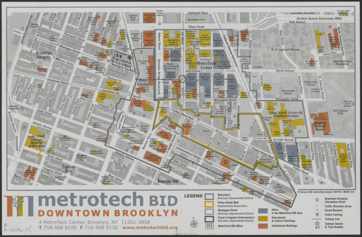
MetroTech BID: Downtown Brooklyn
MetroTech BID: Downtown Brooklyn
[2009; 2009]