
City & County map of New-York, Brooklyn, Williamsburgh, Jersey City and the adjacent waters: by J.H. Colton 1852; [ca. 1845]
Map No. NYC-1845.Fl
Covers Manhattan, the northwestern part of Brooklyn and the easternmost part of Queens, New York (N.Y.) also Jersey City (N.J.) and the New Jersey shoreline. Shows existing and proposed streets, railroads, piers and fill. Shows built-up area by shading, also some buildings. Also shows streams and wetlands. Shows depths by soundings. “Entered according to act of Congress in the year 1845 by D.G. Johnson….” Includes 5 inset maps and 1 inset illustration. NYHS copy stained, shellacked, cracked, frayed and abraded. Imperfect. Mounted on cloth. M009647
Subjects
Places
Map area shown
Genre
MapRelation
Full catalog recordSize
76 × 139 cmDownload
Low Resolution Image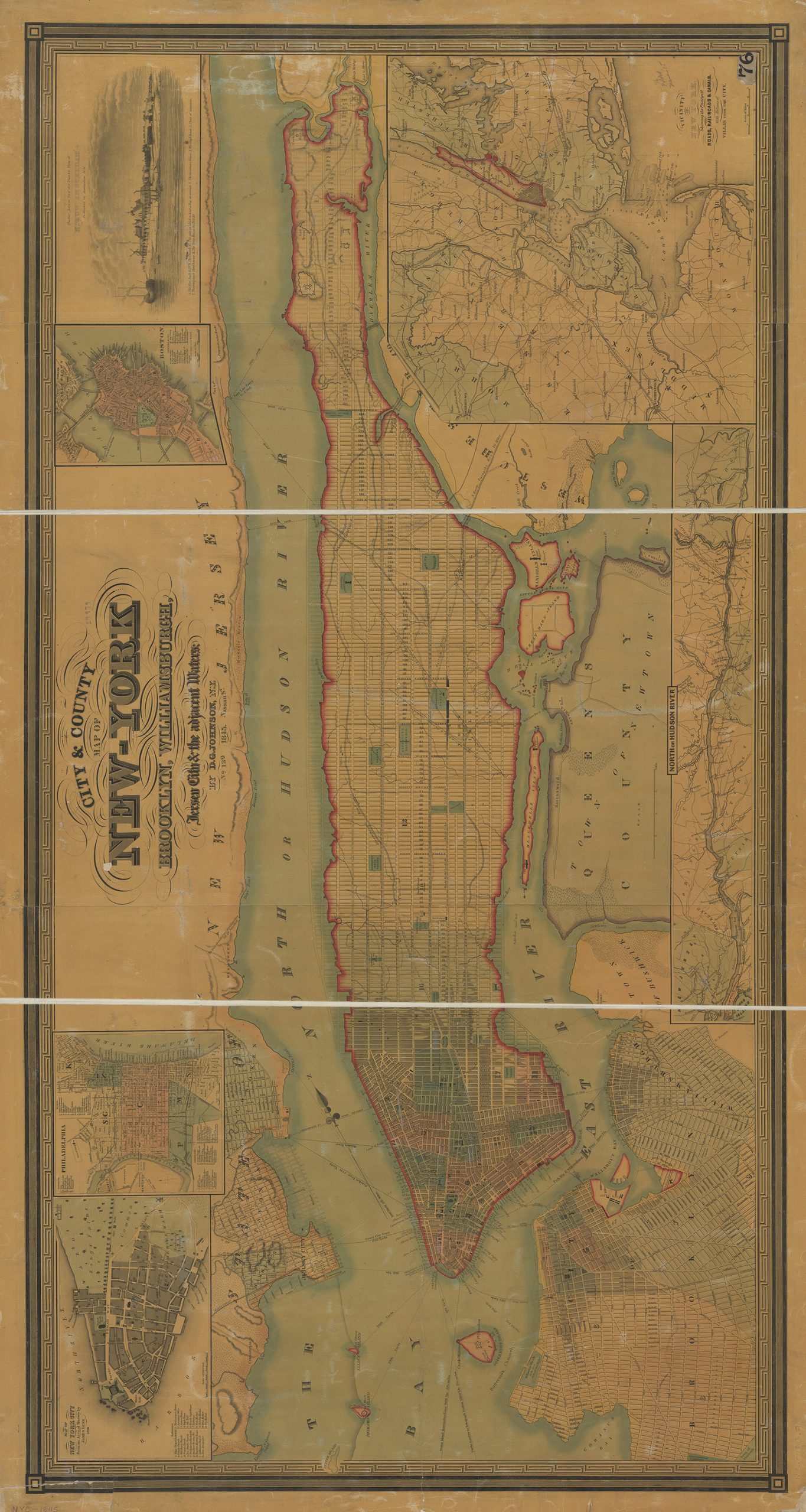
Creator
J.H. Colton & Co.,Publisher
Brooklyn Historical SocietyCitation
City & County map of New-York, Brooklyn, Williamsburgh, Jersey City and the adjacent waters: by J.H. Colton; 1852; [ca. 1845], Map Collection, NYC-1845.Fl; Brooklyn Historical Society.Scale
Scale [ca. 1:18,000]Loading zoom image... 