Center for Brooklyn History
Map Collections
Search
About
Othmer Library & Archives
Submit search query
Refine 4 records
Clear filter
1
Location
Brooklyn (New York, N.Y.)
891
Hoboken (N.J.)
1
Hudson County (N.J.)
3
Jersey City (N.J.)
4
Manhattan (New York, N.Y.)
120
New York (N.Y.)
164
New York Metropolitan Area
40
Queens (New York, N.Y.)
83
Staten Island (N.Y.)
10
Williamsburg (New York, N.Y.)
36
Subject
Buildings
12
Canals
15
ferries
32
Fills (Earthwork)
4
Piers
25
Railroads
72
Rivers
16
Streets
46
Wetlands
6
Date
19th Century
945
20th Century
469
or enter range:
from
to
Genres
Historical maps
53
Map
191
Topographic maps
70
Sort by:
Date (earliest)
Date (most recent)
City & County map of New-York, Brooklyn, Williamsburgh, Jersey City and the adjacent waters: by J.H. Colton
City & County map of New-York, Brooklyn, Williamsburgh, Jersey City and the adjacent waters: by J.H. Colton
1852; [ca. 1845]
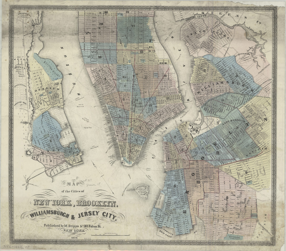
Map of the cities of New York, Brooklyn, Williamsburgh & Jersey City
Map of the cities of New York, Brooklyn, Williamsburgh & Jersey City
1854
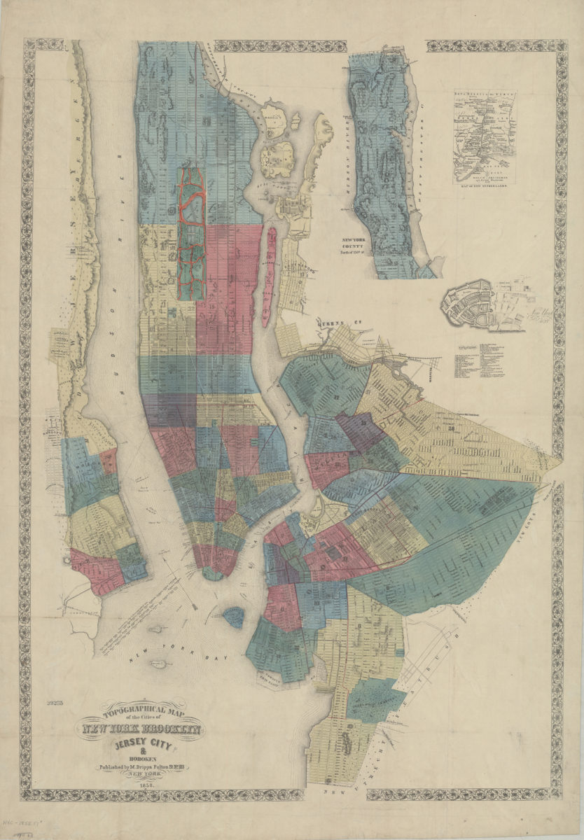
Topographical map of the cities of New York, Brooklyn, Jersey City & Hoboken
Topographical map of the cities of New York, Brooklyn, Jersey City & Hoboken
1858
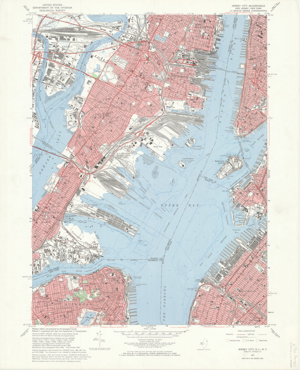
Jersey City quadrangle, New Jersey – New York: mapped, edited, and published by the Geological Survey ; revised in cooperation with New York Dept. of Transportation
Jersey City quadrangle, New Jersey – New York: mapped, edited, and published by the Geological Survey ; revised in cooperation with New York Dept. of Transportation
1967