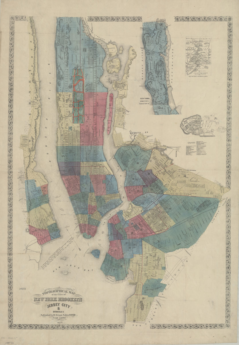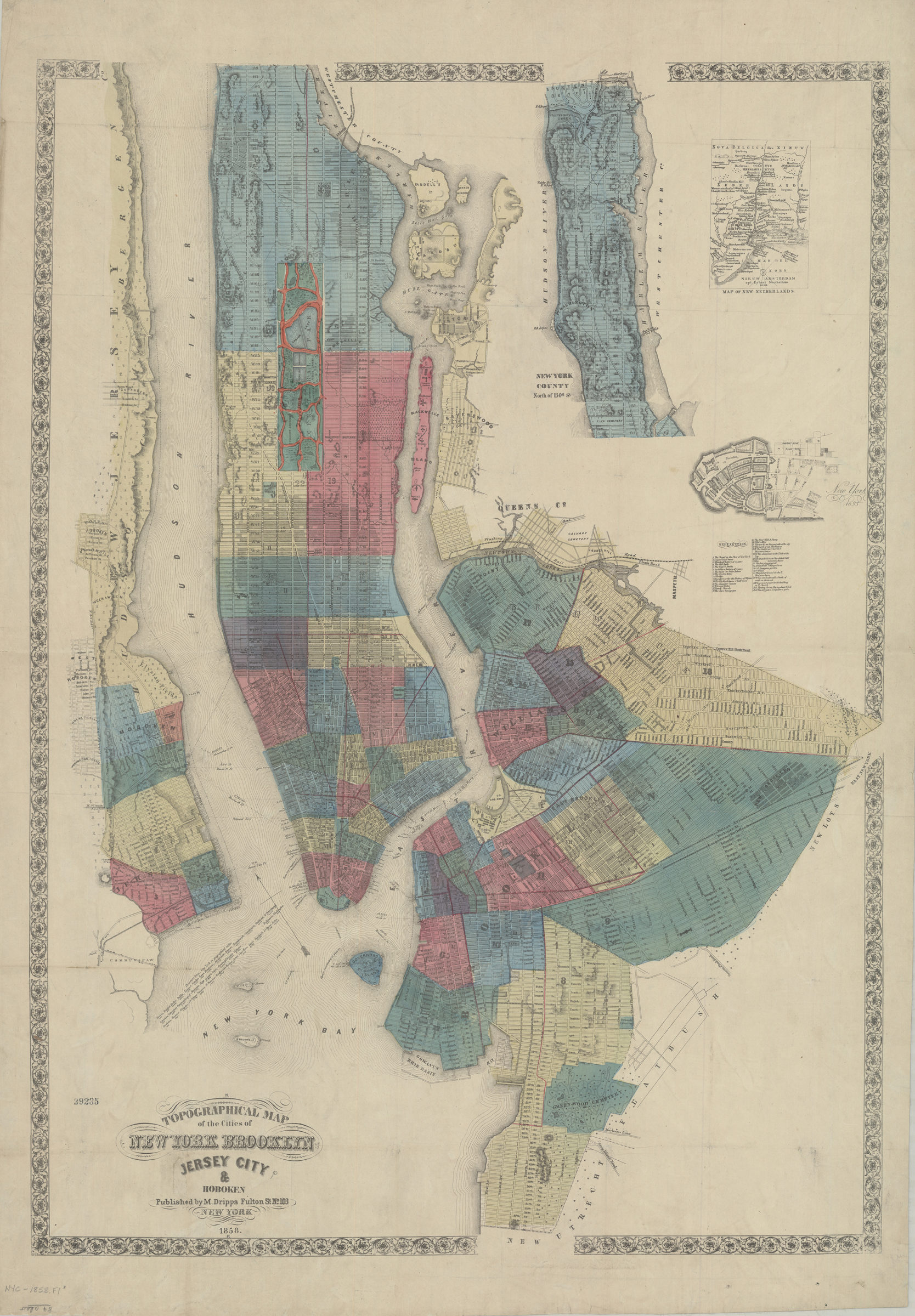
Topographical map of the cities of New York, Brooklyn, Jersey City & Hoboken 1858
Map No. NYC-1858.Fl
Shows wards, other unspecified districts, ferry lines, some buildings and topographical details of surrounding islands, and part of Queens County and New Jersey north of Hoboken. Relief shown by hachures. Oriented with north towards the upper left. On label inside front cover: Sold by M. Nevin, Bookseller … Brooklyn. Includes inset continuation map, 2 insets, and notes on distances between N.Y. and cities around the world. Insets: New York County north of 150th St. — Map of New Netherlands — New York, 1695 [indexed].
Map area shown
Relation
Full catalog recordSize
98 × 69 cmDownload
Low Resolution Image
Creator
Dripps, M.,Publisher
Brooklyn Historical SocietyCitation
Topographical map of the cities of New York, Brooklyn, Jersey City & Hoboken; 1858, Map Collection, NYC-1858.Fl; Brooklyn Historical Society.Scale
Scale [ca. 1:22,000]Loading zoom image...