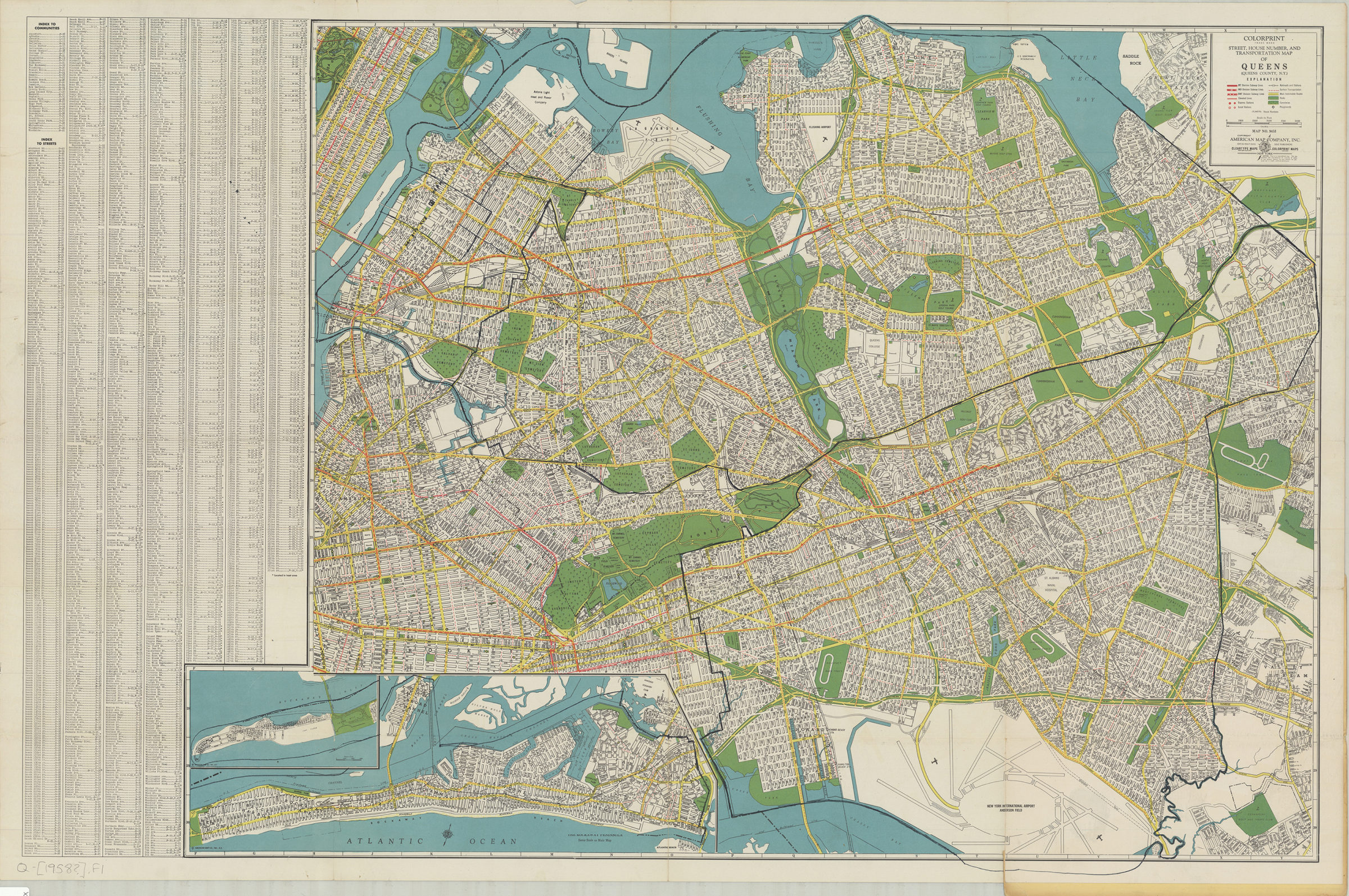
Colorprint street, house number and transportation map of Queens: (Queens County, N.Y.): American Map Company [1958]
Map No. Q-[1958?].Fl
Designed to be folded to 25 x 12 cm. Shows subway, elevated and railroad lines, includes community and street index. Also includes inset map “The Rockaway Peninsula.” “Map no. 9453”
Map area shown
Genre
Road mapsRelation
Full catalog recordSize
63 × 97 cmDownload
Low Resolution Image
Creator
American Map Company (New York, N.Y.),Publisher
Brooklyn Historical SocietyCitation
Colorprint street, house number and transportation map of Queens: (Queens County, N.Y.): American Map Company; [1958], Map Collection, Q-[1958?].Fl; Brooklyn Historical Society.Scale
Scale approximately 1:30,Loading zoom image... 