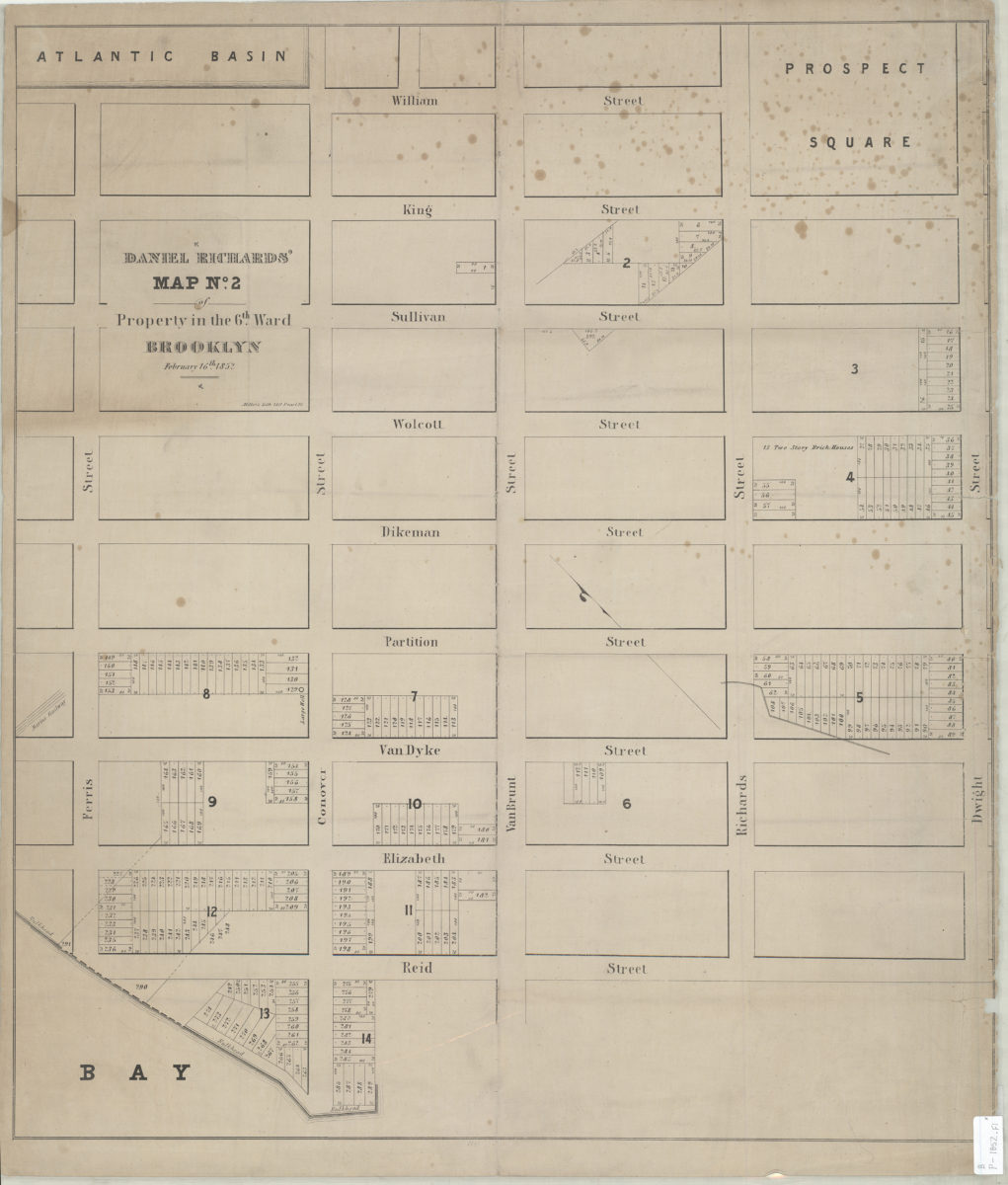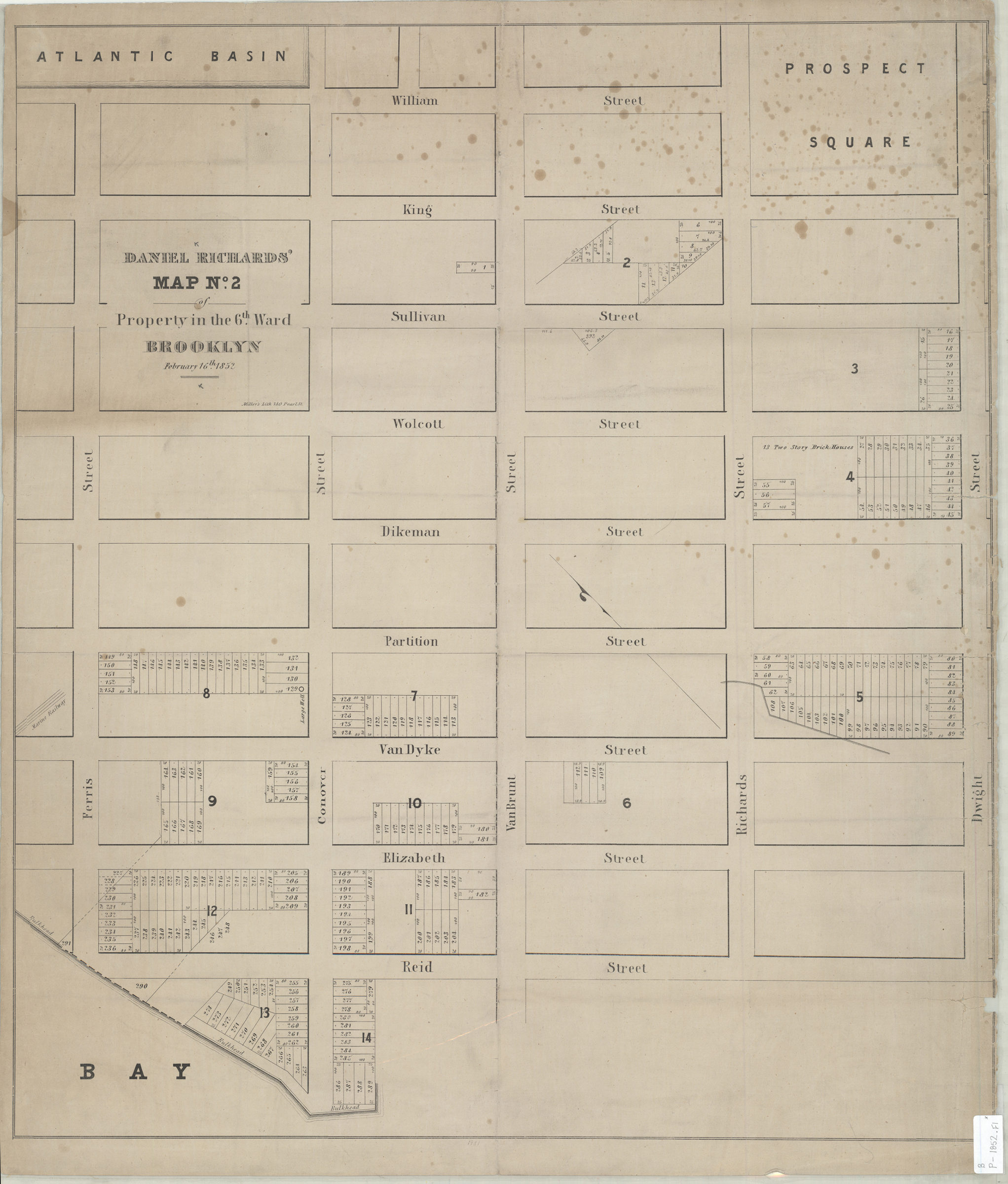
Daniel Richards’ map no. 2 of property in the 6th Ward, Brooklyn 1852
Map No. B P-1852.Fl
Cadastral map covering area northeast from Reid St. to William St. and southeast from Ferris St. to Dwight St. (modern-day Red Hook). Shows property (including lot numbers and dimensions), bulkhead lines, and portions of the Atlantic Basin and Prospect Square. Oriented with north to the upper left. “February 16th, 1852.” “1981”–Lower center margin.
Map area shown
Genre
Cadastral mapsRelation
Full catalog recordSize
67 × 60 cmDownload
Low Resolution Image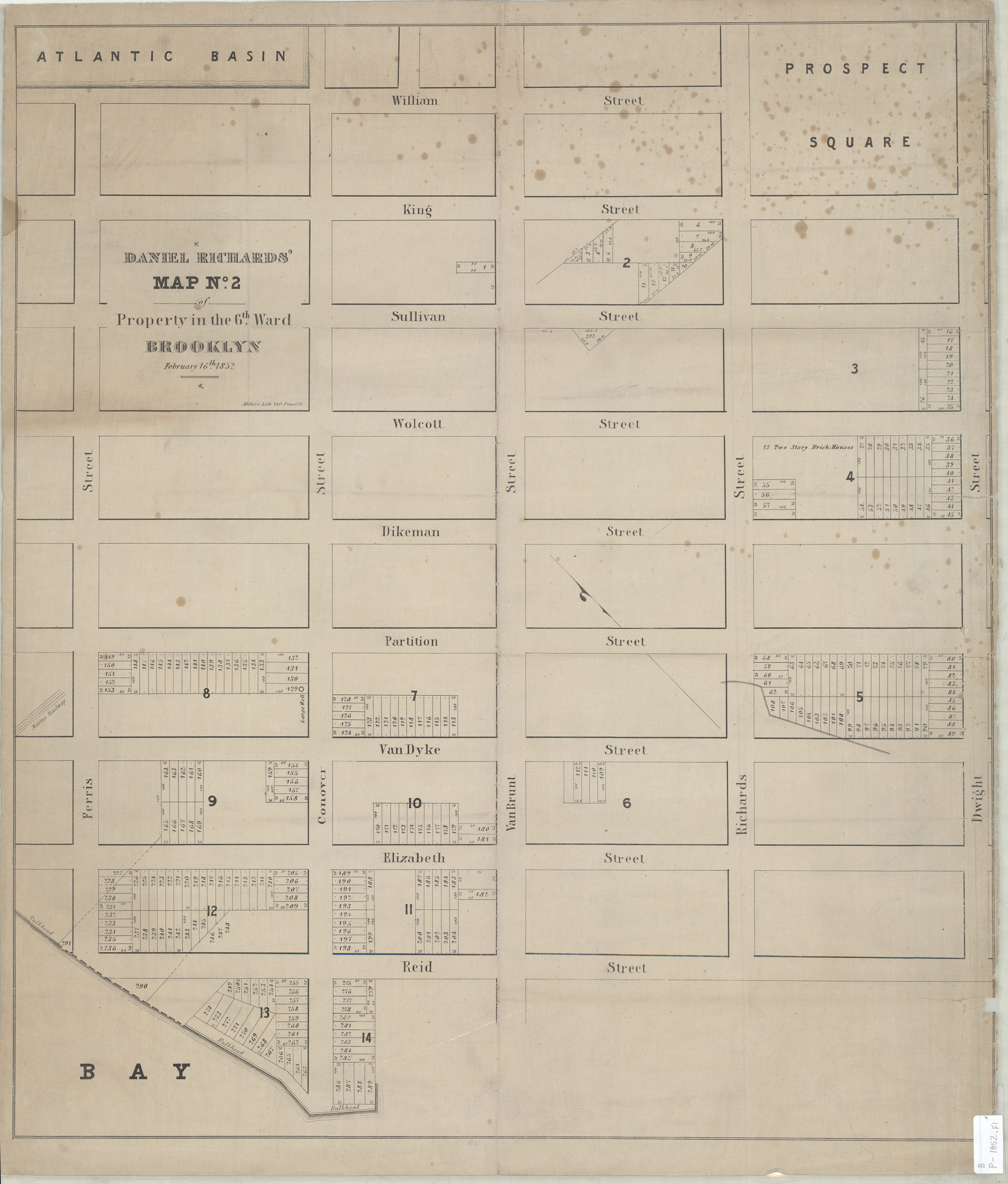
Creator
Richards, Daniel,Publisher
Brooklyn Historical SocietyCitation
Daniel Richards’ map no. 2 of property in the 6th Ward, Brooklyn; 1852, Map Collection, B P-1852.Fl; Brooklyn Historical Society.Scale
Scale not givenLoading zoom image...